Unsettled As Summer Weather Returns

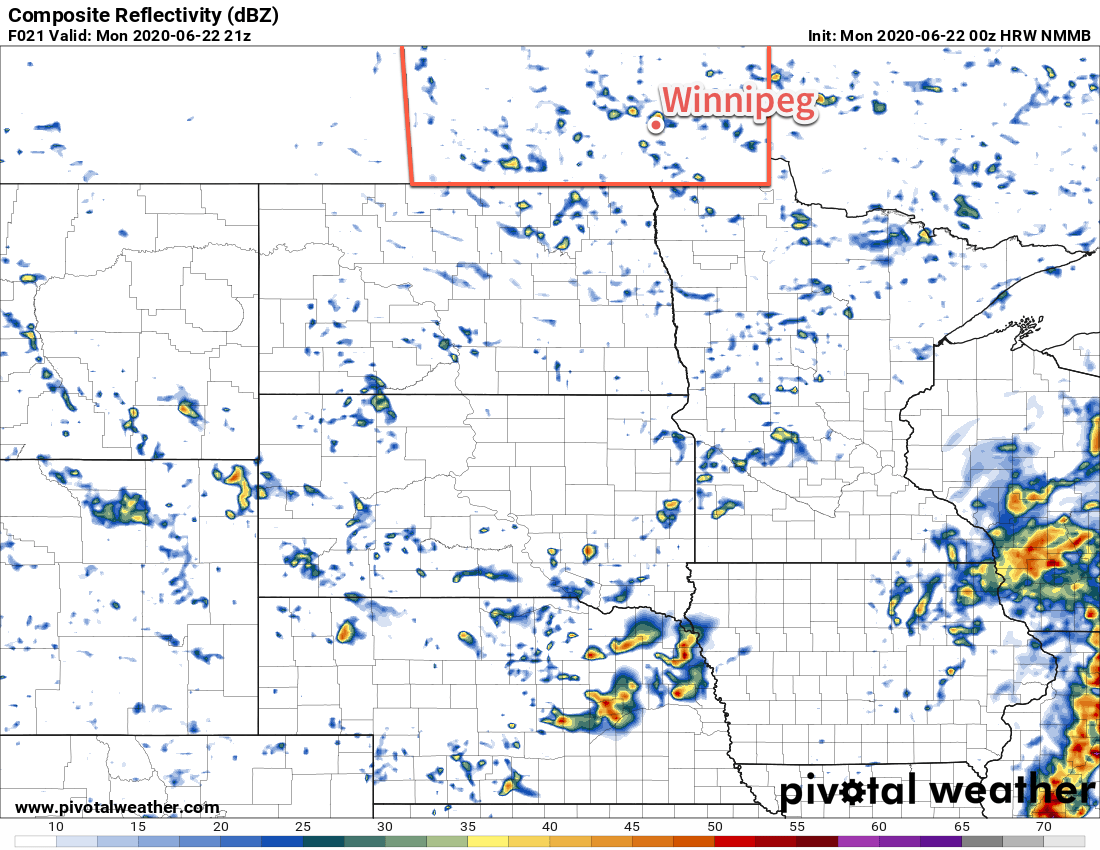
Scattered showers with the risk of isolated thunderstorms continue this week as summer weather slowly returns to the region.

Conditions in Winnipeg will slowly improve this week as a slow-moving upper low finally begins to exit the region. Before it leaves, the city will see one more mostly cloudy day with a seasonably cool high near 20°C. A few more showers are possible today, drifting southwards from the Interlake through the day. The city will see north winds of 20 to 30 km/h today. Skies will clear out in the evening as winds taper off. Temperatures will dip down to a low near 11°C.

On Tuesday, seasonal temperatures will return to Winnipeg as temperatures climb to 23°C. Skies will be partly cloudy with a light northwest wind. Through the afternoon hours, once again the city will see a chance of a passing shower or thundershower. Skies will again clear up in the evening leaving the city with clear skies as temperatures head to a low near 12°C.

HRW-NMMB Composite Reflectivity Forecast valid 21Z Monday June 22, 2020
Southern Manitoba will see scattered showers on Monday afternoon.

An upper ridge moving into the province on Wednesday will bring beautiful summer conditions to the city. With mainly sunny skies and light winds, temperatures will climb to a high near 26°C. Some cloud cover will work into the region on Wednesday night with temperatures heading to a low near 15°C.

Long Range Outlook

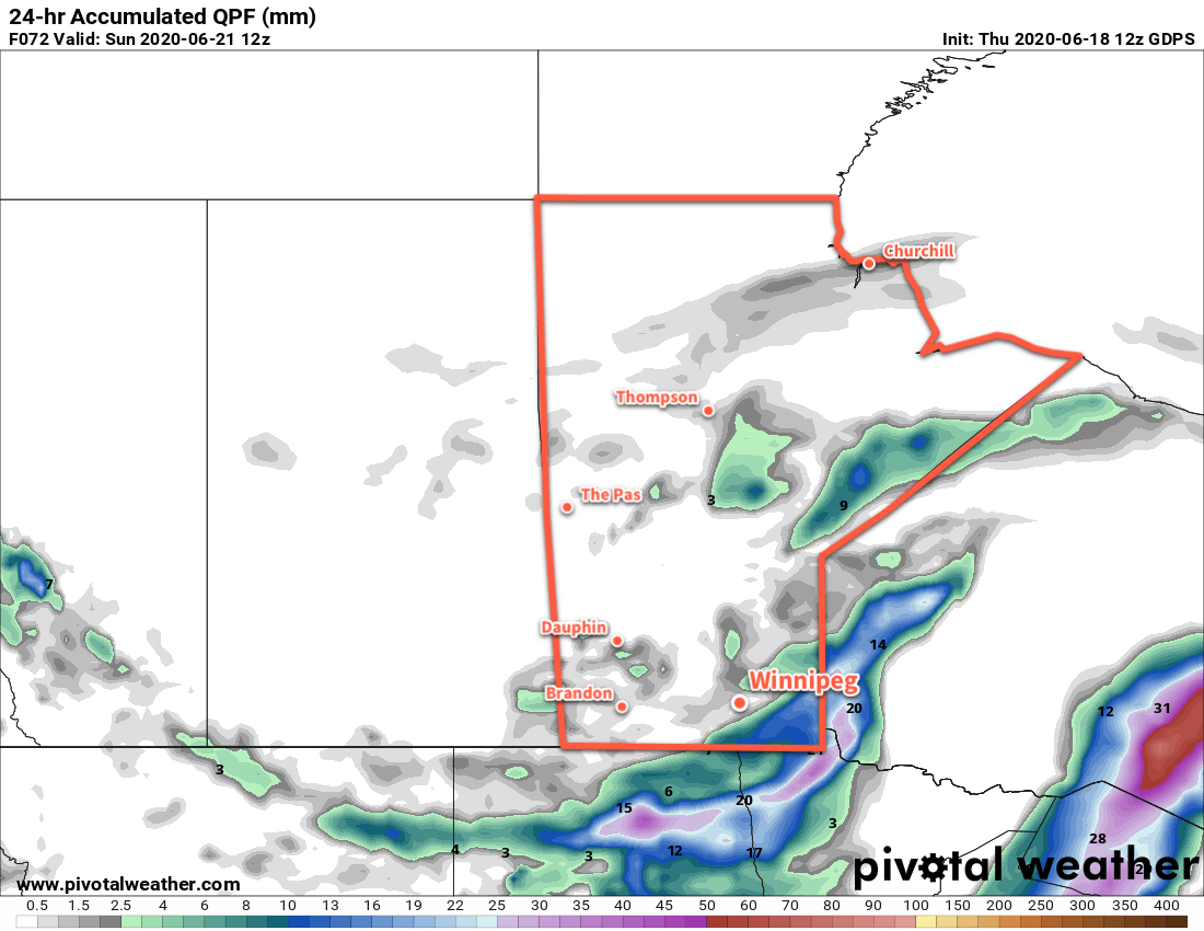
A low pressure system moving across the province in the latter half of the work week will bring unsettled conditions to the region. Scattered showers and/or thunderstorms will be possible Thursday and Thursday night. The system should clear out on Friday morning, leaving southern Manitoba with a beautiful weekend. Highs this weekend will sit in the upper 20’s and lows in the upper teens.

Today’s seasonal daytime high in Winnipeg is 24°C while the seasonal overnight low is 12°C.

Cool Weather for the Weekend

A slow moving upper low over Manitoba will keep temperatures in Winnipeg cool with mixed to cloudy skies through the weekend.

Temperatures will stay seasonably cool right through the weekend for Winnipeg as a cold upper low slowly meanders across the province. Highs will hover around 20°C over the next few days with lows near 10°C. The city will also see a fair amount of cloud cover with mixed to cloudy skies.

Today will be the windiest day of the next few with southwest winds of 20 to 30 km/h in the afternoon. Saturday will bring light southerly winds, then they switch northerly for Sunday up to 30 km/h again.

GDPS 24hr. QPF valid 12Z Sunday June 21, 2020
A disturbance tracking through North Dakota will bring rain to southeastern Manitoba on Saturday.

Saturday will bring the only notable organized weather event over the next few days. A low pressure system moving through North Dakota will spread an area of rain across the southeastern Manitoba. The rain will develop midday and taper off through the evening and overnight periods. Regions under the main band of rain will see about 5 to 10 mm. Winnipeg will sit along the northwestern edge of the rain and could see a few hours of showers or, if it develops just a bit to the southeast, nothing but some clouds.

Some scattered showers are possible on Sunday, but will most likely occur over the Parkland and Interlake.

Long Range Outlook

Temperatures should return to seasonal values by the middle of next week with a bit more sunshine. For the second half of the week, Winnipeg should start seeing highs in the mid- to upper 20s again with comfortable humidity. No notable rain or severe weather threats appear in the forecasts through next week.

Today’s seasonal daytime high in Winnipeg is 24°C while the seasonal overnight low is 11°C.

Cooling Off But Remaining Unsettled

Winnipeg will see another hot and humid day capped off with a risk of thunderstorms before cooler temperatures move in.

Temperatures will again climb into the low 30s today in Winnipeg as southerly winds continue to pump heat northwards. The city has seen a bit of a break from the humidity overnight, but it will build back in through the day with dew points rising to around 20°C. A disturbance lifting northwards into the region this morning will bring a chance of showers later this morning into the afternoon. By late afteroon, activity will intensify with thunderstorms developing along a cold front pushing eastwards across the province.

Much of the Red River Valley and areas east will see a risk of severe thunderstorms this evening, but the greatest threat will be over southeastern Manitoba. The main threats in the Red River Valley will be large hail and damaging wind gusts. The thunderstorms should move eastwards out of the Red River Valley through the evening. Brisk southerly winds of 30 to 40 km/h today will ease in the evening.

For more details on the severe thunderstorm threat over southern Manitoba, refer to ECCC’s Thunderstorm Outlook on our Bulletin Viewer and watch for updated forecasts and/or any alerts issued today.

NAM 2m Dew Point Forecast valid 00Z Thursday June 18, 2020
A hot and humid air mass will provide fuel for a thunderstorm outbreak over southern Manitoba later today.

Much cooler conditions will arrive for Thursday with mixed skies and a good chance of showers. Temperatures will work towards a high of 22°C with west-northwest winds picking up to around 30 km/h. The region will see a good chance of showers as an upper low stalls over southern Manitoba. Any showers will taper off in the evening as temperatures head to a low near 9°C under partly cloudy skies.

The sluggish upper low will still impact the region on Friday with partly cloudy skies and a chance of showers. The high will be seasonably cool near 21°C with southwest winds of 20 to 30 km/h. Winnipeg should see a few clouds on Friday night with a low near 11°C.

Long Range Outlook

Cool and unsettled conditions will likely persist into the weekend with highs in the low 20s and a couple more chances for showers. Seasonal conditions will return next week with more settled conditions developing.

Today’s seasonal daytime high in Winnipeg is 24°C while the seasonal overnight low is 11°C.

Hot, Often Humid, And Unsettled

Several days of hot and humid weather lie ahead for Winnipeg with increasingly unsettled conditions.

Winnipeg will see temperatures climb to 30°C today with mixed skies in an increasingly humid air mass. With dew points reaching the upper teens later today, it will feel more like the mid-30’s outside. A cool front will nudge eastwards this afternoon, bringing a chance of showers or thunderstorms followed by some drier air. Winds will be south at 30 to 40 km/h through the morning, then ease and shift westerly behind the cold front. Temperatures will dip to a low near 16°C tonight with mixed skies.

Heat and humidity will return on Tuesday as a warm front lifts northwards out of the Dakotas. There will be a chance of a passing shower or thunderstorm in the morning if some elevated convection manages to develop and slide eastwards across the Red River Valley ahead of the warm front. Temperatures will climb to a high near 32°C in the afternoon with humid conditions developing. Dew point temperatures should climb into the 20 to 22°C range, producing humidex values in the 35 to 40 range. Winds will pick back up into the 30 to 40 km/h range and keep most of their strength through the night. The humid and windy conditions will keep temperatures very warm on Tuesday night with a low of just 22°C.

RDPS 2m Dew Point Temperature Forecast valid 00Z Wednesday June 17, 2020
After a brief reprieve on Monday night, humid weather will build back into southern Manitoba through the day on Tuesday and persist through Wednesday. Temperatures may stay very warm on Tuesday night across the region.

Wednesday will continue the hot and humid weather with a high near 30°C and breezy southerlies. Cloud cover will increase through the day with another chance of showers or thunderstorms redeveloping. Temperatures will dip back to a low near 17°C on Wednesday night.

Beginning Tuesday evening, there will be several chances for showers or thunderstorms in the Winnipeg and across much of southern Manitoba. With the hot and humid air mass in place, many of the thunderstorms may have the potential to be severe. These upcoming setups are nuanced and other than the broad generalizations above, few specifics are available until closer to the events.

NAM MLCAPE Forecast valid 21Z Wednesday June 17, 2020
Hot and humid conditions will provide moderate to high amounts of energy for thunderstorms to work with beginning Tuesday evening and lasting through Wednesday.

Over the coming days, be sure to check the ECCC Thunderstorm Outlook, available on our bulletin viewer. We’ll have more to say in the coming days on the thunderstorm threat, but for now just take note that beginning Tuesday evening, Winnipeg may see several chances for thunderstorms with a risk of severe thunderstorms right through Wednesday night.

Long Range Outlook

A cold front pushing through on Wednesday night will bring calmer weather and seasonal temperatures back to Winnipeg. The weekend is looking seasonably cool with perhaps a passing chance of showers. Temperatures will begin to warm through the start of next week.

Today’s seasonal daytime high in Winnipeg is 24°C while the seasonal overnight low is 11°C.