Turning Up The Heat

A long-deserved taste of summer is in store for Southern Mantioba as the temperature rises with little chance of precipitation until the end of the week.

An upper-level ridge of high pressure building into the region will tap some of the record-breaking heat over British Columbia and slowly spread it eastwards over the Prairies. While we won’t see temperatures nearly has hot as the 40°C+ they’ve seen in B.C., temperatures will push towards the 30°C mark by week’s end. While some scattered thunderstorm activity is possible Thursday night, in general it looks like it will be quite dry in many places over the next couple days. With all the heat, it does look like a more organized thunderstorm threat is set to re-develop on Friday in the Red River Valley.

Wednesday
26°C / 15°C
Mainly sunny

Thursday
29°C / 17°C
Mainly sunny

Friday
30°C / 16°C
Chance of showers or thunderstorms.

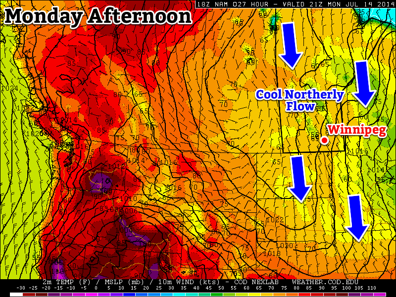
Today will be a beautiful summer day with a seasonal high of 26°C and relatively light winds out of the south at 15-25km/h. Tonight will be mainly clear with light winds and a temperature dropping to around 15°C.

Thursday will see the heat really begin to show up with temperatures climbing into the upper 20’s to just over the 30°C mark across much of Southern Manitoba. Winds will be out of the south or southwest at 20-30km/h. By evening, a weak cold front will move in from the northwest and will likely spark of some scattered thunderstorm activity over Western Manitoba that may slowly spread SE into the Red River Valley overnight. At this point, it doesn’t appear that there will be a significant threat of severe thunderstorms with Thursday’s activity.

Thunderstorm Threat Returns Friday

Friday will start off with a slight chance of showers or thundershowers if Thursday night’s convection manages to make it this far east, but then see temperatures once again approach 30°C with winds building out of the south to around 30km/h. The cold front that moved in Thursday will lift back northwards ahead of another approaching low pressure system and the associated incoming upper-level trough will likely generate thunderstorm activity through the Red River Valley on Friday afternoon into the evening.

GFS-forecasted upper-level winds (500mb) for Friday evening.

With in excess of 1500J/kg of CAPE, 30-40kt of bulk shear, fair surface moisture and the strong dynamical forcing of the upper-level trough coupled with enhanced lift in the right entrance region of the jet, it looks like there will probably be a slight risk for severe thunderstorms. At this point, the main threats look to be wind and hail, although if things continue to trend in a similar direction, the Red River Valley could see one of it’s first organized tornado threats of the year. We’ll be keeping a keen eye on things and have updates later in the week.

A Slow Recovery

After a major temperature setback on the weekend, we’ll see summer gradually return this week.

A northerly flow will maintain cool conditions over Manitoba to start the week

Monday

Monday
20°C / 8°C
Mix of Sun and Cloud. Chance of Showers.

Today will be cool, with temperatures remaining well below normal values. High temperatures will be in the upper teens or lower twenties, with a breezy north-west wind. We may also see some light shower activity during the day as pop-up showers develop with daytime heating.

Tuesday

Tuesday
21°C / 9°C
Mix of Sun and Cloud

Tuesday will be a pleasant day, but it will still be on the cool side. Temperatures will be in the low twenties and winds will be relatively light. Some convective cloud cover will develop by the afternoon, and perhaps a stray shower here and there as well, but it won’t amount to anything of significance.

Wednesday

Wednesday
24°C / 11°C
Mainly Sunny

Wednesday will see temperatures recover further, with values in the low to mid twenties. Cloud cover should be less than earlier in the week and winds will remain light.

Long Range

The long range forecast is looking more summer like. Some models suggest we’ll see temperatures climb into the thirties either late this week or on the weekend. As temperatures begin to climb, the humidity likely will as well. That additional humidity means that the thunderstorm risk will begin to increase again. It’s too early to say if we’re looking at more severe storms, but that potential is usually present under humid conditions.

Elsewhere in Weather News: July 12th, 2014

Atlantic and West Pacific Oceans See Storms

Hurricane Arthur
The beginning of July started off on an active note as hurricane Arthur spun up just off the coast of Florida. Arthur quickly organized, pushing out the dry air that was initially a problem on the northwest side of the storm. Following the short bout with the dry air, Arthur formed a well-defined eye. The storm “only” reached category two as it made landfall on the Carolina coast near Cape Lookout, shortly after forming the well-defined eye. It brought with it sustained winds of 160km/h, whipping up a significant storm surge as high as 1.4m on the outer banks.

Base reflectivity radar image of Arthur shortly after it made landfall on the outer banks of North Carolina very early on July 4th. (Source: GRlevel3)

In the aftermath of the storm 41,000 residents from North Carolina had lost power, in addition to some minor damage to houses. Flooding was also a concern where a few areas received over 100mm of rain from the storm. Thanks to much warning in advance, no residents were injured or killed with this storm. Arthur brings an end to the lull in hurricane activity the United States has seen in the past couple years. The last hurricane to have made landfall in the United States prior to Arthur was in August, 2012.

Arthur further continued its trek up the East Coast bringing miserable weather to the US Northeast as well as Atlantic Canada, but was less of a threat (still significant) as a post-tropical storm.

Super Typhoon Neoguri
Super typhoon Neoguri was another significant storm that spun up to start off the month of July, this time in the western Pacific Ocean. With the help of very warm sea surface temperatures as well as little shear to tear it apart, Neoguri strengthened to a super typhoon producing sustained winds of 250km/h and bottoming out at a pressure of 930mb. Six deaths have been attributed to Neoguri as well as over 100 injuries. After passing through the Ryuku Islands, Neoguri got caught up in the polar jet stream and curved back east towards Japan as it started its transition to an extratropical storm over Japan. Satellite observations indicated rainfall totals of over 500mm in a few mountainous regions of Japan. Neoguri was officially declared an extratropical storm yesterday.

Another disturbed area is currently over the Pacific and is expected to become of tropical storm strength this weekend, however, is not expected to impact any landmasses in the near future.

Cooling Trend Brings More Unsettled Weather

The system that brought severe thunderstorms to the Interlake and southwestern Manitoba will bring a huge shift in the weather pattern over the next couple days as it moves over Hudson Bay and stalls, setting up an extremely abnormal pattern for July that will see cool Arctic air spilling southwards unhindered. In the process another cold front will slump through Southern Manitoba bringing another day of unsettled weather on Saturday.

Friday
25°C / 15°C
Becoming mainly sunny.

Saturday
26°C / 11°C
Showers or thunderstorms likely.

Sunday
19°C / 9°C
Mainly cloudy.

Today will be a fairly nice day all things considered. Winds will be out of the west to northwest at 20-30km/h as temperatures climb into the mid-20’s. No precipitation is expected today. Temperatures will remain somewhat mild tonight, dropping only into the mid-teens.

The RDPS, among other models, is forecasting widespread shower activity in Southern Manitoba on Saturday.

Saturday will bring another bout of unsettled weather as a cold front slumps southward through the Interlake into the Red River Valley. Instability will build throughout the morning with showers and thunderstorms developing along the cold front by midday through the Interlake. The activity will slump southwards through the day, with showers and thunderstorms likely through the Red River Valley, particularly the northern & eastern halves.

Saturday is also the Morden triathlon. Conditions will be fairly pleasant, with temperatures around 15°C in early in the morning warming to around 24°C by lunch time. Winds will start the morning out of the southwest at around 15km/h and increase to 30km/h or so by midday. There will be a very slight chance of a shower beginning late in the morning and through the early afternoon, although precipitation is most likely to hold off until the cold front passes through the region late in the afternoon.

Sunday will mark our first day in a very unseasonably cold air mass. Most of Southern Manitoba will see a northwesterly wind at 30-40km/h. The high will only be around 19°C – some 7 or 8°C below normal. There will be a chance of showers on Sunday night while temperatures dip below the 10°C mark.

How Long Will The Cold Last?

The CPC is forecasting a 100% chance of below-normal temperatures for the Eastern US in the 6-10 day range.

There’s no question the incoming cold air is hugely abnormal for this time of year: 1000-500mb thicknesses[1] are expected to fall below 546dm through Northwestern Ontario into MN/WI/MI. These values are more appropriate for late in the fall than in the middle of July. Depending on exactly how deep this cold trough becomes, record low thicknesses for July may be set in those regions.

Here in Manitoba, we’ll avoid the core of the coldest air, but we’ll still be well below normal. Fortunately this setup doesn’t appear to want to remain locked in for very long. The cold trough is expected to push off to the east fairly quickly with warm air pushing back into the province by mid-week.

As the warm air pushes in, it actually looks like we may finally move into a warm and dry summer-like pattern. All long-range weather models are showing a nice dry spell developing from mid-week into next, with temperatures gradually warming up towards the 30°C by the end of the week!


  1. The 1000-500mb thickness is literally the distance between those two levels in the atmosphere. The colder the column of air is, the lower the thickness while the warmer the column is, the higher the thickness is.  ↩