Santa Delivers A Break From the Deep Freeze

Merry Christmas!

All of us here at A Weather Moment would like to take just a moment to wish you and your families a very Merry Christmas! It’s been a wonderful year here at A Weather Moment and I want to thank you for dropping by — whether this is the first time you’ve ever been to the site or come here regularly — to see what we have to say about the weather. I hope that you find (or continue to find!) what we do here of value and continue to stop by for your weather forecasts, summaries and news!

Holiday Forecast

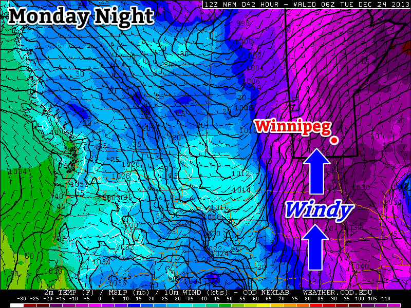
At the risk of sounding like a broken record that simply utters the phrase “deep freeze” over and over again, I’m glad to let everyone know that we all get perhaps the most wonderful Christmas gift that could be given to us this year: a break from the deep freeze. The next few days will bring temperatures near-then-surpassing our normal temperatures for this year as warmer air floods eastwards across the Prairies.

Christmas Day

-15°C / -25°C
Mixed skies with a chance of afternoon flurries.
Boxing Day

-11°C / ⇒ -10°C
Cloudy periods with seasonal temperatures. Chance of flurries in the morning.
Friday

-4°C / -17°C
Mixed skies and warm. Slight chance of light, isolated flurries.

We’ll see mixed skies today with a daytime high of around –15°C and a chance of some afternoon flurry activity as a weak upper disturbance makes it’s way over our area. No significant accumulations are expected. Winds will be a fairly steady 20km/h or so out of the northwest. We’ll continue to see mixed skies through the overnight period as the temperature drops to around –25°C.

Tomorrow will bring cloudy periods with fairly seasonal temperatures as the mercury climbs to around –11°C. A few flurries are possible in the morning as a weak upper-level warm front pushes eastwards over the Red River Valley. Winds will be fairly light out of the south at only around 15–20km/h. Overcast conditions are expected on Thursday night as a warm front pushes eastwards through the region. Little-to-no precipitation is expected with it as it manages to keep our temperature steady near around –10°C.

Friday will again bring mixed skies, although we do have a chance at becoming mainly sunny for a decent amount of time sometime between the late morning and mid-afternoon period. There’s a slight chance of an isolated flurry or two, but nothing worth going into any detail about. The temperature will climb to a balmy –4°C or so thanks to westerly winds bringing in much milder air.

GDPS precipitation accumluations from Friday evening to Saturday evening show a swath of 10-20cm of snow just north of Winnipeg.
GDPS precipitation accumluations from Friday evening to Saturday evening show a swath of 10–20cm of snow just north of Winnipeg.

Snow will push in overnight as a powerful Alberta Clipper moves into the region. It’s still too early to make any precise predictions, but it appears that the track of the system will bring the heaviest band of snow through the Southern Interlake region with anywhere from 10–20cm of new snow on the ground by the end of Saturday. Amounts drop off to 2–5cm in the Southern Red River Valley. Here in Winnipeg it could end up being a major snowfall; cold air has a tendency to be a bit of a bigger bully than the models let it be and shift storm tracks further south. It wouldn’t take too much shifting for that 10–20cm band to move right over Winnipeg. It’s all too early to tell specifics at the moment, though; it’s fairly likely we’ll see accumulating snow Friday night/Saturday morning, the only question is will it be a little or a lot? We’ll have more details on the system in Friday’s post once things have a chance to develop more.

The Weekend

Things go downhill from there, unfortunately. Another shot of bitterly cold Arctic air[1] will push into the Prairies which will push our daytime highs back into the –20’s and overnight lows to near or below –30°C. Unfortunately, it also looks like it’s going to stick around until at least the middle of next week, if not longer.

So enjoy your Christmas present of a pretty nice 3 days and get out there while you can! From all of us here at A Weather Moment, we wish you and your families a very Merry Christmas and all the best in the coming year!


  1. Have we used this phrase enough to be able to ™ it yet?  ↩

Mild, Snowy Christmas Eve Gives Way to Another Cold Snap

This week will see cold weather continue — not exactly the Christmas present that many were hoping for.

The Wind Will Pick Up on Monday Night

The Wind Will Pick Up on Monday Night

Monday

Monday

Sunny
-23°C / -25°C

After a frigid morning, temperatures won’t recover a whole lot today, but at least it will be sunny! Afternoon temperatures will be in the low to mid minus twenties, with increasing winds. Wind speeds during the morning and afternoon won’t be particularly high, but winds will increase through the evening and into the overnight period. Some blowing and drifting snow is likely in open areas on Monday night as winds increase to 30-40km/h gusting to 50-60km/h out of the south. To add insult to injury, snow is expected on Monday night into Tuesday. The snow will begin in Western Manitoba on Monday night, and push into the rest of Southern Manitoba by Tuesday morning.

Christmas Eve

Tuesday

Mainly cloudy. Snow.
-12°C / -20°C

Tuesday will be warmer than Monday as those stiff southerly winds overnight bring in some milder air, but this reprieve from the cold will be accompanied by snow. A total of 4-8cm of snow is expected in Southern Manitoba by the time the snow ends on Tuesday afternoon. Temperatures on Tuesday morning will be in the minus twenties, but by afternoon we should climb into the minus single digits over Western Manitoba and the mid minus teens over Eastern Manitoba. The Red River Valley will likely remain stuck in a southerly flow through the day, causing temperatures to remain a bit below -10C.

Christmas Day

Wednesday

Mainly cloudy. Chance of flurries.
-18°C / -28°C

Another cold front will pass through Southern Manitoba on Christmas morning, allowing cold weather to return for the big day. The wind will also pick up behind this front, generating chilly wind chill values. High temperatures for Christmas will be in the upper minus teens, with a chance of flurries through the day.

Long Range

The long range forecast looks cold, cold, cold. We may see one warmer day towards the end of the week, but other than that there is no moderation in the forecast.

$("").attr({
    "rel": "stylesheet",
    "href": "http://fonts.googleapis.com/css?family=Mountains+of+Christmas:700"
}).appendTo("head");
$("h1, h2, h3, h4, h5").css("font-family", "Mountains of Christmas");

Elsewhere in Weather News: December 21st, 2013

Southern Ontario, Midsection of US Anticipate Ice Storm

A major ice storm has been taking shape as of Friday night across parts of Oklahoma and Texas and will continue to push northeast. A potent cold front with Arctic air filtering in behind it is clashing with gulf moisture moving north and thereby creating prime conditions for ice accumulation from Oklahoma all the way to southern Ontario. Dangerous travel conditions are expected as there could be significant ice accumulation due prolonged periods of freezing rain through this weekend. With this comes the possibility of downed power lines so residents have been made aware to prepare for power outages across southern Ontario. So overall, not ideal conditions for holiday travel this weekend as all kinds of precipitation will be falling across the eastern half of the US and southern Ontario.


Freezing rain sounding from Oklahoma on Friday evening. Note the shallow freezing layer near the surface where the arrow is. (Souce: Twisterdata)

Freezing rain forms when there is a deep layer of warm air that is above freezing aloft. As the ice crystals fall and meet the warm layer, they melt and become raindrops while falling towards the ground. A shallow layer of cold air just above the surface of the earth must also be present for freezing rain to form. Supercooled water droplets – drops of liquid water that exist in below freezing air, will be in place and won’t have enough time to freeze into ice pellets, thus will freeze (as ice) on contact as they hit the ground.

In addition to this, a severe weather outbreak is expected in Dixie Alley of the US today. The outbreak is associated with the same system as the cold front slices through the warm, moist air mass in place. A moderate risk has been issued by the Storm Prediction Center as well as a 15% hatched area for tornadoes in Mississippi and northern Louisiana. Chances of tornadoes are quite high, the only possible limiting factor is that CAPE will be fairly low (only around 500-1000J/kg) but this will still be sufficient for supercells which will quickly evolve into a quasi-linear convective system – a line of severe thunderstorms that can have bowing segments. SPC gives fairly strong wording for today in Dixie Alley saying that “there is potential for several tornadoes – some of which should be strong”.

By Monday night the system will have moved off the US East Coast but will still be a weather-maker for Atlantic Canada.

Cold Weekend Ahead

Cold temperatures will dominate as Arctic air once again finds itself entrenched over Southern Manitoba. Snow will make an early weekend appearance as a weak disturbance pushes across the province on Saturday, but it won’t be a significant weather-maker.

Friday

-17°C / -24°C
A Mix of Sun and Clouds
Saturday

-20°C / -26°C
Mostly cloudy; scattered flurries likely.
Sunday

-20°C / -24°C
A few clouds.

Temperatures are going to remain fairly steady through the next few days with daytime highs near –20°C and overnight lows dipping to around –25°C. Today we’ll see a mix of sun and cloud as the next disturbance set to track through our region begins taking shape over the western Prairies. Skies will cloud over completely overnight with a chance of flurries.

The light grey shading depicts areas across Southern Manitoba that will likely see some light flurries on Saturday
The light grey shading depicts areas across Southern Manitoba that will likely see some light flurries on Saturday.

Saturday will bring mostly cloudy skies although a few sunny breaks are possible. Scattered flurries are fairly likely throughout most areas along and south of the Trans-Canada Highway in Southern Manitoba. At this point it seems like accumulations will be practically non-existent; there’s a slight place some places may see a cm so, but a significant snow-maker this system is not. The light snow will taper off in the evening as the system moves off and the clouds begin to break up.

Behind this system we’ll see another Arctic high push into Southern Manitoba. This will clear out the cloud, but once again bring cold temperatures with a high of only –21 or –20°C. The mercury will drop to –25°C or so overnight. There may be a very slight chance we may see some flurries thanks to another system passing to our southwest, but at this point I have a feeling that “cold air is king” and it will be restricted to southwest Manitoba. Keep it in mind, but even if it did happen, it would once again be just a few non-accumulating light flurries.

Looking Towards Christmas

Next week will start off with some slightly milder temperatures as a powerful low pressure moving along north of 60 drags warmer air eastwards across the Prairies with it. At this point it looks like we’ll see warmest temperatures on Christmas Eve with snow moving in through the day and a snow Christmas Eve night. Christmas Day is looking like a snowy start will give way to clear skies and cold temperatures. We’ll have the full forecast for the holidays on Monday!