Europe Battles Cold
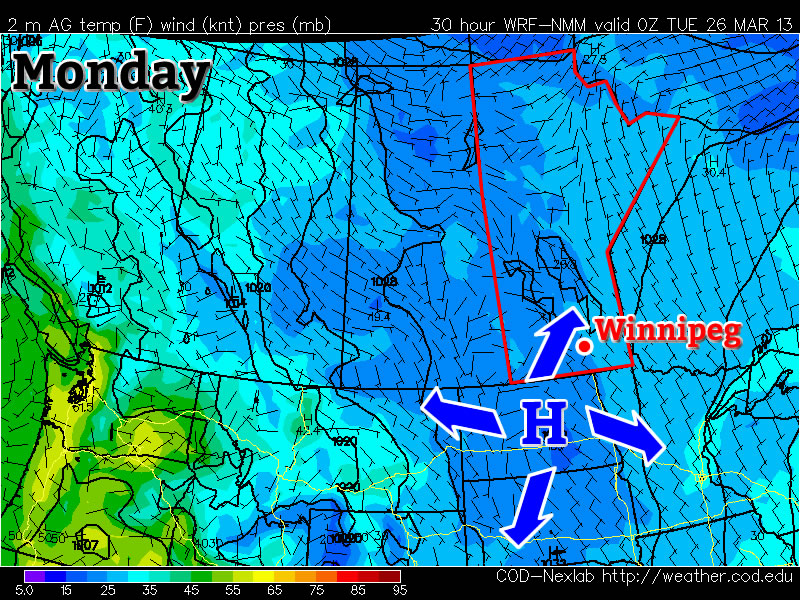
This past month it has not only been Southern Manitoba dealing with pesky cold Arctic air lingering around while the spring thaw should be starting up, most of Europe has also been under significantly below normal temperatures for the month of March. What has been bringing such cold weather can be attributed mostly to the same reason why we’ve been getting such cold; a negative NAO (North Atlantic Oscillation) pattern. This is cause for Scandanavian highs staying put and bringing down some unseasonably cold air from the north-east in Europe’s case.
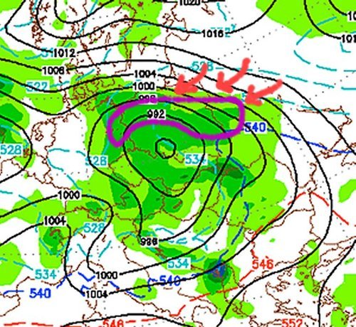
Germany has had the worst of the cold in Europe with their average March temperature 4°C below average – the coldest ever since record keeping started in 1883. Other parts of Europe were generally 3°C below average for March. To add to the cold temperatures, Europe has been faced with a few significant snowstorms this month, such as last week’s snowstorm that caused hundreds of flight cancellations and even the closure of Frankfurt’s International Airport. The reason for these significant snow events this late in the season can be attributed to a low pressure system drawing in moist air from the North Mediterranean. This, when combined with the stationary Siberian high feeding cold air into the northern half of the low, makes for ideal snowy conditions.
The Scandanavian high looks to stay put over the region for just a little less than another week, however, with the NAO trending upwards and with the sun getting stronger every day (we are now at the equivalent of a September sun), this means that warmer temperatures are on the horizon for most of Europe for the second week of April.