We’ll see one (or two) more day of nice weather before things turn cold again, another arctic blast is on the way!
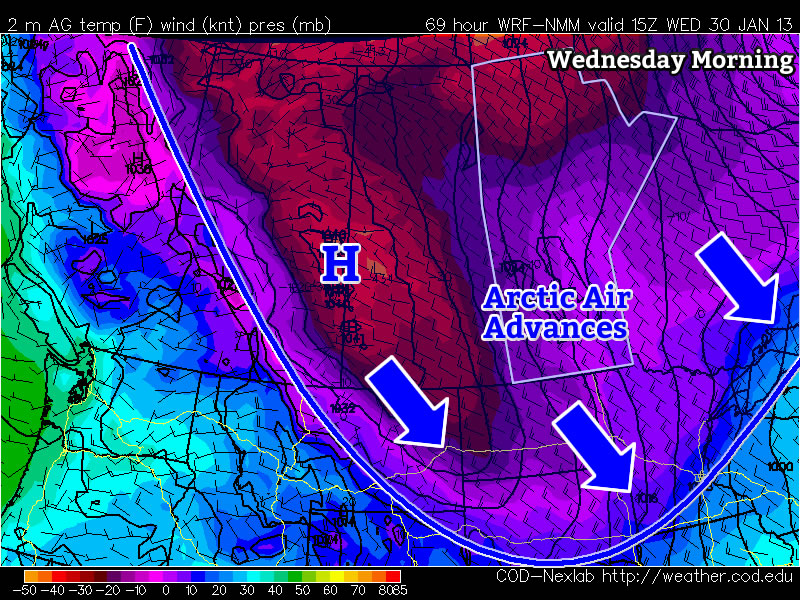
Manitoba will once again find itself right square in the middle of a major trough this week. This will allow another arctic air mass to surge down into Southern Manitoba by mid-week. This frigid air mass will be ushered in by an arctic front on Tuesday, whose arrival will be announced on Tuesday night with increasing north-westerly winds. However, before that happens we’ll see one final warm day on Monday.
Monday
Mainly cloudy. Risk of freezing rain or ice pellets.
-5°C / -12°C
Monday will be the warmest day this week, with high temperatures in the mid minus single digits in Southern Manitoba. There may be some light and sporadic freezing rain or ice pellets in Southern Manitoba on Monday morning. However, colder air aloft will move in later in the morning, turning any lingering precipitation to snow. The wind will be light on Monday, making it a comfortable day.
Tuesday
Mainly cloudy. Chance of flurries.
-10°C / -22°C
On Tuesday we’ll transition from early week’s warm weather to the colder weather that is in store for the rest of the week. As the arctic front approaches we may see a few flurries during the day on Tuesday. However, in general Tuesday looks like an OK day, with temperatures remaining slightly above seasonal and winds remaining fairly light. However, that will change Tuesday night as colder air begins spilling in…
Wednesday
Mainly sunny
-22°C / -32°C
We return to the deep freeze on Wednesday, with temperatures more or less flat-lining through the day at the morning’s low temperature. Wind chill values will be very cold as well. Wednesday night will be another frigid one, with temperatures expected to drop down around the -30C mark once again.
Models are somewhat ambiguous in terms of the long-range forecast. There is some indication that we may begin to warm up in early February, but there are other indications to suggest we may remain cold. It’s too early to say what is going to happen, so stay tuned for more updates as we go along.