Pleasant Fall Weather Ahead for Southern Manitoba

A broad upper ridge will keep the jet stream well to the north over the next 5 to 7 days, keeping the frost away as seasonably mild temperatures stay across the region.

RDPS 2m Temperature Forecast valid 21Z Friday September 30, 2022
Mild temperatures in the low 20s will develop across much of the southern Prairies on Friday.

The weather will be quiet across southern Manitoba over the next several days as an upper ridge continues to sit over the region. Most areas will see a bit of cloud this weekend as an upper low passes through the Northern Plains of the United States, but almost all the rain associated with the system will stay south of the international border.

There will be slight chance of some light showers Saturday night into Sunday, but any amounts will be light and scattered. The upper low will begin to shift out of the region at the beginning of next week, taking the cloud with it, leaving behind mild temperatures to start the week.

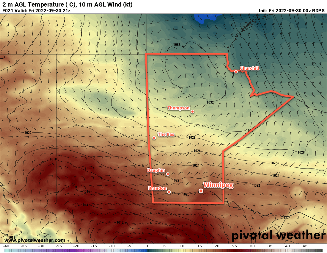
Through this mild period, Winnipeg will see daytime highs in the upper teens or low twenties with overnight lows in the upper single digits.

Long Range Outlook

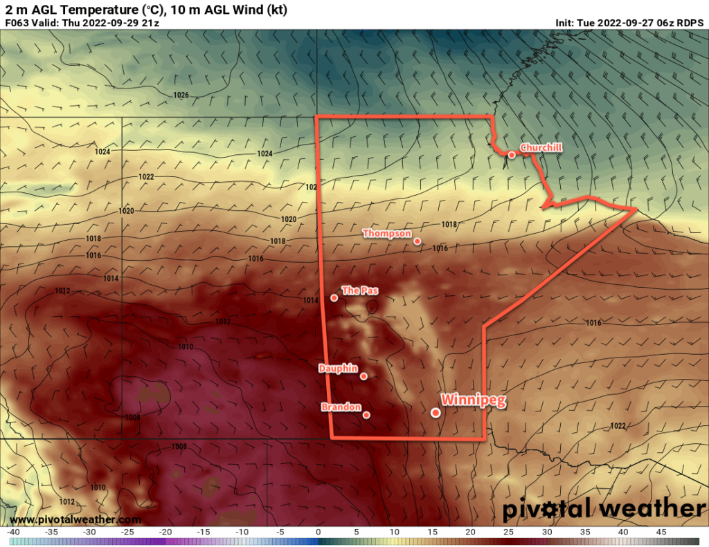
A cold front will push through the region mid-week, ushering cooler conditions. Daytime highs will drop towards the 10 °C mark with frost likely at least a couple times in the second half of the week. No hard freeze is in the forecast, but lows will likely dip just below freezing a couple times.

Before then, though, the weather will be quite pleasant. With the long weekend ahead, we hope you’re able to get out and enjoy some of that fall warmth before it disappears!

Today’s seasonal daytime high in Winnipeg is 15 °C while the seasonal overnight low is 3 °C.

Fall Chill Eases As Week Continues

The cool conditions starting the week off will be replaced by warmer weather as an upper ridge moves across the Prairies.

RDPS 2m Temperature Forecast valid 21Z Thursday September 29, 2022
Much warmer weather will push eastwards into the Prairies this week as an upper ridge builds over the region.

Winnipeg will start the day off today with a touch of frost courtesy a strong high pressure system sitting over the province. This system will keep skies sunny and temperatures seasonal with highs in the mid-teens this afternoon. Temperatures will dip back down into the low single digits tonight with a light southerly wind developing. Sub-freezing temperatures are unlikely in Winnipeg tonight, but outlying areas could see temperatures touch the freezing mark.

Heading into the rest of the week, the high responsible for the cool weather will shift off into Ontario and an upper ridge will build in behind it. This will bring warmer weather back to southern Manitoba and shift the region into an extended period of seasonably warm conditions.

Mainly sunny conditions will persist through the rest of the week with daytime highs climb into the low 20s and overnight lows in the upper single digits. Wednesday will be more of a transition day, though, with a strong southerly wind up to 50 gusting 70 km/h and a high in the upper teens.

There’s just the slightest chance of a light shower on Wednesday evening, otherwise it will be dry through the rest of the week.

Long Range Outlook

Some cloud is possible later Friday into Saturday, but temperatures should continue to be seasonably mild. Mainly sunny conditions are forecast to return Sunday and continue into much of next week. The forecast shows no notable precipitation in the next 10 days.

Today’s seasonal daytime high in Winnipeg is 15 °C while the seasonal overnight low is 4 °C.

Friday Showers Give Way To Seasonal Weekend Temperatures

A passing low will bring cool weather and scattered showers to the region today. It will be a quick turnaround to nicer weather for the weekend with sun returning and warmer temperatures.

RDPS 24-hr Precipitation Accumulation Forecast valid 12Z Saturday September 24, 2022
Many places in southern Manitoba will have a good chance of seeing rain showers on Friday.

Today’s main influence on Winnipeg’s weather will be a slow-moving upper low crossing the region. This system brought rain to southwestern Manitoba overnight, but it will weaken as it pushes eastwards. A few showers will be possible through the morning hours as a leading band of rain weakens heading into the Red River Valley. A bit of a cloudy break is likely, then another chance for scattered showers will develop midday as the upper low itself moves over the region.

Most of the rain will be over by the evening, but a lingering chance for some patchy light rain will continue into the night as the system moves into Ontario. Temperatures will dip to around the 10 °C mark overnight.

With the cloud and rain, temperatures will be quite cool with a high in the low teens. Winds will persist out of the southeast around 20 km/h through the day.

On Saturday, a bit of light rain could be lingering in the morning, but the cloud cover should begin to break up later in the day. Skies will clear later in the afternoon with a northwest wind at 20 to 30 km/h. Temperatures should climb into the upper teens in the afternoon, then head again to a low near 10 °C under clear skies tonight.

On Sunday, the sun will make a full return with just a few clouds through the day. Temperatures should again climb into the upper teens   with a breezy northwest wind. Temperatures will dip into the upper single digits on Sunday night.

Long Range Outlook

Near or slightly above-seasonal temperatures will continue into the first half of next week. By mid-week, a surge of warmer air will begin pushing across the Prairies. This will bring highs back into the 20s across southern Manitoba with highs in the mid-20s possible by the end of the week. It should stay dry with variable cloudiness through much of the week.

Today’s seasonal daytime high in Winnipeg is 16 °C while the seasonal overnight low is 5 °C.

More Mixed Weather Ahead for Winnipeg

Winnipeg will continue to see a mix of weather this week with near-seasonal temperatures.

RDPS 12-hr Accumulated Precipitation Forecast valid 18Z Wednesday September 21, 2022
Some showers will move through southern Manitoba on Tuesday night as cooler air slumps into the region.

Today will be a pleasant late-summer day in Winnipeg with westerly winds picking up to 30 km/h and bringing sunshine back to the area. Temperatures should climb close to the 20 °C mark this afternoon. More cloud will move into the region this evening as a cold front sweeps through. Some more showers are likely tonight as northwest winds usher cooler air into the region, but the most organized precipitation will fall along the western escarpment of the Red River Valley and in the lee of the lakes. In these areas, anywhere from a couple millimetres to potentially over 10 mm is possible. In Winnipeg and much of the Red River Valley itself, though, just a few light showers are likely through the night with little accumulation.

Any remaining showers should taper off on Wednesday morning as a high pressure system pushes into the region. The clouds may linger into the afternoon as brisk northwest winds up into the 30 to 40 km/h range continue. Temperatures will be cooler on Wednesday with highs only in the mid-teens. The winds will ease off on Wednesday night as skies clear and temperatures head to an overnight low as cold as +1 or +2 °C.

RDPS 2m Temperature Forecast valid 12Z Thursday September 22, 2022
A high pressure system will bring very cool overnight lows to the region on Wednesday night with temperatures close to freezing by Thursday morning in many places.

The high pressure system will bring mainly sunny skies to the region on Thursday. Winds will be light and highs will again sit in the mid-teens. The high will begin shifting off to the east later in the day. As it exits the area, southerly winds will begin to pick up as more cloud moves into the 

Long Range Outlook

Another disturbance moving into the region on Friday will bring cloud and a good chance of rain. Accumulations across the region may vary significantly; Winnipeg could see 2 to 4 mm with increasing amounts southwards. Some cloud and showers may persist into Saturday as temperatures finally warm back to seasonal values. The sun should make a full return on Sunday.

Today’s seasonal daytime high in Winnipeg is 17 °C while the seasonal overnight low is 5 °C.