New Year…Same Old News

Happy New Year! Hope you didn’t expect any significant shift in our weather pattern because the cold air is here to stay. A brief reprieve may be seen as a system slides through by week’s end, but the cold air is set to return behind it.

Wednesday

-27°C / -34°C
Mainly sunny; cold.
Thursday

-24°C / -26°C
Mainly sunny. Increasing cloud with a chance of light snow overnight.
Friday

-14°C / -25°C
Periods of light snow, 2-5cm. Clearing overnight.

We’ll see another very cold day today with any remaining clouds clearing out this morning as we march towards a daytime high of just –27°C or so. Temperatures will drop to around –34°C tonight under clear skies. Tomorrow will bring mainly sunny skies and slightly warmer temperatures as a system pushing eastwards into the Prairies begins bringing some slightly warmer air eastwards. Our high should reach around –24°C while the warmer air becomes much more apparent with our overnight low which will be comparatively balmy around –26°C. Clouds will push in overnight with a slight chance of some light snow before morning.

Snow Likely on Friday

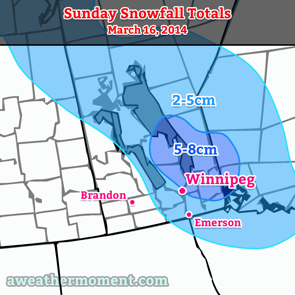
Friday will likely bring light snow to Winnipeg as a low pressure system works through Manitoba. The bulk of the snow will through the Interlake into Central Manitoba, but we’ll likely see the white stuff here in the Red River Valley as well. It looks like most places will see around 2–4cm of snow, however it’s possible that we sneak into the 5–8cm range if things end up just a little heavier than currently forecast. At this point, it looks like Winnipeg would likely see 4–5cm of snow; we’ll be sure to update this if need be as the system gets closer.

A benefit to the cloud and snow will be warmer weather; temperatures should climb to around –14°C on Friday. Skies will clear overnight and we’ll drop down into the mid-minus twenties.

Cold Air Returns

Yet another shot of extremely cold Arctic air is set to move back into Manitoba behind this system. Daytime highs will likely sit in the mid-minus 20’s through the weekend with overnight lows near –30°C, but the cold air should work it’s way into the region early next week, bringing another round of extremely cold temperatures.

2013 In Review

As it’s now 2014, I’ve already begun working on the 2013 statistics for Winnipeg. I hope to have a post ready within a couple weeks with a complete summary of the year past that will put into perspective where last year sat in the big picture!

Stuck In A Cool Pattern

A high-ampltude jet stream is bringing unseasonable weather to much of Canada.

A high amplitude jet stream is bringing unseasonable weather to much of Canada.

Temperatures will remain fairly cool through the next few days as Southern Manitoba remains entrenched in a pattern that has the jet stream diving through Saskatchewan well to our south, trapping cooler air over the area. In addition, snow will enter the picture as snow squalls batter areas in the lee of the lakes – in particular Lake Winnipeg – and a weak disturbance slides down from the North and brings flurry activity to many regions tonight.

Today

Wednesday

3°C
Mainly cloudy. Chance of flurries in the afternoon.

Through much of the Red River Valley today we’ll see mainly cloudy skies – perhaps with a sunny break or two – with the weather pattern being dominated by snow squalls coming off the lakes. While some squall activity is expected off of Lake Manitoba, with a band of snow extending SSE from the lake positioned between Portage la Prairie and Elie. More vigorous activity is expected off of Lake Winnipeg, where cooler air aloft will combine with favourable winds which will bring air not just over the South Basin, but over the North Basin as well. The cooler air aloft coupled with the air being over water for longer will combine to produce vigorous convection that will push SSE off the lake into areas around Beausejour and east.

The snow has the potential to be very heavy, producing near-whiteout conditions and rapid snowfall accumulation. Fortunately it will be confined to a fairly narrow corridor in the lee of the lake, but if you are expecting to travel east towards the Whiteshell today, you should be prepared for potentially encountering treacherous winter driving conditions.

Wednesday Night

-2°C
Light snow beginning in the evening.

Embedded above these local features will be a weak frontal wave sliding southwards along the baroclinic zone that is dividing the Prairies. This weak wave will bring light snow activity to the Interlake through the daytime today, pushing southwards and entering the northern Red River Valley by late in the afternoon or early evening hours. This light snow will push all the way south to the US border through the evening and persist through much of the night. No significant accumulation is expected from this system, although if it ends up intense enough then its possible some areas may awake to a cm or two on Thursday morning.

High temperatures will be around 2–3°C today throughout the Red River Valley while the ample cloud cover and light snow will limit our overnight lows to just around –2°C.

Thursday & Friday

Thursday

4°C / -4°C
A mix of sun and cloud; chance of flurries in the morning.
Friday

7°C / 0°C
Sunny becoming a mix of sun and clouds. Chance of showers.

Thursday will bring a mix of sun and cloud as the cloud from the overnight snow clears out but ample low cloud continues to flow off the lakes. There will be a chance of flurries in the morning as the overnight disturbance leaves the province, but little is expected otherwise. Some light snow may fall out of any clouds that wander through Winnipeg in the afternoon, but it would likely be exceptionally light if that were to happen.

Overall it will be a relatively nice, albeit cool, day. We’ll drop down to around –4°C under partly cloudy skies on Thursday night.

Friday will start with relatively clear skies but we’ll see things become more mixed as the day progresses. A significant low pressure system will be pushing through Northern Manitoba into NW Ontario dragging warm air with it across the Prairies; we’ll see southwesterly winds of 20–30km/h bring warmer air into the region as we head to a seasonal high of 7°C. There will be a chance of showers here in Winnipeg, although we look to be on the periphery of the system with the bulk of the precipitation falling through the Interlake into Southeast Manitoba. Friday night will bring partly cloudy skies and a low of about 0°C.

Weather Set to Slowly Improve

After a few days under the influence of significantly below-normal temperatures, conditions are set to gradually improve as the cold low that has been anchored over Northern Manitoba, Northwestern Ontario and Hudson Bay – for what feels like forever – begins to slowly shift off to the east.

Friday

21°C / 9°C
A few scattered showers in the morning, then a mix of sun and cloud.
Saturday

22°C / 11°C
Mainly Sunny
Sunday

24°C / 11°C
Mainly Sunny

This morning will start with mostly cloudy skies and a few scattered showers through the Red River Valley. These showers will taper off through the morning and should be over by midday. After that, we’ll see a mix of sun and clouds (although there’s a slight chance we might end up fairly cloudy, but I’ll bet on some sunshine) as we climb to a high of only around 21°C. We’ll have a partly cloudy sky tonight as we drop to a low of about 9°C.

Forecast for 700mb heights & winds from the RDPS valid this morning. The orange dashed line represents an upper trough swinging southwards that is expected to produce a few showers Friday morning.

Saturday and Sunday will be fairly nice days. Winds won’t make much of an appearance while much of our cloud cover finally moves off into Ontario and some warmer air finally starts to push back into the region. We may see a bit of a cloudy start to Saturday, but things should quickly turn sunny as we climb to around 22 or 23°C. We’ll drop to around 11°C Saturday night and then climb to a sunny high of 24°C on Sunday.

Moderation, At Last

The NAEFS 8-14 temperature anomaly outlook issued 12Z August 8th.

The NAEFS 8–14 temperature anomaly outlook issued 12Z August 8th. The lack of colours over Manitoba represents a return to seasonal weather is expected.

Long-range forecast models are finally forecasting a return to seasonal weather over the next week or two. With the relocation of the cold low into Eastern Canada, the persistent cold trough that drove our northwesterly winds will also vacate the region allowing milder air to push back in. Like we mentioned on Wednesday, no particularly warm is set to push into the area, but the warm August sun should quickly modify our air mass back towards seasonal values.

Little to no precipitation is expected in the next 5–7 days as broad upper-ridging slowly builds into the Prairies. A couple weak disturbances will have to be monitored, but for now there’s no rainy days in sight.

Fall Arrives Early

Distinctly fall-like weather will dominate over Southern Manitoba through the rest of the work week as a (unfairly) cold low slumps southwards into Central Manitoba, spreading cool Arctic air southwards across the Red River Valley and into the northern Plains of the United States.

A cold low slumping southwards into Central Manitoba will bring cooler, distinctly fall-like weather to Southern Manitoba. Image depicts 700mb temperatures for midday today.

A cold low slumping southwards into Central Manitoba will bring cooler, distinctly fall-like weather to Southern Manitoba. Image depicts 700mb temperatures for midday today.

Today & Tonight

Wednesday

18°C / 8°C
Mainly cloudy with a chance of showers.

We’ll see mainly cloudy skies today as the upper low continues it’s southwards trek pushing cool, unstable air into the Red River Valley. There may be some drizzle or a few showers to the in the lee of Lake Manitoba and the south basin of Lake Winnipeg this morning, although there may be enough wind shear to prevent any lake-effect precipitation from forming in this cool air mass. Temperatures will climb to only around 18°C today with some scattered showers developing through the day in most areas of the Red River Valley. The clouds and showers will move out in the evening leaving us with clear skies and light winds as we drop down to a temperature of around 8°C.

Thursday & Friday

Thursday

20°C / 11°C
Mainly cloudy with a chance of showers.
Friday

22°C / 9°C
Cloudy with a chance of showers in the morning then clearing.

Thursday will start off nice and sunny but quite cool. Scattered clouds will develop midday before a more organized area of cloud begins work it’s way into the city from the north in the afternoon. The afternoon cloud will limit our daytime high to only around 20°C. By late afternoon or early evening we’ll see a chance of showers move into the Red River Valley as another batch of moisture wraps around the back-side of the upper low and down through the Interlake. The cloud cover will help keep our overnight low a little warmer – close to 11°C – instead of the cooler temperatures of Wednesday night.

Early Friday morning we’ll probably see mostly cloudy skies with a chance of showers. The cloud cover will push out in the mid-to-late morning and we’ll be left with sunny skies and a high near 22°C. Friday night will be cloudy with a low of around 9°C.

Hope For the Weekend?

While some long-range models are forecasting temperatures in the mid–20’s, at this point it doesn’t look like we’ll see a warm-up that quickly. While the cold air definitely begins to push off to the east through the weekend, no particularly warm air is pushing in to replace it. We’ll see gradual warming thanks to the sunny skies, but at the moment a more conservative forecast of temperatures climbing towards the mid–20’s – instead of rocketing past it – is probably a safer bet. At this point it does look like it will be nice and sunny through the weekend, though, so all in all it will be quite pleasant.