Mild November Weather Continues, Cooler Later This Week

Winnipeg will continue to see very mild November temperatures into mid-week, then a cold front will sweep through and bring seasonal temperatures back to the region.

RDPS 2m Temperature Forecast valid 21Z Wednesday November 2, 2022
A low pressure system will push very mild temperatures into southern Manitoba on Wednesday afternoon.

The warm weather will continue for Winnipeg as a southerly flow continues to draw mild air into the region. The skies will be partly cloudy in Winnipeg with a high in the mid-teens. As the day progresses, an upper trough will dig southwards over the Rocky Mountains. This will push more warm air northwards over Manitoba and keep overnight lows very warm (for November). Winnipeg will only dip down to around 10 °C tonight, a whole 15 °C above normal for this time of the year!

Skies should stay partly cloudy into Wednesday, but its shaping up to be a gorgeous November day. It will be a bit windy as a low pressure system developing building into SW Manitoba brings southerly winds up to 30 to 40 km/h. The upside will be the warmth, with highs climbing into the upper teens and topping out at 18 or 19 °C here in the city.

The low will pass on Wednesday night, but the cold front will stay to the west a little bit longer. While the low will bring cloud to the area, the precipitation associated this system will stay well to the west and north. Winds will shift to the west overnight with a low down into the mid-single digits.

The cold front will swing through early Thursday, shifting winds to the northwest and keeping skies cloudy for the day. Winnipeg will see temperatures recover only a few degrees with just a slight chance of a scattered shower or two. Everything should clear out on Thursday night with temperatures dropping to a near-seasonal low of -4 °C.

Long Range Outlook

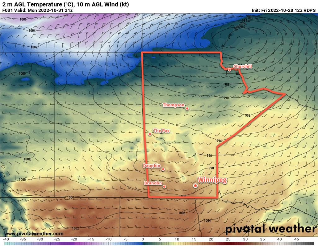
Friday will bring some sunshine and near-seasonal temperatures to the region, followed by slightly warmer weather on Saturday. Things will shift beginning Sunday, though, with most weather models showing a transition to cooler weather with the first real chance of accumulating snow beginning next Monday.

Today’s seasonal daytime high in Winnipeg is +4 °C while the seasonal overnight low is -5 °C.

Warm Weekend Ahead; Halloween Looks Great

There are no complaints here about the upcoming weather in Winnipeg: plenty of sunshine and mild temperatures!

RDPS 2m Temperature Forecast valid 21Z Monday October 31, 2022
It continues to look like Winnipeg will see a beautiful Halloween this year with highs in the mid-teens dropping to around 10 °C in the evening.

A series of strong low pressure systems moving through the Canadian Arctic will sustain a westerly flow aloft over the Prairies this week. That will keep western Canada under the influence of milder Pacific air and keep the colder Arctic air locked up in the north.

As a result, Winnipeg will see nothing but seasonably mild conditions ahead with daytime highs in the 10 to 15 °C range and overnight lows hovering near or just above freezing. Skies will be fairly sunny as dry conditions persist across the region, but some cloud cover is possible on tonight into Saturday morning before clearing out. Winds will be a bit breezy out o the southwest today, then calmer conditions will move in for Saturday and Sunday.

Long Range Outlook

The warm weather will stick around into the start of next week, but it will get a bit windier out of the west. For Halloween evening, it still looks like it will be close to 10 °C around trick or treat time and cool off gradually through the evening.

By mid-week, the weather pattern will begin to shift, bringing in cloudier conditions and a return towards seasonal temperatures. Long-range forecasts show the next notable chance for precipitation arriving at the end of next week. What it falls at is anyone’s guess right now, but signs point towards a bit of a wintery mix that could end with a bit of snow finally sticking. Hopefully not, though, and we can keep the snow away for as long as possible!

Today’s seasonal daytime high in Winnipeg is 7 °C while the seasonal overnight low is -3 °C.

A Brief Cold Snap Followed By A Warmer Weekend

Winnipeg will see a few cold days in the wake of yesterday’s Colorado Low, followed by a return to milder conditions on the weekend.

RDPS 2m Temperature Forecast valid 12Z Wednesday October 26, 2022
The Prairies will be flooded with colder air behind the departing Colorado Low. Overnight lows will drop below freezing almost everywhere in the region, with some fairly cold temperatures over far northern Manitoba.

A push of colder air will settle over southern Manitoba in the wake of yesterday’s Colorado Low that moved through the province. With light west-northwest winds, daytime highs will only climb into the low single digits today and tomorrow. Skies will stay on the cloudier side as well, making for a rather chilly couple days. It should stay dry, but some lake-effect snow will be possible in the lee of both Lake Manitoba and Lake Winnipeg. The city will likely miss out on this activity, but some persistent flurries will definitely be possible to the north.

The cloud cover over the region will help keep it from getting too cold at night with lows close to -5 °C on both Tuesday night and Wednesday night. If some clear patches open up, then temperatures could dip closer to -10 °C.

Later this week, a zonal flow aloft will develop over the Prairies, cutting off the pipeline of Arctic air and allowing milder Pacific air into the region. On Thursday, that should allow highs to climb back to seasonal values in the upper single digits with more sunshine. It may get a bit windier out of the south, but that will help keep lows above freezing into Friday.

Long Range Outlook

By Friday, it looks like Winnipeg and area could be enjoying daytime highs in the low to mid-teens with mainly sunny skies. This pleasant and dry pattern will persist right through the weekend with highs continuing in the low teens. Long-range forecasts show a disturbance moving through the region on Tuesday, bringing some showers and a return to seasonal temperatures.

That said, aside from the next couple days, it looks like Winnipeg will be closing out October with beautiful weather. If early indications hold, Halloween could be one of the better ones this year with temperatures near 10 °C through the evening!

Today’s seasonal daytime high in Winnipeg is 7 °C while the seasonal overnight low is -3 °C.

Warmer Weather Ahead

The Arctic ridge bringing seasonably cold temperatures to southern Mantioba will head out later this week. In its wake? Much warmer weather will return as temperatures climb back above seasonal values.

RDPS 2m Temperature Forecast valid 21Z Tuesday October 18, 2022
The colder weather will hang on for one more day in southern Manitoba, then warmer air will push into the region from the west.

Today will bring more cold weather; the Arctic high hasn’t quite left the region yet and will keep highs in the low single digits. Winds will be light and skies will be mostly sunny, so it shouldn’t be a bad day overall.

Beginning Wednesday, the Arctic high will start moving out of the region and the broader long-wave pattern will begin to break down. This will cut off the pipeline of Arctic air that’s been entrenched over the region and begin to allow milder air from the west to build in.

Wednesday will bring near-seasonal highs back to Winnipeg with a high near 10 °C. The winds won’t even be too much of an issue with light southerlies of 15 to 25 km/h. There will be a bit more cloud than Tuesday, so expected partly cloudy to mixed skies. Temperatures will still likely fall below zero again on Wednesday night.

On Thursday, a weak disturbance will drop southeastwards through the province. Temperatures will be similar to Wednesday, but most areas will see a mainly cloudy day. The cloud cover will keep it warmer on Thursday night with a low in the mid-single digits. 

Long Range Outlook

The sun will reappear on Friday across southern Manitoba while a potent low pressure system begins to develop in Alberta. As it tracks eastwards over the weekend, it will draw warmer air into southern Manitoba. Daytime highs will likely climb into the upper teens by Sunday with increasing southeasterly winds.

It should stay dry through the weekend, but as the system passes on Sunday night, the weather will turn more unsettled. Rain and/or snow will be possible to start off next week as cooler temperatures once again push back into the region.

The timing of this system could change a bit in the days ahead given how far out it is, but the general trend of warming into the weekend, then a notable cool-down by the middle of next week looks fairly reliable.

Enjoy nicer late-fall weather ahead!

Today’s seasonal daytime high in Winnipeg is 9 °C while the seasonal overnight low is -1 °C.