An Improvement In The Weather Ahead

I can't speak for others, but I think I've nearly forgotten what the sun looks like. Fortunately, a reminder is on the way as the persistent cloud that's been locked into the region for so long will be exiting stage right. While it'll take several days until temperatures climb back to seasonal values, the sunshine alone will be a much welcome change.

This morning will start off with some remnant cloud in the Red River Valley–particularly in areas downwind of the lakes where flurries will be possible–but the cloud will clear through midday, with plenty of sun appearing. It will be chilly, though, with temperatures climbing only to around 6°C. A hard freeze is on the way tonight as temperatures drop to -2 to -3°C under mainly clear skies.

A few flurries are possible in Winnipeg on Wednesday morning from a streamer off Lake Manitoba.

Thursday will be a mainly sunny day with a high near 8°C. Winnipeg will likely see a few afternoon clouds, but otherwise no significant weather is expected. Temperatures will dip to around 2°C on Thursday night.

Breezy southerly winds on Friday will bring warmer temperatures back to the region with daytime highs topping out around 14°C. This warmer air will also come with a fair amount of cloud, though, with mixed to mainly cloud skies in place over the Red River Valley. The winds will be notable, though, increasing out of the south to 30-40 km/h in the afternoon.

Above-normal temperatures (red) will push into Southern Manitoba on Friday.

With a warmer air mass in place, temperatures will be milder on Friday night with a low near 8°C.
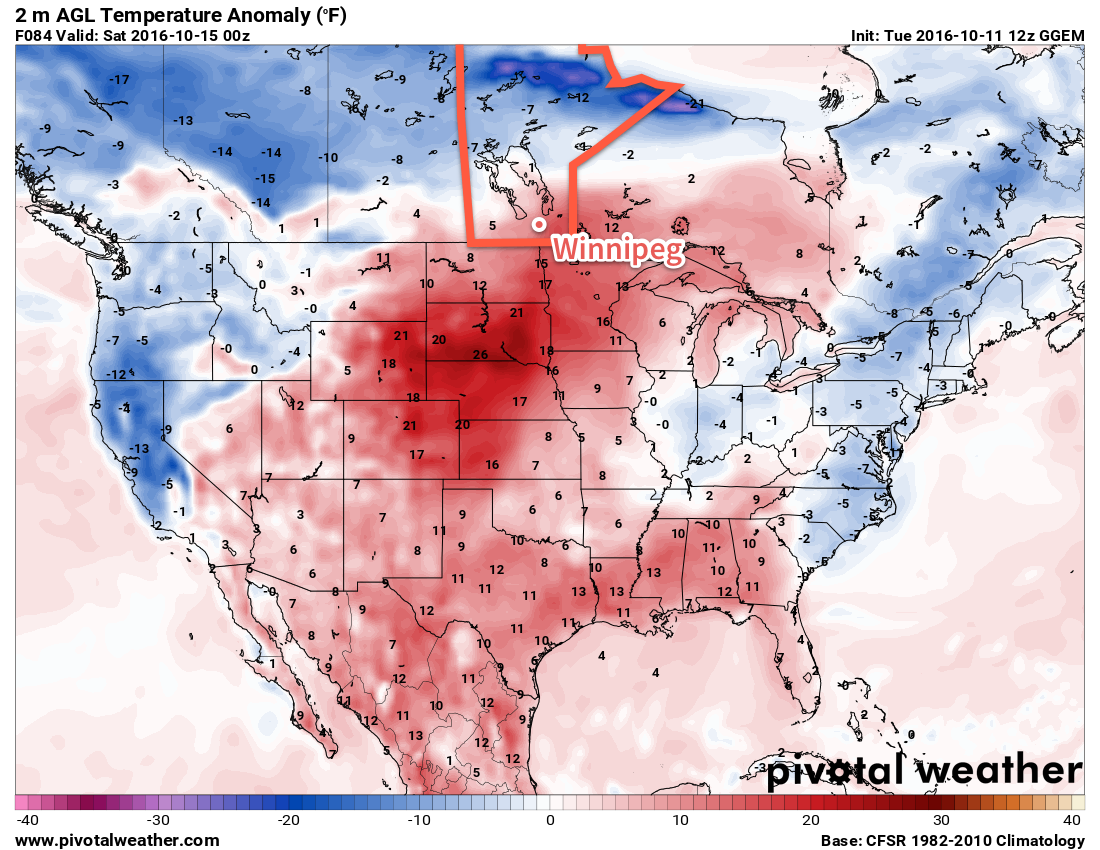
Long Range

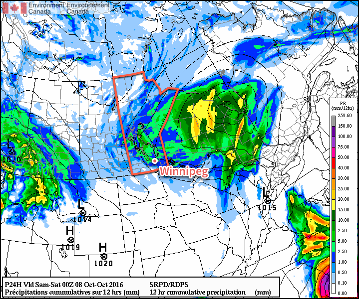
The weekend looks milder with seasonal to slightly above-seasonal temperatures in the Red River Valley. A major low pressure system will track through the region, however the precipitation associated with it should remain north of the Trans-Canada corridor, falling primarily across the Parkland, Interlake, and portions of Central Manitoba.

Despite not expecting much precipitation, we'll probably see a fair amount more cloud associated with the warmer weather, so enjoy these sunny days while we have them!

Winnipeg’s seasonal daytime high is currently 11°C while the seasonal overnight low is 0°C.

Cool Weather Starts The Week

This week will remain on the cool side as we continue to deal with chilly air flooding down from the north.

Cool air will continue to push down from the north today

This Week

Today will be another cool one in southern Manitoba. High temperatures in the upper single digits are expected with breezy north winds. A weak low pressure system will pass through the region, perhaps bringing a few showers to southern Manitoba. Portions of western Manitoba and the Interlake may receive some heavier precipitation, with periods of light to moderate rain possible. There may even be some snow mixed in, especially as temperatures cool in the evening and after dark.

Tuesday will remain cool, with temperatures once again in the mid to upper single digits across southern Manitoba. Skies will be mainly cloudy with a slight chance of a shower or flurry. Winds will be breezy out of the north at 20 km/h.

Cool weather will continue on Wednesday as high temperatures only climb into the mid single digits. Skies will remain mainly cloudy with a slight chance of showers or flurries. Winds will be westerly at 20 km/h.

Long Range

Medium- to long-range models suggest that above-normal weather may make a come back as we move toward mid-month with temperatures that may begin to climb back to normal or above-normal values by the weekend and continue into next week. This should stave off the risk of any significant snow for the foreseeable future.

Chilly Weekend Ahead

Cool, unsettled weather will dominate the weather for much of the coming few days as a northwesterly flow of Arctic air puts a damper on the weekend.

The chill northwesterly flow will be in place for today and tomorrow, keeping temperatures well below normal and spreading plenty of clouds across the region and bringing several chances for showers or flurries. High temperatures will sit near 6°C and 8°C tomorrow, with overnight lows near 1°C both tonight and tomorrow night. Winds will be breezy today out of the west at around 30 gusting to 50 km/h and lighter on Saturday.

A smattering of showers and flurries are expected across Southern Manitoba today.

Today will bring widespread showers or flurries to Winnipeg & area today, with enhancement in the lee of the lakes leading to isolated bands of heavier precipitation. The unsettled weather will diminish overnight until all that’s left into Saturday morning is some streamer activity off of both Lake Manitoba and Lake Winnipeg. There’s a slight chance that the lake-effect activity will clip through Winnipeg Saturday morning, but otherwise it should be cloudy & fairly dry.

A new disturbance will move into the region on Sunday, shifting winds out of the south and spreading some light rain across much of Southern Manitoba. Temperatures will climb a bit higher than they’ve been lately with a high near 11°C, but winds will be a bit breezy out of the south.

Long Range

Cooler weather will persist into the start of next week, but hope is on the horizon.

NAEFS Temperature Anomaly Forecast valid October 14 to October 21, 2016.

Models are all very consistent in building a fairly substantial upper ridge into the United States, bringing slightly above-normal temperatures for next week and fewer chances for precipitation.

Flurries Start Off A Cool Weekend

Today will start off with flurries moving through the Red River Valley, setting the stage for a snap of cool weather that will bring temperatures well below seasonal. While temperatures will rebound slowly through the weekend, it will hardly be beautiful spring weather.

Today will be a rude awakening for many, as cold temperatures combine with a weak disturbance rolling through the region to produce widespread light flurry activity through the Red River Valley. Some places might get lucky enough to see things change over to scattered showers briefly this afternoon, but for the most part, expect some light snow for much of the morning and into the afternoon. Fortunately, the snow won't really stick and no accumulation is expected.

In addition to the snow, the winds will continue to be strong out of the northwest at 40 gusting 60km/h with a daytime high that just barely gets to 5°C.1 Temperatures will dip to near the -4°C mark tonight with clearing skies. Near the core of Winnipeg it's not as likely that there will be a hard freeze, but certainly near the outer edges of the city and into the rural areas a significant freeze is likely so you may want to take precautions if you've any sensitive plants outside already.

GDPS Forecast 850mb Temperature Anomaly
The 850mb temperature anomaly forecast shows a large core of below-seasonal (blue) temperatures over Manitoba today.

Saturday will finally bring out the sun in Winnipeg, but it will continue to be chilly with a daytime high of 9°C under mainly sunny skies. Winds will continue out of the northwest, but be slightly weaker at 20km/h or so. Expect a low near the freezing mark on Saturday night with partly cloudy skies and light winds.

Sunday will see another disturbance moving through the province in the northwest flow. More cloud will move into Winnipeg alongside slightly warmer temperatures; daytime highs are expected to climb into the mid-teens! A band of showers will likely move through in the afternoon, bringing a decent chance of precipitation to most areas in the Red River Valley. Winds will vary through the Red River Valley from light to around 30km/h. Expect a low on Sunday night near 3°C with partly cloudy skies.

Long Range: Climbing To Seasonal

Looking ahead to the start of next week, it appears that temperatures will make a continued climb back towards seasonal, however the with a stubborn upper trough refusing to leave the area, that could end up taking longer than expected. Conditions aren't expected to be too bad with a good mix of sun and cloud and highs in the mid- to upper-teens. There will be a slight chance of showers.

Winnipeg’s seasonal daytime high is currently 19°C while the seasonal overnight low is 5°C.

  1. Nearly 15°C below normal for daytime highs right now in Winnipeg.