Warm weather continues in Winnipeg, but the city will see occasional snow over the coming days.
A relatively zonal flow across the Canadian Prairies will persist over the coming days, keeping temperatures seasonably mild with the cost of frequent disturbances moving through. In Winnipeg, this means that while the city will continue to see highs near the freezing mark, there will be a fair amount of cloud and several chances for snow.
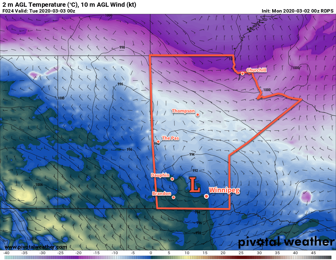
Today, the city will see increasing cloud as a low pressure system moves into the province from the northwest. Winds will strengthen out of the south to around 40 km/h by midday as cloud thickens up and light snow slowly pushes into the Red River Valley. Winds will ease this evening and then shift west-northwest and increase to 30 gusting 50 km/h overnight. The light snow will taper off through the night with accumulations of 1 to 2 cm. Temperatures will dip to a low near -4°C with a continued chance of flurries overnight.
On Tuesday, a weak ridge of high pressure will move across the province. The cloud cover will gradually break up through the day as temperatures climb to a high near -1°C. The city may see some flurries through the morning hours. Winnipeg will see north-westerly winds through the day of around 20 km/h that ease to light in the evening. Temperatures will dip to a low near -11°C on Tuesday night with partly cloudy skies.
Skies will cloud over again on Wednesday as the next low pressure system moves into the province. Winds will pick up out of the south into the 30 to 40 km/h range as the low approaches the region. Temperatures will climb to a high near 0°C with light snow beginning in the afternoon. The city will see periods of snow on Wednesday night with winds turning southwest then gradually westwards.
Model forecasts diverge and show the heaviest snow occurring either just north of Winnipeg or just south of the city. Regardless of the track, it looks like up to 10 to 15 cm may be possible. At the moment, solutions generally agree with 2 to 5 cm of snow in Winnipeg by Thursday morning. That said, we’ll track this system as it develops and monitor the trend on the track for the heaviest snow. Depending on the track, Winnipeg could end up seeing heavy snow on Wednesday night.
In addition to the snow, there will also be a risk of some freezing rain across the region, particularly from the late afternoon until around midnight. Temperatures will fall to a low near -2°C.
Long Range Outlook
Winnipeg will see mild but windy conditions on Thursday as temperatures return to the freezing mark with moderate to strong northwest winds. The rest of the week looks to continue mild with breezy conditions reappearing for Friday (southerlies) and Sunday (northerlies). Occasional flurries are possible, but it looks like there’s no organized snow chances until the second half of the weekend into the new work week.
Today’s seasonal daytime high in Winnipeg is -5°C while the seasonal overnight low is -15°C.