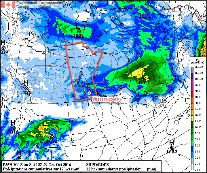
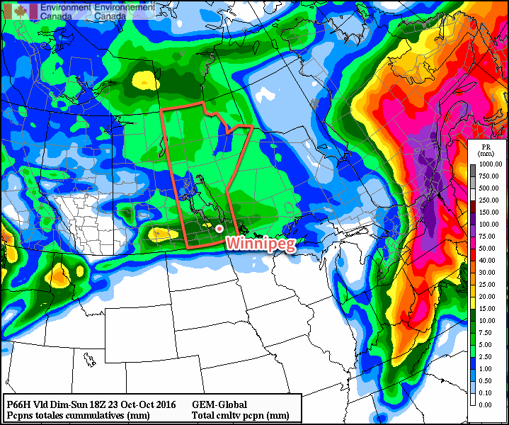
More rain is in store early this week as a well-developed low pressure system pushes across southern Manitoba. Accumulations will be relatively small in the Red River Valley, but more significant to the north and west.
This Week
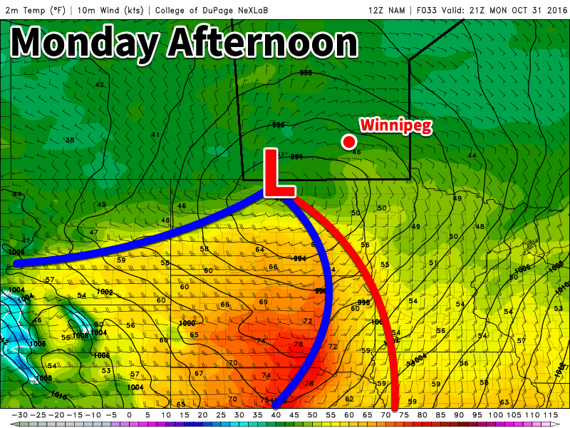
Rain will move into southern Manitoba today in association with a strong low pressure system coming out of Montana. Light rain will likely begin in the Red River Valley this morning, continuing into the afternoon. Models show a break in the rain during the evening hours, which might just provide a good window for trick-or-treating. Regardless of whether it’s raining or not, temperatures will be favourable for the youngsters to be outdoors, with temperatures hovering in the mid-single digits. Total rainfall of 2-5 mm is expected today, with another 2-5 mm tonight. Parts of western Manitoba and the Interlake can expect total accumulations ranging from 10 to 25 mm.
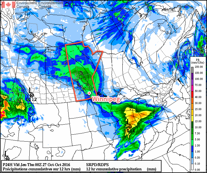
Today’s weather system will still be lingering over Manitoba on Tuesday, with some showers remaining possible through Tuesday morning. A drier flow should develop by Tuesday afternoon, signalling an end to the precipitation. Temperatures will remain relatively normal for late October, with high temperatures in the mid to upper single digits in southern Manitoba. Winds will be breezy out of the west at 20-30 km/h.
Nicer weather should arrive for Wednesday as a ridge of high pressure builds over the region. Mainly sunny skies and temperatures around or just below 10C are expected. Wednesday’s nice conditions should signal the beginning of a significant warm spell which should last into next week. Winds should be relatively light thanks to the surface ridge.
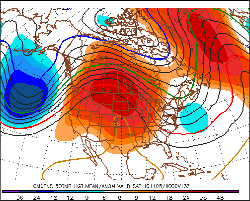
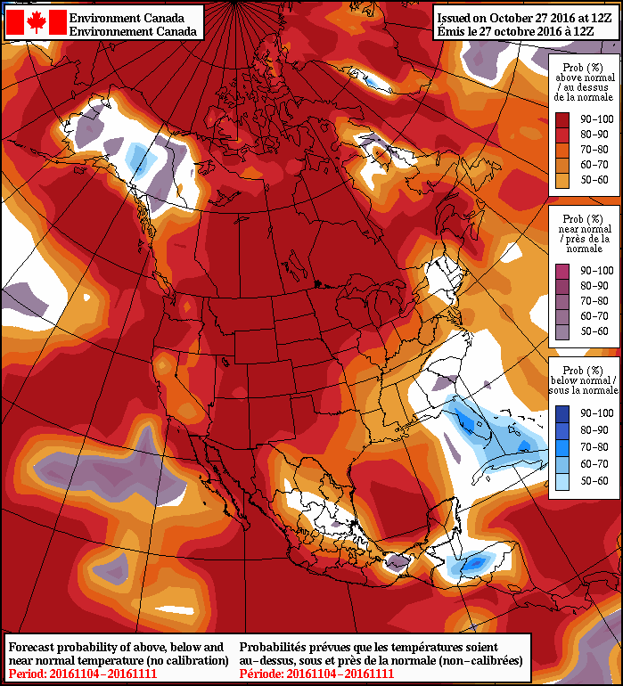
Long Range
Medium- to long-range models have been strongly hinting at a significant warm-up beginning mid to late this week. An anomalously strong upper ridge of high pressure is expected to build over Central North America, signalling a period of well-above seasonal conditions for Manitoba. Given that our normal high is 4C, we can easily expect temperatures of 10-15C. It is not impossible that we reach the upper teens once or twice when the “heat” peaks sometime over the weekend or next week. Models strongly suggest that this above-seasonal pattern will exist for most, if not all, of the first half of November.