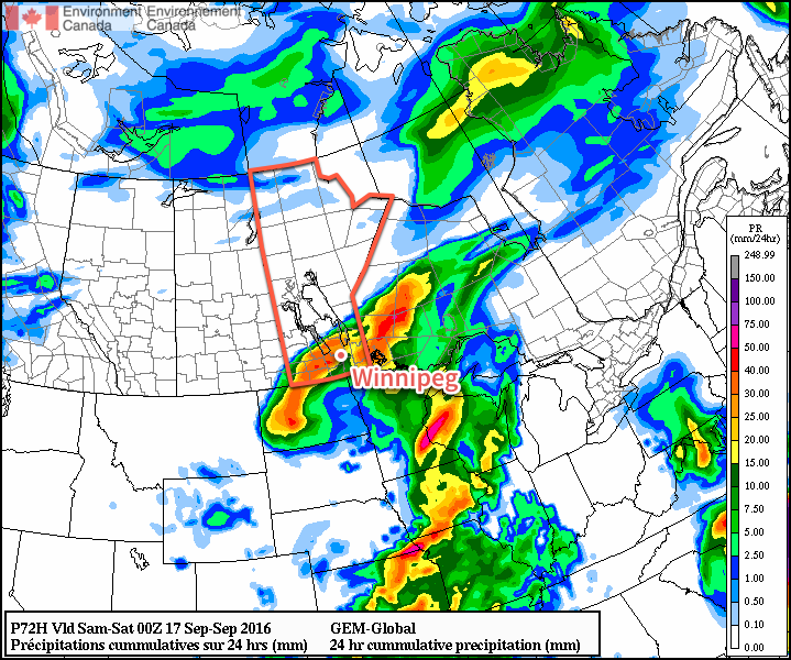
Rain will be the story of the day for Winnipeg as a stalling low pressure system continues to produce rainfall over portions of Southern Manitoba. The wet weather will give way to a fairly pleasant weekend, however, as a westerly flow develops and spreads warmer air eastwards across the Prairies.
Winnipeg can expect another 5-10 mm of rain today as a slow-moving low pressure system continues to produce a band of rain stretching from the Pilot Mound region northeastwards through the Red River Valley, over the south basin of Lake Winnipeg and off through the Nopiming Provincial Park into Ontario. With the wet weather, temperatures will be near-seasonal as the daytime high sits near 17°C. The wind will be gusty out of the north at around 30 km/h gusting to 50 km/h.
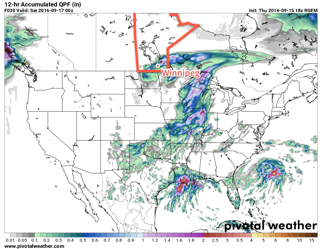
The rain will taper off this evening as the low moves off into Ontario. Clouds will then scattered out as the wind gradually tapers off and the temperature dips to a low near 7°C.
Saturday will be a fairly nice day with a high near 20°C under sunny skies. Expect a low near 11°C on Saturday night under clear skies.
Sunday will be a warmer day with temperatures climbing into the mid-20’s as warmer air spreads eastwards across the Prairies. Cloud cover will increase through the day, though, as a cool front sweeps through the Red River Valley in the afternoon. At this point, no rain is expected. Winds will shift from 20-30 km/h out of the south to 20-30 km/h out of the northwest behind the front. Skies will gradually clear overnight as temperatures head to a low near 13°C.
Long Range
Next week is looking relatively unsettled with multiple chances for rain through the week. Temperatures will be near seasonal for much of the week, although it appears that a more pronounced cool-down may come with some rain at the end of next week.
Winnipeg’s seasonal daytime high is currently 18°C while the seasonal overnight low is 6°C.