Arctic Blast Pushes into Southern Manitoba

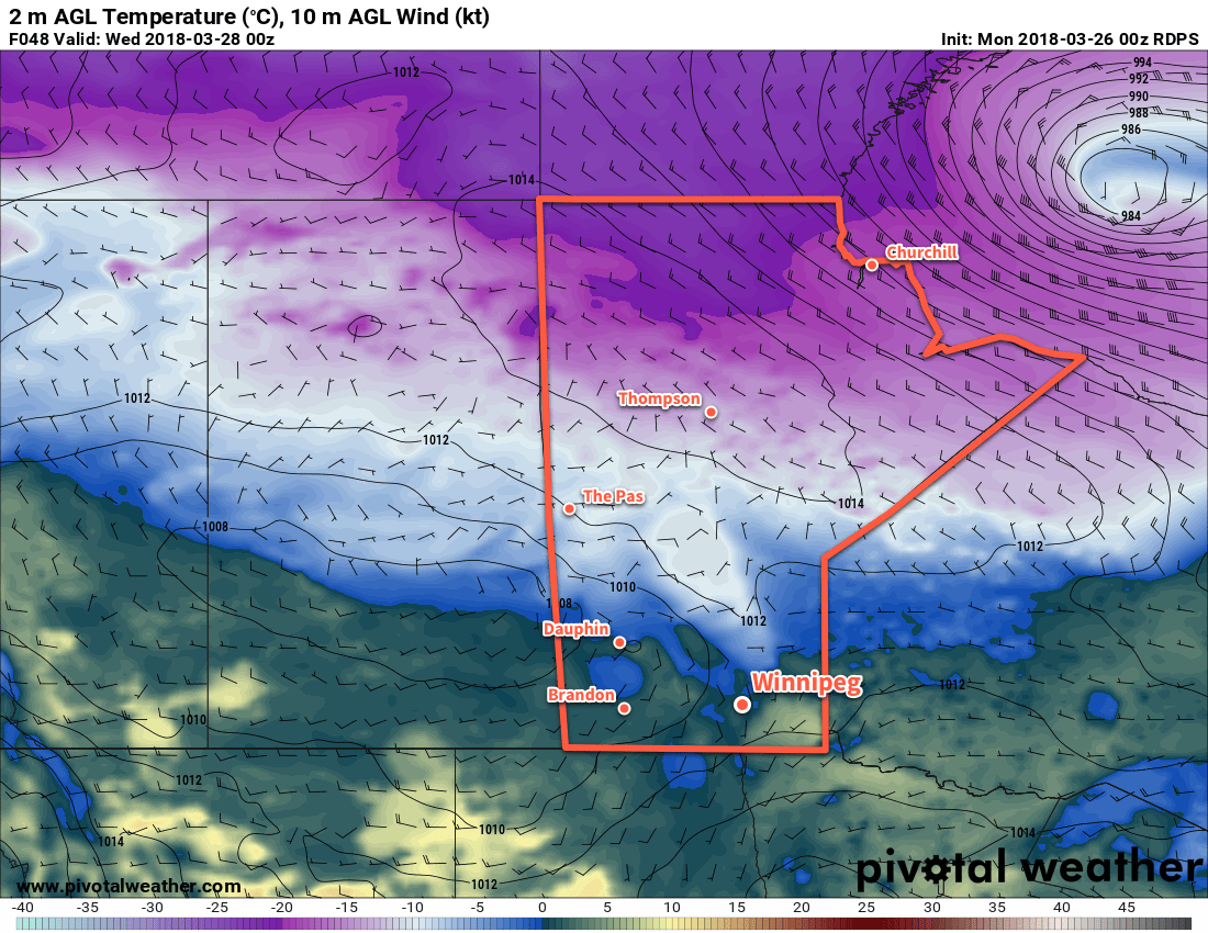
Temperatures will drop significantly below seasonal values over the coming days as Arctic air surges southwards behind the Alberta clipper that brought mild temperatures to the region on Tuesday.

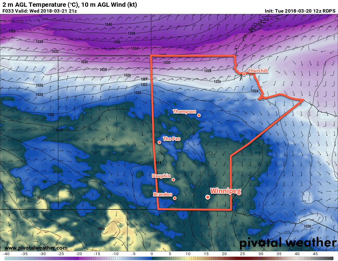
An Alberta clipper exiting the province this morning will usher in significantly cooler temperatures. Northwesterly winds will increase to 40 gusting 60 km/h this morning, cooling temperatures to around -5°C in the Red River Valley by late this afternoon. This cooling trend combined with the wind will make for a positively miserable feeling day. The morning cloud will break up, leaving mixed skies in Winnipeg and the Red River Valley, but the cold air diving southwards will produce instability in the lower atmosphere, bringing a chance of flurries that will persist until evening.

3km NAM Forecast Sounding for CYWG valid 21Z Wednesday March 28, 2018
This 3km NAM forecast sounding for Winnipeg shows the instability expected to develop in the low levels as colder air surges southwards.

Winds will taper off this evening and Winnipeg will head towards an overnight low near -10°C under partly cloudy skies.

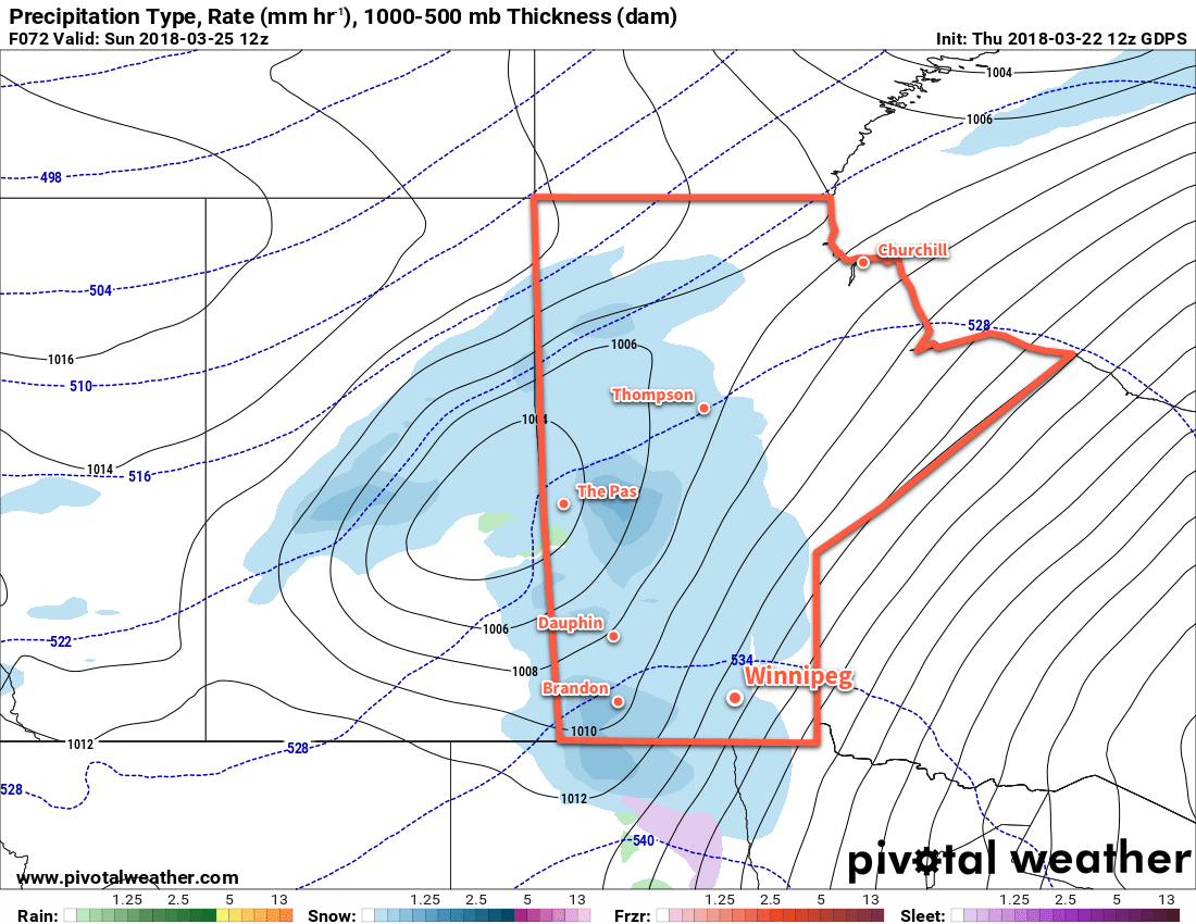
On Thursday, a mid-level disturbance moving from central Alberta southeastwards into North Dakota will bring increasing cloudiness to Winnipeg. Temperatures will reach a high near -5°C by midday, but then the Arctic front will drop southwards through the Red River Valley and send temperatures plummeting. Northerly winds of 20 to 30 km/h will persist behind the Arctic front into the evening. Much of southern Manitoba will see the potential for flurries along the Arctic front on Thursday afternoon.

Significantly colder temperatures will move into the region behind the Arctic front, sending overnight lows down towards -19°C.1

GPDS Forecast 2m Temperature valid 12Z Friday March 30, 2018
The GDPS has temperatures as low as -24°C in the Red River Valley on Friday morning, but may be producing temperatures that are too cold

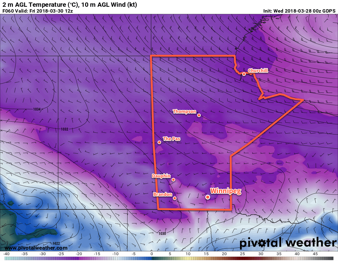
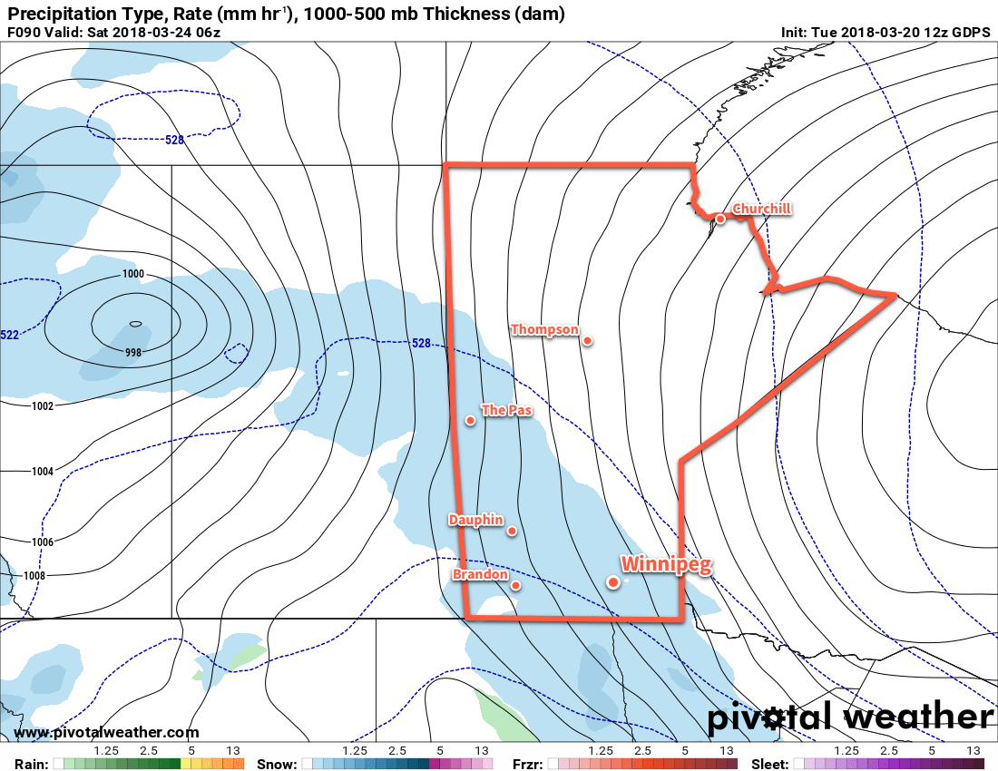
Friday will be a downright chilly late-march day with partly cloudy skies as more clouds pop up for the afternoon. Light northwesterly winds of 10 to 20 km/h will continue with temperatures climbing to a high near -9°C. Temperatures should drop to a low near -18°C once again on Friday night.

Long Range Outlook

Temperatures will moderate slightly on the weekend, but the trend of below-seasonal temperatures is forecast to continue into the middle of next week. No significant precipitation events are forecast for the next 7 days.

Winnipeg’s seasonal daytime high is currently 4°C while the seasonal overnight low is -7°C.

  1. Sometimes models struggle with overnight lows under Arctic ridges. The GDPS is forecasting a low near -23°C, but tends to cool too much due to excessive radiational cooling. Most other models have solutions closer to -13 to -15°C, but that is likely too warm. We’ve picked 19°C as a relatively happy medium, a couple degrees colder than the Barthrom calculation would suggest to account for the advective cooling in the evening.

Seasonal Conditions To Be Ousted Mid-Week By Arctic Cold Front

Winnipeg will see a couple more days of near-seasonal temperatures before a cold front swings through on Wednesday. Behind the passage of the cold front, a cooler Arctic air mass will settle over the region, bringing March to a close with significantly cooler-than-seasonal temperatures.

Mostly cloudy skies will continue in Winnipeg today with light winds and a high near +2°C. Temperatures will down to a low near -3°C tonight under mostly cloudy skies as well. A low pressure system moving through northern Manitoba tonight will bring westerly winds into the Red River Valley for Tuesday, which will help clear out the cloud cover and bring some sunshine back to the region. Temperatures should reach a high near +4 or +5°C, but with fairly warm temperatures aloft in advance of the next low pressure system, isolated areas with less snow cover could see temperatures as warm as +7 or +8°C.

RDPS 2m Temperature valid 00Z Wednesday March 28, 2018
Temperatures will vary between 0°C and +8°C across southern Manitoba on Tuesday

As the next low pressure system pushes into southern Manitoba on Tuesday night, more cloud will build back into the region with southerly winds of 15 to 25 km/h. There may be a passing shower or flurry on Tuesday evening, then temperatures will head towards a low near -1°C. The centre of the low pressure system will move through the Red River Vally on Tuesday night, bringing with it what looks like a fair chance of drizzle or freezing drizzle, depending on exactly what the temperature is at the time.

Forecast sounding for CWYG valid 09Z Wednesday March 28, 2018
Drizzle will be a distinct possibility on Tuesday night with a risk of freezing drizzle as temperatures drop below freezing Wednesday early Wednesday morning

Wednesday will see any remaining drizzle dissipate in the morning as a cold front slumps southwards. Temperatures will drop in the wake of the front to near -3°C by the evening as northwesterly winds of 30 to 40 km/h usher in a colder air mass. The cloud cover should break up on Wednesday night as temperatures drop to a low near -12°C.

Long Range Outlook

The remainder of March into the start of April will bring well below-seasonal temperatures to the region.

NAEFS 8-14 Day Temperature Anomaly Forecast — Valid April 2 to 9, 2018

The remainder of the week into the weekend is looking unseasonably cold with daytime highs in the mid-minus to low-minus single digits and overnight lows in the -15 to -20°C range. The cold will linger at least through the beginning of next week.

Winnipeg’s seasonal daytime high is currently 3°C while the seasonal overnight low is -8°C.

Snow Struggles Against Dry Arctic Air

Several waves of snow will try to push into southern Manitoba over the coming days, but they will have to try and overcome dry air near the surface coming from an abnormally strong Arctic high.

A low pressure system building into Alberta today will spread cloud cover eastwards across the Prairies. This cloud will push into Winnipeg through the day, bringing gradually increasing cloud cover. With some sun, temperatures should be able to climb to a high near 4°C. Winds will be a bit of an issue, however, increasing out of the southeast to around 30 km/h. Snow will begin spreading into southwestern Manitoba in the afternoon, then attempting to move into the Red River Valley this evening.

The snow will have a worthy adversary in the form of a large Arctic ridge over Ontario that will supply the Red River Valley with dry air. This will undercut the band of snow, weakening it and significantly slow down its eastward progress. Some light snow will likely arrive in Winnipeg late overnight into Saturday morning. Winds will continue out of the southeast at 20 to 30 km/h. Temperatures will drop to a low near -4°C.

GDPS Normalized Surface Pressure Anomaly valid 18Z Friday March 23, 2018
An unseasonably strong high pressure system over Ontario will undercut the incoming low with drier Arctic air

Saturday will bring a bit of light snow in the morning with southerly winds continuing at around 30 gusting 50 km/h. Snow should taper off by midday, leaving behind cloudy skies. Temperatures will be cooler than Friday with a high near +1°C. A second low pressure system will move into the Prairies on Saturday night, bringing stronger southerly winds of 40 gusting 60 km/h to Winnipeg by early Sunday morning along with some snow. At this point, it looks like a few evening flurries will intensify into accumulating snow through the second half of Saturday night. Temperatures will dip to a low near -2°C.

GDPS Precipitation Type/Rate valid 12Z Sunday March 25, 2018
The GDPS is forecasting a large are of snow to spread across Manitoba on Sunday

Sunday morning should bring accumulating snow to Winnipeg with 2 to 5 cm of snow by the time it tapers off midday. The wind will diminish rather quickly in the morning as the low moves into Manitoba. Temperatures will be near-seasonal with a high near +2°C.

Long Range Outlook

Next week looks like it will bring variable cloudiness to Winnipeg with several chances of light snow. Temperatures will remain more or less near-seasonal, possibly shifting to just slightly below-seasonal in the latter half of the week.

Winnipeg’s seasonal daytime high is currently 2°C while the seasonal overnight low is -9°C.

Mild and Cloudy In Advance of Weekend Snow

Winnipeg will see seasonably mild conditions over the next several days with an abundance of cloud cover.

Winnipeg will see the light snow that moved into the region yesterday persist for a few more hours this morning before tapering off. Cloudy skies will remain as temperatures climb to a high near +2°C this afternoon. Winds will stay light through the day. Tonight will bring more cloudy skies with temperatures dipping to a low near -3°C.

Temperatures will climb above 0°C across much of southern Manitoba on Wednesday

With a stagnant pattern in place over Winnipeg on Thursday, the city see similar conditions to Wednesday. Under mostly cloudy skies, temperatures will climb to a high near +3°C with light winds. There may be a few clear patches on Thursday night as temperatures dip to a low near -3°C again. Winds will increase to around 15 km/h by Friday morning.

A more organized disturbance will begin working its way towards Winnipeg on Friday as a large Pacific storm system begins pushing inland. Winnipeg will see mostly cloudy skies with a high near +3°C yet again. Winds, however, will be a bit more noticeable out of the east-southeast near 20 km/h. By late in the day, an area of snow will begin spreading across southwestern Manitoba into the Red River Valley. Winnipeg will likely see a couple cm of snow on Friday night as temperatures drop to a low near -2°C.

Snow is forecast to spread across southern Manitoba on Friday night

Long Range Outlook

Looking ahead to the weekend, Winnipeg will see more of the same with cloudy skies, highs near +3°C, and lows dipping just below freezing. Snow should taper off Saturday morning, then a more significant snowfall of 4 to 8 cm is forecast to move into the region on Sunday.

This second batch of snow is forecast to taper off on Sunday night, followed by gradual clearing in the Red River Valley through the first half of next week. Temperatures will remain relatively mild with highs a few degrees above 0°C and lows dipping a few degrees below.

Winnipeg’s seasonal daytime high is currently 1°C while the seasonal overnight low is -9°C.