Generally Mixed Weather Ahead

Winnipeg will see a little bit of everything over the next few days as warm and humid conditions are replaced by a northwest wind that ushers in slightly cooler and much drier air. Winnipeg will also see several chances for thunderstorms this week.

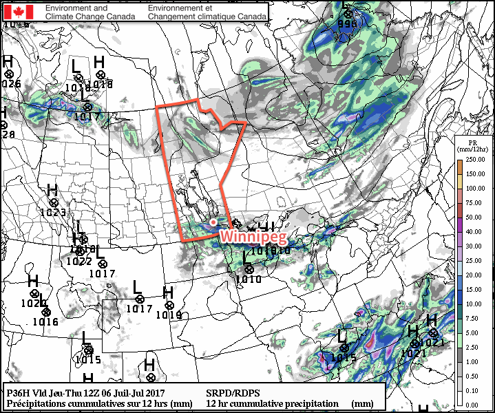
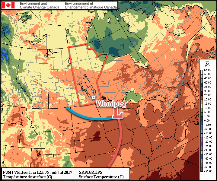
This morning will start off cloudy with the chance of a thunderstorm for Winnipeg & much of the Red River Valley as elevated convection that developed overnight moves through the region. Behind the morning convection, temperatures will climb to a high near 28 or 29°C with winds of 15-25 km/h out of the northwest. It’ll get rather humid this morning with dew points climbing up to around the 18°C mark before drier air works in from the northwest for the afternoon. Skies will break up somewhat for the afternoon and then clear out in the late afternoon or evening. Temperatures will head to a low near 14°C under clear skies tonight.

Slightly cooler weather will be in place over Southern Manitoba on Tuesday

A ridge of high pressure will move across the province on Tuesday, bringing slightly cooler temperatures and mainly sunny skies for Winnipeg. A disturbance moving through North Dakota may spread cloud cover across the southern Red River Valley, but there’s still a bit of uncertainty about that. Temperatures will be just a touch below-seasonal for the latter half of June with a high near 25°C, but winds will be light, so it’ll feel like a pretty nice summer day. Temperatures will dip to a low near 13°C on Tuesday night under clear skies.

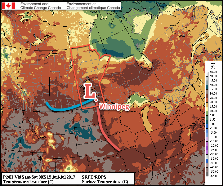
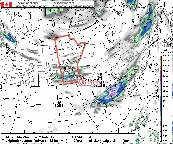
Wednesday will bring the next chance for thunderstorms to the province as a warm front moves in. It’s expected that elevated convection will from ahead of the warm front on Tuesday night in Saskatchewan, and then spread across southwest Manitoba overnight and into the Red River Valley on Wednesday morning.

The general consensus is that thunderstorm activity that develops on Tuesday night will move across the Red River Valley on Wednesday.

In these situations, there’s almost always a significant amount of uncertainty, so we’ll definitely be keeping an eye on how things develop. The end result will be a “cloudy with sunny breaks” kind of day with a high near 25°C once again. Winds will be fairly light. Skies will clear by evening & temperatures will be on the way to a low near 15°C.

Long Range

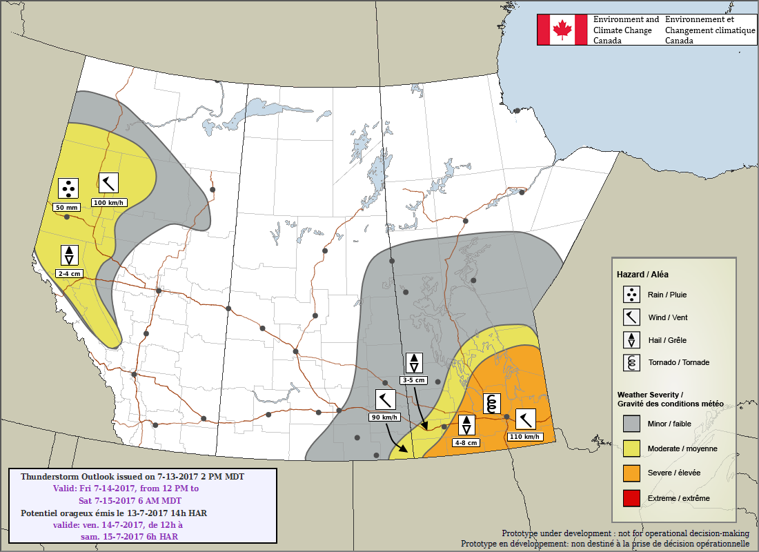
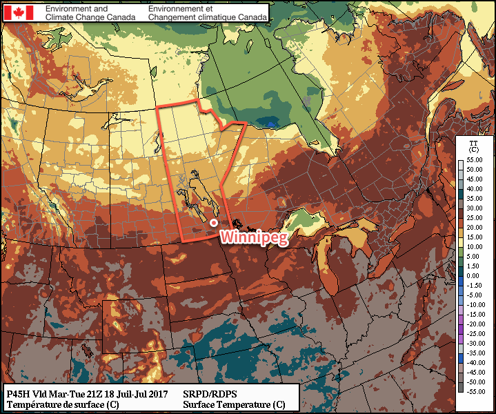
The remainder of the week looks continue the pattern. Temperatures will edge up a few degrees for Thursday and Friday, but it appears that things will turn increasingly unsettled Thursday night into Friday morning, and Friday night into Saturday.

Extended forecasts hint that we may see a stretch of warm, dry weather beginning Sunday, but that’s been advertised more than once this summer and vanished like dust in the wind, so we’ll hold off on promising that.

So…pleasant overall, but still no sign of that big hot, dry summer stretch.

Winnipeg’s seasonal daytime high is currently 26°C while the seasonal overnight low is 13°C.

Severe Thunderstorm Threat Leads Into Beautiful Weekend

The threat for severe thunderstorms exists today across the Red River Valley as a cold front pushing in from the northwest clashes with a hot and increasingly humid air mass. Once the cold front moves through, conditions will settle with a fantastic weekend ahead.

Today will see temperatures soaring across the Red River Valley as a southerly wind strengthening to 30 gusting 50 km/h brings in hot, humid conditions. Temperatures will climb to a high near 30 or 31°C in Winnipeg and the Red River Valley today with a comfortable morning quickly turning muggy as dew points climb up to the 19-20°C mark by late afternoon. The heat and humidity together will combine to make it feel more like the mid- to upper-thirties, so be sure to minimize prolonged exposure to the heat and stay hydrated.

A cold front will push southeastwards across the Red River Valley this afternoon. This is the estimated location of the frontal wave at 7PM tonight.

A cold front will slump through the Red River Valley late this afternoon, and as it does so there will be the threat for severe thunderstorms. With MLCAPE1 values climbing up to 2000 J/kg and 45-50 kt of deep shear2, the potential for explosive thunderstorm development exists. The biggest questions that need to be answered are:3

  1. Does nocturnal convection develop Thursday night, producing more cloud cover and delaying heating over the Red River Valley and/or eat up some of the instability over the region?
  2. What exactly is the expected strength of the capping inversion and will it be strong enough to prevent any thunderstorms from developing?

The first question we’ll know the answer to by the time you read this. If there is some thunderstorm activity overnight, it doesn’t necessarily rule out thunderstorms later today, just makes it more dependent on the clouds clearing out in time to get enough heating. The second question is much more difficult to answer, and we’ll just have to see how things go. If there happens to be an intermediate sounding available from Winnipeg later today, that should give a much better idea of how much of a thunderstorm threat there is.

As shown in yesterday’s Day 2 Thunderstorm Outlook, ECCC is forecasting a threat of severe thunderstorms over the region today.

That said, if thunderstorms do develop, which I think is likely, they will be bad. All hazards will be possible with these storms: large hail, damaging winds, torrential rainfall, and tornadoes. Rain may be the least of the concerns as the storms will be moving fairly quickly to the southeast at around 40 km/h. Tornadoes will be a threat with these storms, so make sure you stay aware of any severe thunderstorm or tornado watches and/or warnings issued by Environment Canada. The best chance for thunderstorms will be between 6PM and 11PM.

Rest of the Weekend

One the cold front passes, winds will switch around to the northwest and Winnipeg will be set for a great weekend. Saturday will see a high near 25°C with a bit of morning cloud clearing out for the afternoon. The humidity will flush out through the day, making for quite a comfortable afternoon. Temperatures will drop to a low near 12°C on Saturday night. Sunday will bring partly cloudy skies to the region with temperatures climbing back up to a high near 28°C with southerly winds increasing to 20-30 km/h. A disturbance looks set to move through on Sunday night which would bring the chance for some showers or thunderstorms and a return of the humid conditions for Monday. Expect a mild low near just 18°C on Sunday night.

Long Range

The beginning of next week looks hot and humid once again, but then temperatures return to near-seasonal values. It looks like there will be occasional chances for showers or thunderstorms through the week.

Winnipeg’s seasonal daytime high is currently 26°C while the seasonal overnight low is 13°C.


  1. MLCAPE stands for “Mixed Layer” CAPE and is an estimate of the amount of energy a thunderstorm has to work with. 
  2. Deep shear refers to how the winds change with height between the surface and 6km up. Under 20 kt would be considered very low, while in excess of 50 kt is extremely high. 
  3. And to note, I’m writing this late Thursday evening… 

Unsettled Tuesday Brings A Break From The Heat

Today will be another warm day in Winnipeg, but unsettled weather is on the way for Tuesday as showers and thunderstorms roll through the region, ushering in cooler weather for mid-week. It’s a short break, though, as temperatures will climb back into the upper 20’s and low 30’s for the end of the week into the weekend.

Another great summer day is on tap for Winnipeg today as some mixed skies in the morning gives way to a bit more sunshine for the afternoon. Temperatures will be warm with highs up around 29°C, but a light northwest wind to around 20-25 km/h will help out with that a little bit. Heading into the evening, things begin to get interesting.

Showers and thunderstorms will spread into western Manitoba this evening, triggered by a low pressure system moving across Saskatchewan. For portions of Parkland and Southwestern Manitoba, some of these storms may still be severe as they cross the border posing threats of large hail and strong winds. While tornadoes are possible on the Saskatchewan side of the border, it’s unlikely that they’ll be a significant threat by the time the thunderstorms move into Manitoba.

PASPC Thunderstorm Outlook valid 12PM Monday July 7 to 6AM Tuesday July 11, 2107

These storms will continue east-southeastwards all night, gradually weakening as they do so. They activity should reach the Red River Valley sometime between 3-6AM and while an impressive light show is likely, no severe weather is expected here.

Tuesday will continue unsettled, however there’s uncertainty as to the extent. The setup for showers or thunderstorms will be good; a low pressure system tracking east-southeast will have a warm front laid out west-to-east across the southern portion of the province, likely being a focus for further surface-based thunderstorm development (which would likely be south of Winnipeg), or elevated thunderstorm development (which would likely impact the city). It seems likely that there will be showers and/or thunderstorms throughout the region on Tuesday, but it’s just too early to say where exactly they’ll set up. Otherwise, expect mostly cloudy skies and a high near 21°C. Skies will continue cloudy on Tuesday night as temperatures drop to a low near 14°C with a continued chance of showers.

NAM forecast of simulated reflectivity valid  mid-morning on Tuesday July 11, 2017
NAM forecast of simulated reflectivity valid mid-morning on Tuesday July 11, 2017

Wednesday will be cloudy and cooler, but more settled as a trough of low pressure remains in place over the region. Temperatures will reach a high near 21°C with some sunny breaks in the late afternoon or evening before dropping to a low near 15°C on Wednesday night. Some additional showers or thunderstorms may materialize as an upper-level disturbance moves through the region overnight.

Long Range

The cool weather won’t last long; the heat begins to return on Thursday with seasonal temperatures building back into the region. A low passing to our northeast on Friday will bring warmer temperatures back into the region that will persist through next week. The weekend looks dry, but next week may bring a couple chances for thunderstorms amid the heat.

Winnipeg’s seasonal daytime high is currently 26°C while the seasonal overnight low is 13°C.

Beautiful Summer Weather Continues

There will be plenty of sunshine over the next few days as near-seasonal warmth remains in place over southern Manitoba. After a risk of thunderstorms this evening, conditions will settle and Winnipeg will round out the work week under plenty of sunshine.

Today will be a beautiful day in Winnipeg; this morning will start off still a bit muggy as some remnant humidity from yesterday remains trapped near the surface, but things should dry out quite quickly as the temperature rises through the morning. With a more comfortable humidity level, Winnipeg’s high of 29°C under mainly sunny skies will make for a great summer day.

The Red River Valley will see some increasing cloud cover late in the day as a disturbance slides along the international border and drags a cold front southwards. This will likely trigger thunderstorms, however the extent is still uncertain. The chances are best close to the U.S. border, and then diminish heading northwards. North of the Trans-Canada Highway, it appears there will be just a very small chance of seeing anything. Temperatures will then drop to a low near 17°C with any remaining cloud clearing out overnight.

The RDPS is forecasting thunderstorms to roll across southern Manitoba on Wednesday night.

Temperatures will drop back closer to seasonal on Thursday as slightly cooler air moves into the region behind a cold front that will pass through early in the day. Winds will pick up out of the northwest to around 30 gusting 50 km/h as temperatures climb to high of 25°C under sunny skies with just a few afternoon clouds.

The wind will taper off in the evening as temperatures dip down to a low near 12°C with just a few clouds lingering through the night.

A cold front will move through Southern Manitoba on Wednesday night, slumping south of the border by Thursday morning.

Friday will be another beautiful day with temperatures once again climbing to a seasonal 25 or 26°C. Winds will be much lighter than Thursday, and skies will be partly cloudy to mixed for much of the day. All in all still a very pleasant summer day. Expect lows to dip down into the mid-teens on Friday night.

Heat Builds in Through Weekend

Warmer weather will build back into the region this weekend with temperatures climbing back into the upper 20’s or perhaps even the low 30’s.

An upper-level ridge (blue squiggle) will build into the Prairies early next week.

This warm weather will be the result of an upper-level ridge building into the Prairies. This feature will remain established over the Prairies for much of next week, giving Winnipeg and the Red River Valley above normal temperatures through much of next week. Conditions look generally dry, but we may see one or two chances of thunderstorms through the week. Summer has arrived!

Winnipeg’s seasonal daytime high is currently 26°C while the seasonal overnight low is 13°C.