A mixed bag of weather lies ahead with some cloudy & cool conditions transitioning to milder weather with variable cloudiness and a chance of showers.
Today will be a rather cool day with a below-seasonal high temperature of just -1°C as last night’s snow pushes out of the region while a ridge of high pressure builds in behind, bringing moderate northerly winds of 30 gusting to 50 km/h. Much of the day will be mainly cloudy, but by the afternoon, clearing should begin working into the Red River Valley from the north.
Tonight will bring mainly clear skies and an overnight low near -10°C while the northerly winds gradually taper off overnight.
Saturday will bring plenty of sunshine to the region with just a few clouds and light winds. Temperatures will climb to a near-seasonal daytime high of +1°C. Saturday night will see an overnight low near -5°C with increasing cloud through the second half of the night as a weak disturbance moves towards the region from the northwest.
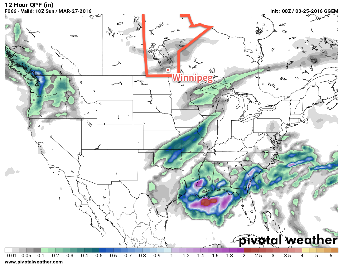
A chance for showers will return to the region on Sunday as a weak low pressure system brings mainly cloudy skies to Winnipeg and the Red River Valley. Temperatures will climb to around 5°C for a daytime high with winds out of the south near 20 km/h. Skies will remain fairly cloudy on Sunday night with a low near -4°C.
Long Range
A quick look ahead to next week shows milder weather with daytime highs in the mid-to-upper single digits through the first half of the week, but then an abrupt shift back to below-normal temperatures after a major low pressure system moves through the United States mid-week.
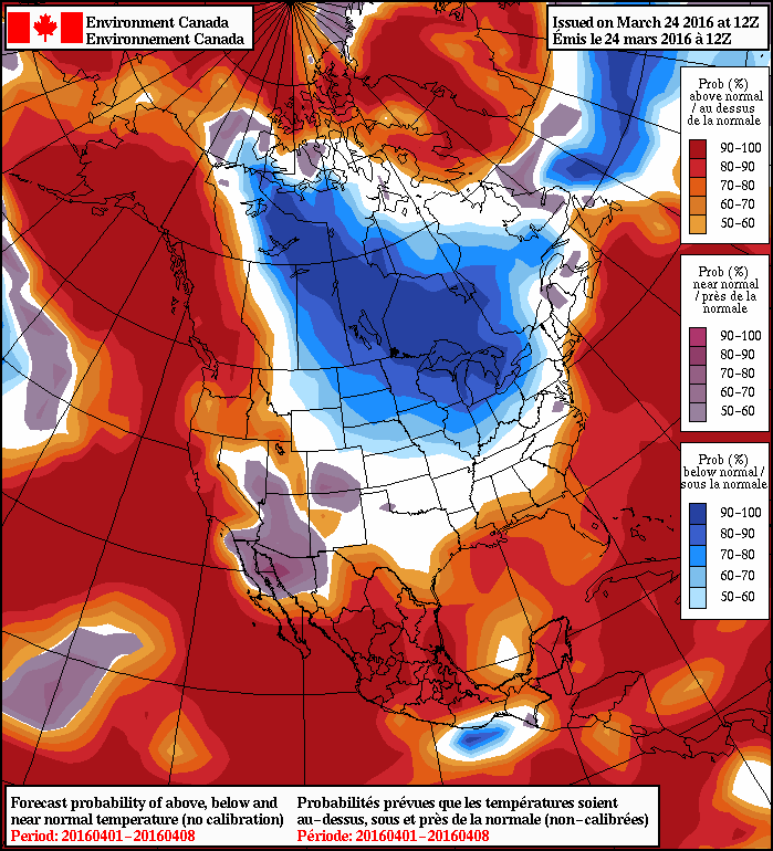
As the NAEFS image shows, for April 1st through April 8th, there’s a near-certainty of seeing below-normal temperatures in Southern Manitoba. At this point, it looks like this will translate to daytime highs near or just below 0°C.
No significant precipitation is expected next week, at least for now. If the track of next week’s major low changes and it shifts further north, well that could be a completely different story!
Winnipeg’s seasonal daytime high is currently 2°C while the seasonal overnight low is -8°C.