Winnipeg will see cool conditions and more snow as clipper after clipper moves through the region.

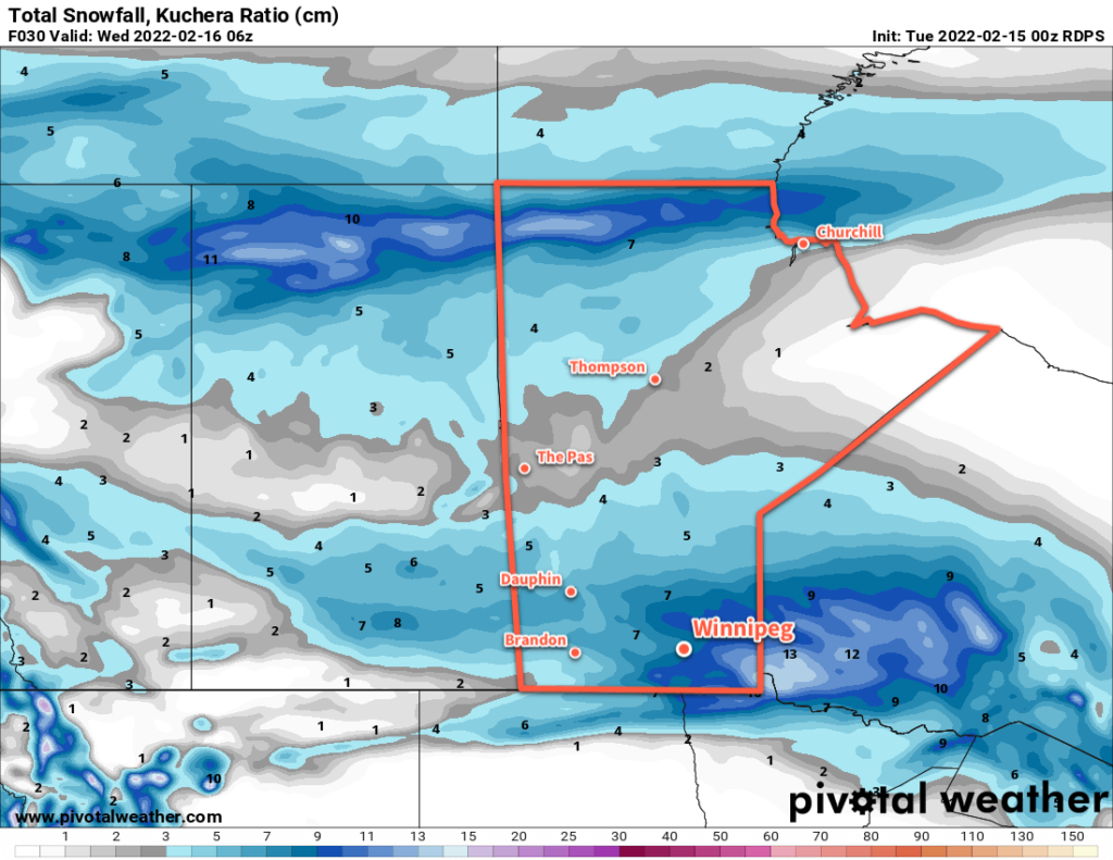
The snow will gradually pile up this week as multiple disturbances move through southern Manitoba. This train of clippers will keep temperatures generally below seasonal and add to the ever-growing snow banks around the city.
The first clipper will move through the region today, bringing moderate southerly winds, some blowing snow in open areas, and 5–10 cm of new snow by the time it tapers off in the evening. The wind will ease off in the afternoon with a high around -10 °C. Temperatures will head back into the low minus teens tonight with some blowing snow and moderate northwesterlies.
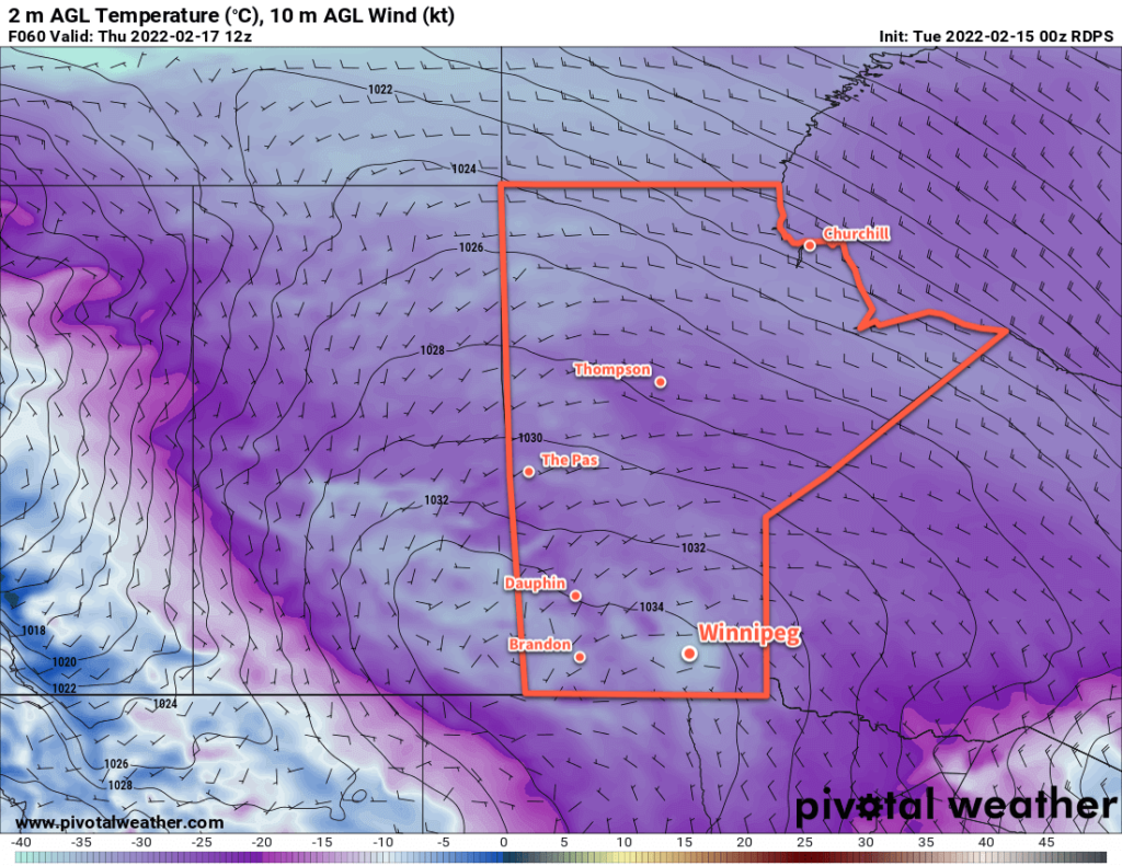
The cloud cover will break up on Wednesday as an Arctic ridge moves into the province. Expect some blowing snow in open areas in the morning, followed by improving conditions as the northwesterlies ease through the afternoon. Temperatures will hover in the -15 to -20 °C range through the day, then quickly drop in the evening with clear skies. Winds will be light on Wednesday night with lows dropping back below -30 °C.

Thursday will be a sunny, cold day with temperatures topping out in the -20 to -25 °C range. The next clipper to impact the region will start pushing in on Thursday evening, bringing increasing cloud and warming tempreatures. Snow will begin overnight as southerly winds strengthen and temperatures warm into the mid-minus teens. More blowing snow will again develop through the Red River Valley by Friday morning.
Long Range Outlook
Another clipper moving through the region on Friday will bring 5–10 more centimetres of snow to the Red River Valley. There will be little reprieve afterwards, as forecast show yet another low impacting the province on Saturday. This system could end up bringing closer to 10 cm of snow to the region on Saturday into Sunday.
Temperatures will trend on the cooler than seasonal side of things through the weekend and potentially cool a little bit more heading into next week.
Today’s seasonal daytime high in Winnipeg is -8 °C while the seasonal overnight low is -18 °C.
