Springtime is on the way to southern Manitoba, but will also bring a wintry mix of precipitation on Tuesday evening.
The the polar vortex retreating into the High Arctic, milder Pacific air has begun to flood across the Prairies. Temperatures climbed above freezing across southern Alberta and Saskatchewan yesterday, and will continue into southern Manitoba today.
Temperatures will warm across southern Manitoba today, but the snowpack will limit highs to within a couple degrees above freezing. An approaching low pressure system will provide more cloud to the region today, followed by precipitation this evening.
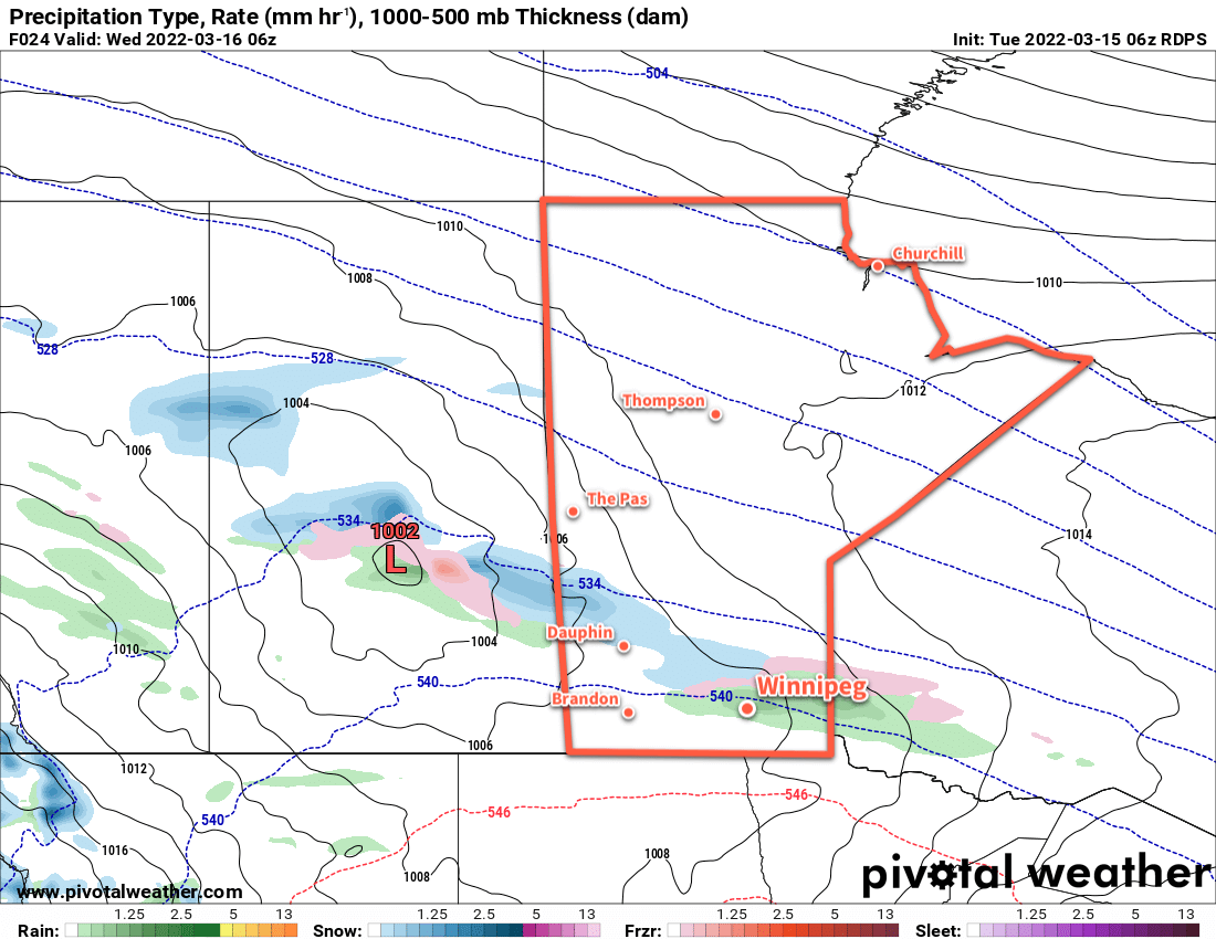
Southern Manitoba will see a wintery mix of precipitation tonight. Rain is likely along and south of the Trans-Canada Highway corridor. North of that, freezing rain will fall through the Parkland and southern Interlake areas. And north of that, snow will cross through Swan River and the northern Interlake. Precipitation types will also mix along the boundaries, making for a bit of a mess in some areas.
In Winnipeg, 3–5 mm of rain seems most likely. When combined with the above-zero temperatures, this will work towards beginning to chip away at the snowpack in the area.
The precipitation will move out of the region early Wednesday, leaving behind cloudy skies, light winds, and temperatures hovering a degree or two above freezing. A cool front will sweep through on Wednesday evening bringing a few flurries to the region.
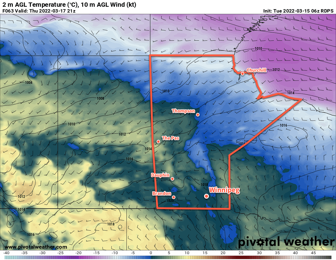
Mixed to cloudy skies will stick around for the rest of the work week. Daytime highs will climb a couple degrees above freezing while overnight lows dip below.
Long Range Outlook
Warm weather will continue through the weekend with highs above freezing and variable cloudiness. This week should provide conditions favourable for a gradual snowmelt with dew point temperatures largely staying below the freezing mark and temperatures largely hovering just a bit above freezing.
Today’s seasonal daytime high in Winnipeg is -1 °C while the seasonal overnight low is -11 °C.