After a few dud events over the region snow is finally on its way to the Red River Valley, but exact amounts are still uncertain.

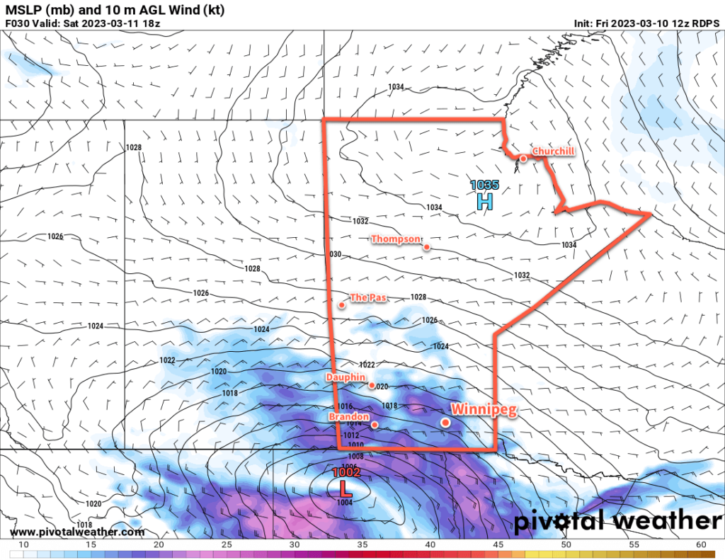
It’s been a complex weather situation over the Red River Valley over the past few days. The snow we earlier this week did develop as expected, and in fact, over the past few days was visible on RADAR as it streamed northwards over the region. But a stubborn Arctic High entrenched over northern Manitoba complicated things substantially.
This high was pumping copious amounts of cool, dry air into the northerly flow over the region which was pushed underneath the snow lifting northwards. This dry air ended up evaporating most of the snow before it managed to reach the surface. As a result, we saw little to no snow through the region over the past few days despite it falling a few thousand feet above ground.
This setup continues today, with cloudy skies and a slight chance of flurries. Temperatures will reach a high near -2 °C this afternoon, the d up down into the -5 to -10 °C range tonight.
The third system we talked about in our last forecast is now developing in the west and will begin bringing snow to Saskatchewan tonight and then spread across Manitoba on Saturday. The snow will begin in Winnipeg mid- to late-morning on Saturday and persist to the evening before beginning to ease. Moderate easterly winds up to 40 gusting 60 km/h will accompany the snow, producing blowing snow across the region in the afternoon.
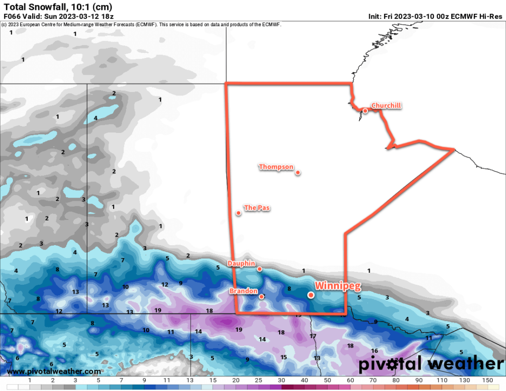
There is still some uncertainty with snowfall totals. Like with the previous systems, weather models have struggled to fully capture the impact of the Arctic High entrenched over the Northern Prairies. As a result, model runs have been slowly shifting the expected track of this system further south over the past few days, reducing the amount of snow over many parts of the Prairies. But the models do seem to be stabilizing their tracks, and it looks reasonable at this point that Winnipeg will likely see 5 to 10 cm of snow with this system.

Further south, snowfall totals could rise quickly, especially along the western escarpment where snow will be enhanced by the persistent easterly winds. Heading southwards through the Red River Valley, accumulations will likely increase into the 10 to 20 cm range. The higher snowfall amounts coupled with the strong winds could result in very poor travel conditions, particularly near the International Border, on Saturday afternoon.
Temperatures will hover around -6 °C on Saturday, then dip down close to -10 °C on Saturday night.
Some light snow will linger through Saturday night and then taper off on Sunday. Temperatures will linger in the -5 to -10 °C range through the day under cloudy skies, then dip to a low in the -15 to -20 °C range overnight as skies clear.
Long Range Outlook
In the wake of this system, skies should clear as cooler air floods into the region. Seasonably cool temperatures will move into the region to start the week with highs generally in the -5 to -10 °C range.
Another disturbance will move into the region mid-week and could bring some more accumulating snow to the area along with warmer seasonal temperatures.
Today’s seasonal daytime high in Winnipeg is -2 °C while the seasonal overnight low is -12 °C.
