September Brought Mild Temperatures, Wet Weather

September brought mild weather to Winnipeg with above normal temperatures on about two-thirds of the days in the month. The month also started off extremely dry, but a change to a more unsettled pattern mid-way through the month ended up producing measurable rain on 9 of 13 days, including 25 mm of rain on September 22.

September is typically a month that brings a lot of cooling to the region; the daily mean temperature drops from 15.6°C at the start of the month to 9.3°C at the end of the month, a drop of 6.3°C. So while the average daytime high did drop considerably through the month in line with this trend, temperatures still remained generally above normal, with cool spells few and fair between. The warmest day of the month came on September 12, when Winnipeg set a new daily record high temperature of 34.8°C, beating the old record of 33.3°C set in 1952. That day was also the most “warmer than normal” day of the month with a daily mean temperature of 24.3°C, a full 11.3°C warmer than the normal daily mean of 13.0°C.

The coldest temperature of the month came on September 29th, where the temperature dipped to a chilly -1.2°C in the morning, 4.6°C below the normal seasonal low of 3.4°C.

September had a monthly mean temperature of 14.2°C, which was 1.9°C above the seasonal normal of 12.3°C. The mean daily high temperature was 20.1°C, which was 1.6°C above normal. Warmer than normal daily highs occurred on 20 out of 30 days. The mean daily low temperature was 8.2°C, which was 2.2°C above normal. Warmer than normal daily low temperatures occurred on 21 of 30 days.

The monthly temperature range was 36°C; from a maximum temperature of 34.8°C on September 12 to a minimum temperature of -1.2°C on September 29.

The longest stretch of above-seasonal days was 8, from September 7 to September 14. The longest stretch of below-seasonal daily mean temperatures was 3, which occurred on September 4-6, 15-17, and 24-26.

An Abrupt Mid-Month Change Brought Rainy Conditions

September begin with very dry conditions, continuing the trend from August, which saw dramatically lower than normal rainfall. Mid-month, however, a significant shift occurred which brought disturbance after disturbance across southern Manitoba, producing much rainier conditions.

As can be seen above, very little rain fell between September 1 to September 14, with just 1.8 mm over two rainfall events. Beginning September 15, however, came rain on 9 of 13 days, producing the wettest 10-day stretch of 2017. Between September 17-26, 61.5 mm of rain fell in Winnipeg, eclipsing the 60.8 mm of rain that fell between July 15-24. The largest rainfall event occurred on September 22, when 25.2 mm of rain fell. This was followed quickly by another 18.3 mm on September 24. These two events combined to make the highest 3-day rainfall total of 2017 as well at 43.5 mm, beating 32.2 mm between July 11-13 by 11.3 mm.

With a monthly total of 67.1 mm, Winnipeg exceeded the seasonal normal of 45.8 mm by 21.3 mm.

2017 Annual Precipitation Statistics – Updated October 1, 2017

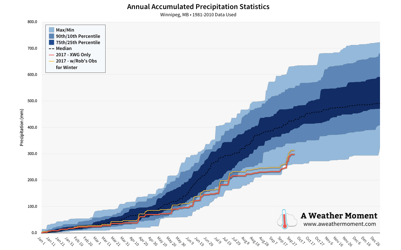
By mid-September, Winnipeg had crept into having the driest year since 1980, however the rainfall through the second half of the month has eliminated that potential by raising our annual precipitation amounts above the driest on record. Winnipeg still remains well below-normal, outside 2 standard deviations from the 1981-2010 normal amounts.


All in all, September was a beautiful month. Exceptional warmth through the first half gave way to near-seasonal temperatures in the second half, but overnight lows that remained well above-normal through much of the month helped keep that fall chill away until near the very end. The rainfall through the second half of the moth helped alleviate some of the drought that the region has seen, although Winnipeg still sits in a significant precipitation deficit for the year.

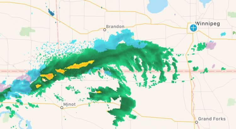
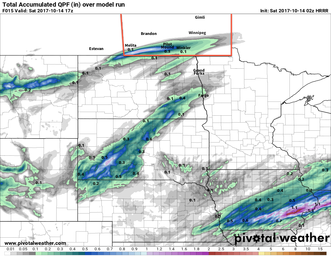
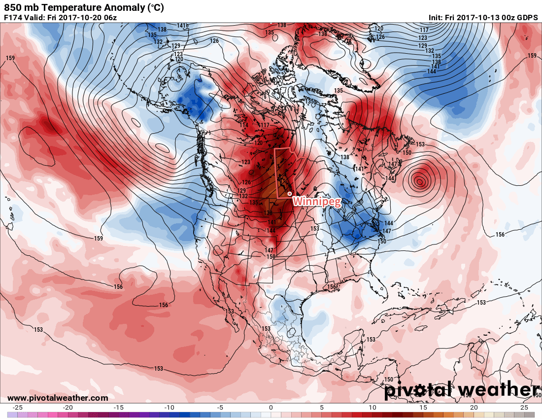
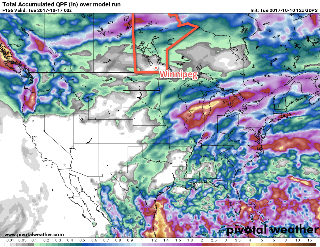
October has continued September’s trend so far with most of the days bringing above-normal temperatures to the region. Precipitation has been sparse, though, and little is on the horizon. Although Winnipeg saw its first snowfall of the year on October 14, temperatures will rebound well above-normal with unseasonably warm temperatures expected to build into the region later this week. With daytime highs nearly 10°C above normal and mild overnight lows, it looks poised to offer one last stretch of summer-ish weather before jacket weather arrives for good.

Forecast Update for Friday Night and Saturday

The disturbance that we wrote about in our forecast that went live early this morning is throwing a wrench into things as it has progressed eastwards much faster than models had anticipated, already spreading across southwestern Manitoba into the Red River Valley. This will dramatically change the forecast for Saturday morning and afternoon.

As of writing, the system is producing a line of precipitation extending from the Manitoba/Saskatchewan/North Dakota border east-northeast along a line that runs just through Boissevain and Deloraine into the Red River Valley. Much of the precipitation from this line is currently falling as rain, however snow is likely mixing in on the northern edge of the band, where temperatures have dropped towards the freezing mark.

HRRR Forecast Accumulated Precipitation valid 17Z Saturday October 14, 2017
The forecast total precipitation amounts from 9PM October 13 to 12PM October 14 reveal the narrow band that the rain/snow is expected to fall along.

Precipitation will push east-northeast throughout the night, however where it is expected to be heavy enough to accumulate in any meaningful way will lie along a very narrow band roughly located where the heaviest of the precipitation is as of this writing.

Much of this will likely remain as rain; there’s a fair amount of warm air aloft and temperatures are being maintained around 2-4°C underneath the precipitation. As mentioned before, some snow will likely mix through as it progresses eastwards, but no significant accumulations are expected.

Over the heaviest band in the southwest corner of the province, it will likely be a decent soaking, however, with 10-20 mm of rain possible.

Shift Southwards Spares Southwestern Manitoba From Snow

With the shift southwards, the southwest corner of the province will be spared from the 5 to 10 cm we suggested was possible in our earlier forecast. The closer proximity to the border has the precipitation falling in warmer conditions, causing that snow to fall as rain instead.

Winnipeg On The Edge

The forecast for Winnipeg continues to be difficult, with the city likely resting right on the northern edge of the precipitation. It seems most likely that the city will see some rain or snow beginning around 2 to 4AM and tapering off by 7 to 8AM. No significant accumulations are expected.

Still A Chance for Afternoon Showers

This disturbance won’t be completely gone for Saturday afternoon, with a chance for showers re-developing over the Red River Valley mid- to late-morning and persisting until mid-afternoon. Temperatures will be warm enough that snow won’t be a concern, but 2-4 mm of rain will be possible under the “heaviest” band of showers. The chance for rain should remain south of Winnipeg.

Slightly Warmer Highs Expected

With the shift in timing for this system, daytime highs will be slightly higher than we forecast earlier. With the higher intensity precipitation finished by mid-morning, highs will be able to climb a bit warmer into the 6 to 8°C range instead of near 5°C like we advertised before.


The faster and more southerly arrival of this system means that the daytime hours on Saturday will see less precipitation than expected and allow daytime highs to climb a bit warmer. The heaviest amounts will fall along a narrow band in the southwest corner of the province with 10 to 20 mm possible through the and Saturday morning. The precipitation is largely falling as rain instead of snow, thanks to the slightly warmer temperatures aloft due to the shift southwards of this disturbance’s track.

Hopefully this covers what to expect; sometimes these systems progress a bit unexpectedly and all model guidance just…fails. This is one of those cases. We think the newer runs of rapid-update models are getting a good handle on it, though, so hopefully this forecast is able to hold up a bit better than the last one.

Saturday Brings First Snowfall of the Season

A low pressure system tracking along the U.S. border will bring a mix of rain and snow to southern Manitoba on Saturday, and while the Red River Valley may see a few slushy centimetres, higher accumulations of 5 to 10 cm will be possible over the southwest corner of the province. The snow will be short-lived, however, as above-seasonal temperatures are set to return next week!

Models took a quick turn after our Wednesday forecast with a dry weekend quickly turning…not so dry as they picked up on a disturbance that will track along the US border and likely bring rain and snow to southern Manitoba on Saturday. Before that, though…

Today will be a cool but beautiful day! Winnipeg will see sunny skies and westerly winds at around 15 to 25 km/h as temperatures climb to a high near 10°C. Cloud will begin pushing into the Red River Valley tonight, bringing a chance for some rain showers to Winnipeg before morning. Winds will be calm as temperatures dip to a low near 2°C.

3km NAM Forecast Precipitation Type and Intensity valid 18Z Saturday October 14, 2017
Rain showers will give way to snow from northwest to southeast across the Red River Valley on Saturday. Winnipeg will likely see the changeover occur midday.

Southern Manitoba will see a mix of precipitation through the day on Saturday. The biggest question of the day will be where the rain/snow line will set up, and right now it appears that Winnipeg will straddle that line, with a few morning showers either mixing with or changing over to snow midday. Fortunately, with near-zero temperatures, any snow will be unlikely to accumulate too much through the city, with just a slushy couple centimetres possible. Further to the west and north, more substantial snowfall is possible, with 5-10 cm possible along a line from around Estevan, SK to Virden, MB to Lake Manitoba.

We’ll definitely post an update later tonight with a revised snow/rain forecast for Saturday.

Aside from the precipitation, expect to see temperatures climb to a high just near 5°C with northeasterly winds of 15 to 25 km/h. Temperatures will dip down to around -2°C with some clear breaks overnight.

Sunday will see conditions improve, with mixed skies and a light west-southwest wind as temperatures climb to a high near 10°C. Temperatures will drop to a low slightly above freezing.

Long Range

Next week is looking fantastic for those who aren’t quite ready for the latter parts of fall. Warmer air is expected to spread eastwards across the Prairies, and while there may be a disturbance or two with a brief cool-down associated with it that moves through, temperatures will tend to remain above-seasonal.

GDPS 850mb Temperature Anomaly valid 06Z Friday October 20, 2017
Very mild air will spread eastwards across the Prairies through next week, with significantly warmer-than-seasonal temperatures (red, brown) possible at the end of the work week.

Daytime highs in the mid- to upper-teens will be common through the week, alongside variable cloudiness and few chances for rain as the main storm track appears to remain in the central and northern Prairies.

So make it through a bit of an unpleasant Saturday, and a beautiful mid-October week lies ahead.

Winnipeg’s seasonal daytime high is currently 11°C while the seasonal overnight low is 0°C.

Mild & Windy Mid-Week Leads To A Cooler Weekend

A low pressure system approaching from the west will bring windy conditions today and keep above-seasonal temperatures in Winnipeg and the Red River Valley for a couple more days. Cooler temperatures will return for the weekend, however, as Arctic air floods southwards across the Prairies on the back-side of this disturbance.

Temperatures will climb to a seasonally balmy 16°C today under partly cloudy skies as mild air moves northwards into the province ahead of an approaching low pressure system in Saskatchewan. While there will be a fair amount of sun today with just partly cloudy skies, the wind may make things a bit unpleasant as it ramps up out of the south to 40 gusting 60 km/h this afternoon. Skies will cloud up for the evening with winds continuing to be breezy out of the south at 20-30 km/h. Temperatures look to drop to a low near 7°C.

Breezy southerly winds (purple, pink) will be in place across southern Manitoba later today

Thursday will bring mainly cloudy skies to the region with winds diminishing to 15-25 km/h, first out of the south then switching to the west after a trough of low pressure moves through in the afternoon. Temperatures will reach a high near 16°C, but clearing skies in the evening will allow temperatures to dip to a chilly +3°C overnight.

Cooler temperatures return to the region on Friday as Arctic air spreads across the Prairies. Temperatures will reach a high of just 10 or 11°C with breezy westerly winds to around 30 km/h that will taper off on Friday evening. The cool temperatures and breezy winds will make it feel rather chilly, but at least the sun will be out in full force with mainly sunny conditions expected throughout the Red River Valley. Winnipeg will then likely see another freeze on Friday night with temperatures dipping into the -2 to 0°C range.

Long Range

The weekend looks like it will bring variable cloudiness and below to near-seasonal temperatures with highs in the upper single digits or low teens and overnight lows dipping down near the freezing mark. Conditions continue to look dry with no significant chances for precipitation on the horizon.

No precipitation is expected in Winnipeg between now and next Monday

Heading into next week, temperatures look to be near to slightly above-seasonal, however the chances for precipitation will begin to return as a slightly more unsettled pattern develops.

Winnipeg’s seasonal daytime high is currently 12°C while the seasonal overnight low is 1°C.