July Finishes Slightly Cool with Near-Normal Rainfall

July 2017 spent much of it’s time with below normal temperatures — 16 of 31 days had daily mean temperatures below the 30-year average — but was still generally pleasant with much fewer days of rain than in June and many daytime highs that were close to seasonal values.

The first third of July consisted of a swing from well below-normal temperatures to well above normal temperatures followed by a brief period of near-normal temperatures. The deviations from normal more-or-less cancelled each other out with a month-to-date departure from normal of -0.2°C by July 10th. For the next 14 days, though, Winnipeg fell into a prolonged period of below normal temperatures with daily means generally 1.5 to 2.5°C below normal. By July 23rd, Winnipeg’s month-to-date departure from normal had fallen to -1.2°C. The end of the month saw an abrupt turnaround, though, as hot and humid weather moved into the region. Several days saw high temperatures in the upper 20’s to low 30’s and overnight lows in the mid- to upper-teens.

No record temperatures were set in July, however.

By the end of the month, the warm spell had allowed the monthly mean temperature departure from normal to recover to -0.4°C.

In other temperature statistics:

  • July 2017’s average high temperature was 25.7°C, just -0.1°C below the 30-year average of 25.8°C.
  • July 2017’s average low was 12.5°C, -0.8°C below the 30-year average of 13.3°C.

Near-Seasonal Rain at the Airport

While there was only rain on 8 of 31 days in July, total rainfall ended up near-normal with 71.1 mm.

While it rained infrequently, the Winnipeg airport measured a total of 71.1 mm of rain through July 2017, 90% of 30-year normal of 79.5 mm. Much of the rain fell on just 3 days: July 11 (21.7 mm), July 21 (14.1 mm), and July 22 (14.3 mm). The combined 3-day total of 50.1 accounted for 70% of the month’s rainfall.

The 8 days of measurable precipitation was a welcome improvement from June which saw 14 days of measurable precipitation. The concentration of the bulk of the rain into just 3 days did make for some drying, though, and some gardeners likely needed to begin watering their plants occasionally again.

It is worth noting, however, that rainfall was variable throughout the city. At my Glenwood personal weather station I measured slightly less at 68.6 mm. Some locations over south and eastern Winnipeg saw as little as 50-55 mm while other locations across the west side of the city saw up to 85 mm.


So in the end, July 2017 was a very nice rebound from June. There were few days with rain, quite a few days with near-seasonal highs and a lack of humidity that brought more frequent slightly below-normal temperatures at night.

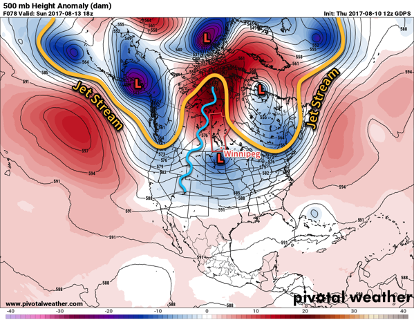
August seems to be continuing the trend so far with near-seasonal highs and cooler nights courtesy a lack of humidity. No complaints from this author!

Unless otherwise noted, all normal values referred to in this post use the 1981-2010 normals for Winnipeg, Manitoba.

Warm and Dry Weather Ahead

An upper-level ridge slowly building eastwards across the Prairies will bring generally sunny and increasingly warm weather to Winnipeg and the Red River Valley. For those who like summer weather, the next 5 days will be pretty much perfect!

The upper-level ridge that has been anchored over British Columbia over the past week will begin pushing eastwards, shifting the omega block pattern from the west coast to over the Prairies. This will spread mild weather over the Prairies and, eventually, break the persistent northerly winds that have been in place over the province and return a southerly flow that will bring humid conditions back to the region next week.

GDPS forecast 500mb heights and height anomalies valid 18Z Sunday August 13, 2017 with weather feature annotations.
By Sunday, the omega block will be situated over the central Prairies, however parts of Southern Manitoba will see some cloud as an upper low tracks through North Dakota.

So, for the coming few days, the forecast will be straightforward with daytime highs of 26 or 27°C and overnight lows in the 13-15°C range. Winds will be light over the next 3 days and there will be plenty of sunshine. Sunday may bring a few more clouds as an upper-level low passes by to our south, but even then we expect things to remain dry.

Long Range

Looking into the beginning of next week, things start off quite warm with highs climbing into the upper 20’s and overnight lows creeping up into the high teens. A trough of low pressure will begin building across the Prairies Monday night, bringing southerly winds into the region on Tuesday that will gradually ramp up the humidity. As it stands now, it appears that by the end of Tuesday dew points will climb to around 17°C, bringing slightly muggy weather back to the region.

A chance of showers or thunderstorms then returns to the region on Tuesday night into Wednesday and marks the transition into a few days of potentially unsettled weather. Temperatures will remain warm, though with highs continuing in the mid- to upper-twenties.

Winnipeg’s seasonal daytime high is currently 26°C while the seasonal overnight low is 12°C.

Showers And Thunderstorms Today, Then Beautiful Weather Ahead

A disturbance moving through Southern Manitoba today is bringing showers and thunderstorms across many areas this morning, and will be the focus for the redevelopment of more significant thunderstorm activity this afternoon. Once the disturbance leaves the region tonight, it’s nothing but beautiful weather ahead for Winnipeg & the Red River Valley.

A frontal wave collapsing southwards through the region is bringing scattered showers and thunderstorms to the region this morning, and will continue to for much of the day. The focus for most of the thunderstorm activity will be a shortwave spinning up along the international border. This feature will support an area of slow-moving thunderstorms this afternoon; these storms will potentially be capable of producing significant rainfall totals due to their slow speed.1 Where exactly these thunderstorms develop will depend exactly on the track o the shortwave; at this point though it looks like the most likely area is south of the Trans-Canada Highway between Pilot Mound and Emerson.

PASPC Day 1 Thunderstorm Outlook valid 1PM CDT August 9, 2017 to 7AM CDT August 10, 2017

Other than the rain, today will see temperatures climbing to a below-seasonal high near 20°C with winds out of the northeast at 20 gusting to 40 km/h.

The showers and thunderstorms will head out of the province to the southeast later this afternoon into the evening. Skies will clear as temperatures head to a low near 10°C with light winds.

Thursday and Friday will bring pleasant weather back to the region with plenty of sunshine, highs near 25 or 26°C, and lighter winds. Expect a low near 11°C on Thursday night and near 14°C on Friday night.

Long Range

Looking further ahead, the general trend will be for the upper-ridge over B.C. to gradually work its way eastwards, bringing mild and dry weather to the region. Expect to see seasonal to above-seasonal temperature build in through the weekend with the potential for more humid weather to arrive next week. It also looks fairly dry precipitation-wise with little chance of rain until the latter half of next week.

So make it through today and there’s plenty more sunshine and summer warmth to enjoy ahead!

Winnipeg’s seasonal daytime high is currently 26°C while the seasonal overnight low is 12°C.

  1. Anywhere from 25 – 75 mm seems possible with today’s thunderstorms.

Mild Monday Followed by A Cold Front & Chance of Showers

Mild weather returns to Winnipeg and the Red River Valley today thanks to a warm front that moved through the region overnight. It will be short-lived, however, as a cold front sweeps through on Monday night, bringing with it a chance of showers and a return to below-seasonal temperatures.

Today will be a very pleasant day across the Red River Valley as a sunny start to the day sends temperatures climbing towards a high near 27°C. A cold front slowly pushing southwards will start spreading cloud into the region from the north for mixed skies this afternoon and then clouding over this evening. Winds will pick up out of the west around 20 km/h.

Tonight will bring a chance of showers with the risk of isolated thunderstorms to Winnipeg & area as temperatures dip to a low near 14 or 15°C.

A cold front will be slumping southwards across the Prairies this afternoon.

Tuesday will bring mixed to cloudy skies to the region as the cold front swings through, with a continued low chance of showers. Temperatures will be much cooler with a high of just near 22°C as winds shift to northerly at 10-20 km/h. Temperatures will then drop towards a low near 12°C under cloudy skies on Tuesday night with a continued low chance of showers.

Things will finally clear out on Wednesday as the front pushes off to the southeast. Expect temperatures to reach a high near 24°C with a low near 12°C on Wednesday night.

Long Range

It appears that things will settle down again with near-seasonal temperatures for the remainder of the week into the weekend as a very broad area of high pressure moves through the Prairies.

Winnipeg’s seasonal daytime high is currently 26°C while the seasonal overnight low is 13°C.