Sunny Weekend Ahead for Winnipeg

Winnipeg will get to enjoy sunny to partly cloudy skies right through the weekend.

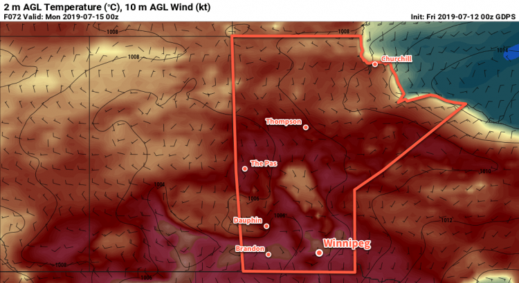
Winnipeg will find itself between two main weather features today: a trough of low pressure laying across the Interlake, and a mid-level disturbance zipping along near the U.S. border. Not being directly affected by either system, the city will see plenty of sunshine today. With a few clouds grazing by, temperatures will climb to a high near 26°C. Winds will be breezy out of the west-southwest at up to 30 gusting 50 km/h. Skies will clear out tonight with winds easing as temperatures head to a low near 15°C.

Saturday will bring partly cloudy skies to the city again as a cold front slumps southwards. Winds will shift out to the north-northwest in the morning, picking up into the 20 to 30 km/h range. There might be a slight chance of a shower midday as the front passes, but it looks like things should stay dry. Temperatures will reach a high near 23 or 24°C behind the front. Winds will taper off in the evening as temperatures head to a low near 12°C.

On Sunday, a ridge of high pressure will slowly build into southern Manitoba. As a result, the city will see mainly sunny conditions with northwest winds around 20 km/h. Temperatures will climb to a high near 23°C, then dip to a low near 13°C on Sunday night.

Long Range Outlook

Next week will see temperatures climbing back into the upper 20s or low 30s as an upper ridge redevelops over the Prairies. Winnipeg should see plenty of sunshine through the first half of the week, then unsettled weather may return for the second half into the weekend.

Today’s seasonal daytime high in Winnipeg is 26°C while the seasonal overnight low is 13°C.

Unsettled Conditions Return to Winnipeg

The dry conditions of just a couple weeks ago are almost a distant memory with more showers and thunderstorms possible through the second half of the week.

More showers are on the way for Winnipeg later today. The city will see cloudy skies as a low pressure system works its way across the province. By midday, scattered to widespread showers will develop ahead a trough of low pressure with the chance of embedded thunderstorms. The unsettled conditions should clear out by late in the afternoon with the skies clearing out a bit after that.

Temperatures will be cooler today; Winnipeg will have southerly winds to around 20 km/h and a high near 23°C. It will continue to be a bit muggy today with dew point temperatures near 18°C with only slight relief tonight. The city will see a low near 16°C with partly cloudy skies.

Thursday will be a bit of a tricky weather day over the region. Warmer weather will return to Winnipeg with temperatures climbing to around 28°C with muggy dew points near 18 or 19°C. Winds will pick up out of the southwest into the 20 to 30 km/h range.

The southwesterly flow over southern Manitoba will push a broad frontal wave into the province. As it moves into place, a low pressure system will push into western Manitoba from Saskatchewan. The interaction of these two systems will produce a conditional threat of thunderstorms over the region late in the day. There will be a chance that these thunderstorms, should they form, could be severe. Unfortunately, the subtle nature of the interactions that will lead to thunderstorm development can’t be forecast with too much accuracy this far out. Be sure to check out ECCC’s thunderstorm outlook on our Bulletin Viewer on Thursday morning for a complete discussion on the day’s thunderstorm potential.

Warmer weather will return to southern Manitoba on Thursday.

Once the thunderstorm threat diminishes on Thursday evening, the city will see partly cloudy skies with temperatures heading to a low near 15°C. Winds will persist out of the southwest near 20 km/h through the night.

Partly cloudy skies will be in place for Winnipeg on Friday, although cloudier conditions won’t be too far to the north. Temperatures will reach a high near 24°C with westerly winds of 30 gusting 50 km/h. Of note will be that those westerly winds will finally flush the humidity out of the region, bringing a return of more comfortable conditions.

Winnipeg will see a few clouds on Friday night as winds ease and temperatures drop to a low near 13°C.

Long Range Outlook

Winnipeg will see variable cloudiness this weekend with a chance of a few showers on Sunday. Settled conditions will move in after that with plenty of sunshine through next week. Temperatures will be near-seasonal through the weekend, but a warm-up is forecast by mid-week with daytime highs returning to the 30°C mark. Humidity levels are forecast to stay low through much of next week.

Today’s seasonal daytime high in Winnipeg is 26°C while the seasonal overnight low is 13°C.

RDPS 2m Temperature Forecast valid 21Z Monday July 15, 2019

Summer Heat And Occasional Showers Ahead

Winnipeg may see a few showers or thunderstorms today and Wednesday, but the summer heat and relatively humid conditions continue.

The warm and humid weather continues this morning, but relief is on the way. Winnipeg may see a thunderstorm to start the day, but it’s dependent on where the overnight activity decides to move. Most guidance suggests the line will remain north of the city, but there’s a small chance that some new thunderstorms will develop along the southern end of the line. After that passes this morning, the region will see a mainly sunny morning with mixed skies in the afternoon. Temperatures will climb back up to 29 or 30°C with humid conditions continuing. A weak cold front will sweep through late in the day, bringing another chance of showers or thunderstorms to the city.

Winds will gradually turn northwesterly and strengthen to around 30 km/h through the day today, then ease in the evening. Winnipeg will see partly cloudy skies tonight as temperatures drop to around 17°C.

Tuesday will bring increasing cloudiness in the afternoon as the next low pressure system approaches. While still noticeable, the humidity will be a bit lower and comfortable as climb to a high near 26°C. Skies will remain mostly cloudy on Tuesday night with a small chance of showers. Temperatures will dip to a low near 17°C again.

While still humid, Tuesday will bring some relief from the humidity in place over the region on Sunday and Monday.

Unsettled weather returns on Wednesday as a low pressure system crosses the province. The showers or thunderstorms are likely, particularly heading into the afternoon. Early indications are that much of the Red River Valley will see 5 to 15 mm, but the convective nature of the rain will mean some places see more, and some less, than that. All the cloud cover will mean cooler temperatures with a high near 23°C in Winnipeg. The rain should taper off by evening leaving partly cloudy skies overnight.

Long Range Outlook

Thursday will likely bring mixed skies and another small chance of thunderstorms, then a big pattern change moves in. While temperatures won’t cool down too much, a much drier air mass is forecast to move into the region. The weekend should bring highs in the mid- to upper 20s and plenty of sunshine!

Today’s seasonal daytime high in Winnipeg is 26°C while the seasonal overnight low is 13°C.

Another Brief Reprieve Before Heat & Humidity Return

Winnipeg will see a one-day break before heat and humidity builds back in for the weekend.

Conditions will be calm, comfortable, and quiet in Winnipeg today. A ridge of high pressure will move into the region today behind a cold front that passed through overnight. This ridge will bring plenty of sunshine to the region as temperatures climb to a high near 24°C. A northwesterly wind near 20 km/h will persist through much of the day, then diminish through the evening. Skies will stay fairly clear tonight as temperatures drop to a low near 16°C.

Heading into the weekend, a weak upper-level ridge will usher heat and humidity back into the region. For both Saturday and Sunday, daytime highs will climb to 29 or 30°C and overnight lows near 20°C. The humidity will build on Saturday with dew points climbing into the upper teens. For Sunday, dew points will rise back to the 20°C mark, similar to Thursday afternoon. The humid conditions will result in Humidex values in the mid-30s. Winds will be light out of the south on Saturday at around 15 km/h, but pick up into the 20 to 30 km/h range on Sunday.

Very humid conditions are forecast to re-develop over southern Manitoba on Sunday through Sunday night.

As far as active weather goes, the city will see a few chances for thunderstorms. The first will be on Saturday afternoon as a warm front pushes through the region. The second will be Sunday morning as an area of nocturnal convection moves through the region. Both are highly conditional, so be sure to stay tuned for any watches or warnings issued by Environment and Climate Change Canada through the weekend.

All in all prepare for a hot and muggy weekend with variable cloudiness and a couple chances for thunderstorms!

Long Range Outlook

Next week looks to bring seasonably warm conditions with slightly less humidity. The muggiest air will clear out on Monday with the chance for more thunderstorms. Then the remainder of the week will bring daytime highs in the 27 to 30°C range with overnight lows of 17 to 20°C. The city will likely see plenty of sun, but the overall pattern is slightly unsettled. As a result, there will likely be several chances of thunderstorms through the week.

Today’s seasonal daytime high in Winnipeg is 26°C while the seasonal overnight low is 13°C.