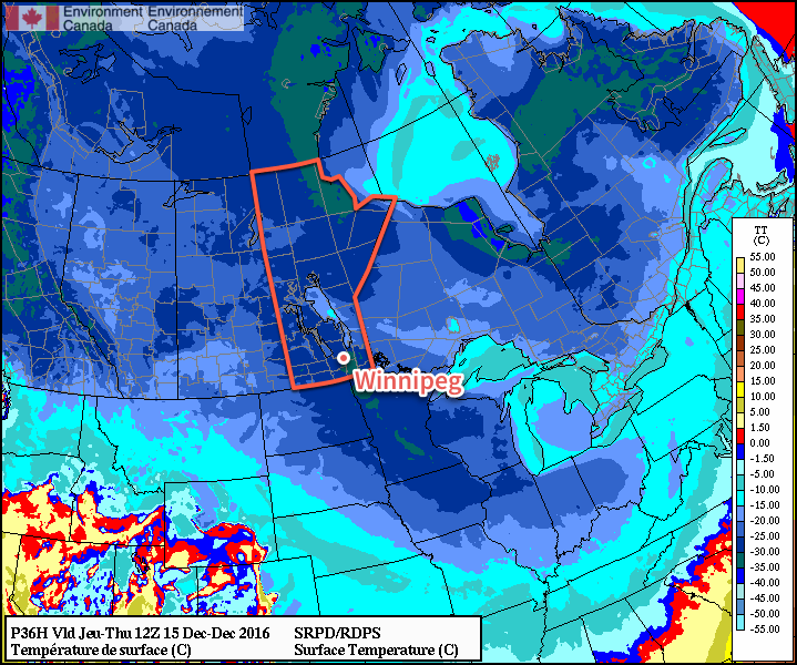
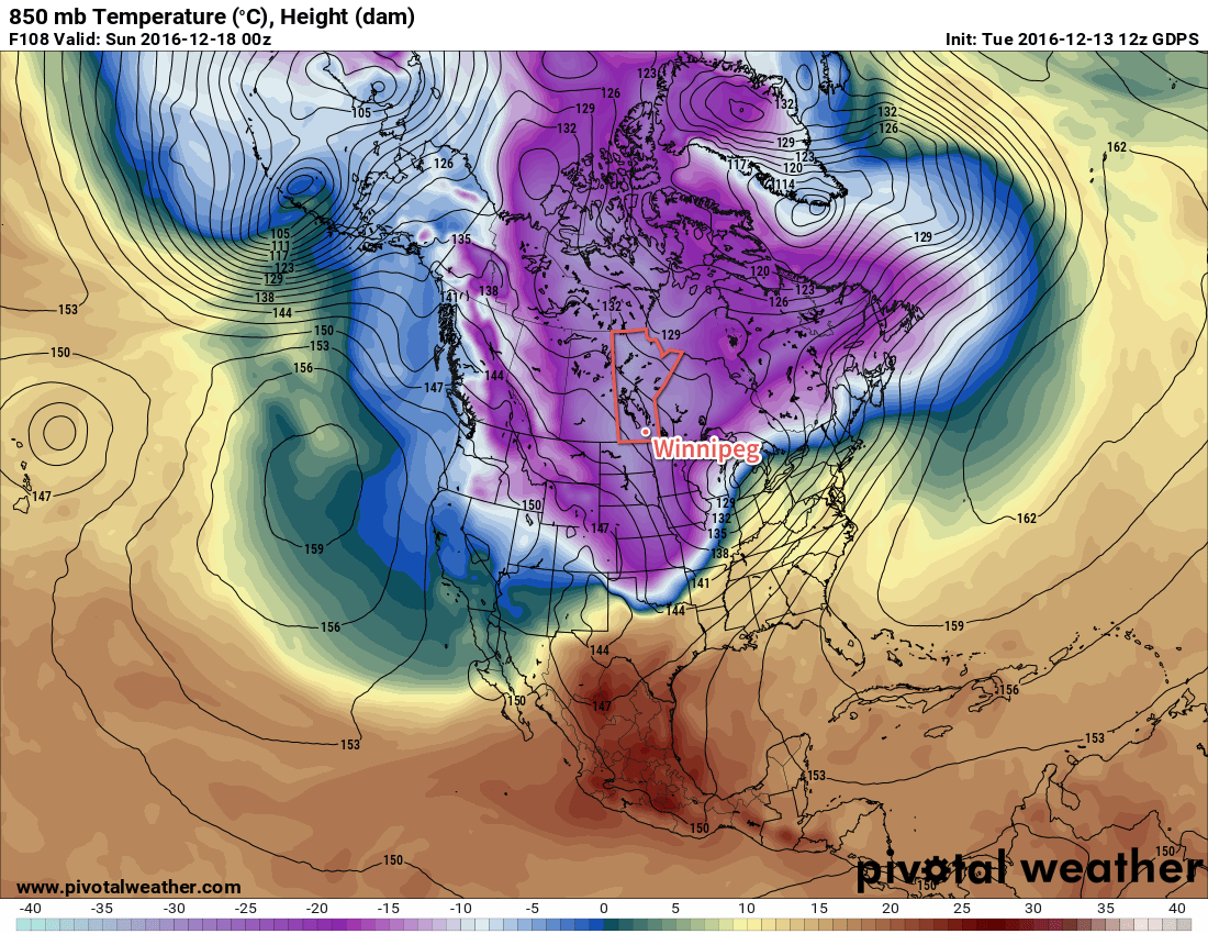
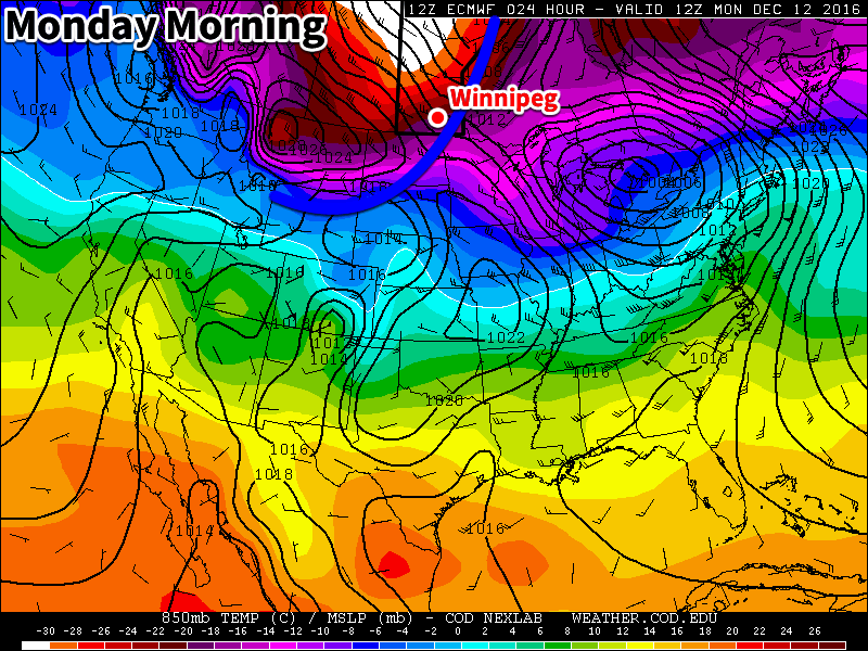
Winnipeg just experienced one of the most extreme months ever seen since records began in 1872.
With every single day posting above-normal temperatures and an average mean temperature of 3.1°C, it was the warmest November on record. In fact, much of Manitoba recorded its warmest November this year. According to Environment and Climate Change Canada, Brandon, Emerson, Portage, Sprague, Flin Flon, Thompson, The Pas and Swan River all had their warmest November on record. The month was marked by both a lack of cold and frequent bouts of record warmth.
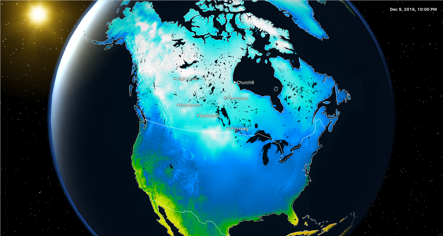
Every single day was warmer than normal in Winnipeg, a streak that began in late October. Up to December 7th, we have now had 48 consecutive days of above normal temperatures.
Warmest November on Record: The Numbers
| Rank | Average
Daily High (°C) | Average
Daily Mean (°C) | Average
Daily Low (°C) |
| 1 | 7.2 (2016) | 3.1 (2016) | -1.1 (2016) |
| 2 | 7.1 (2009) | 1.3 (1899) | -3.2 (1923) |
| 3 | 6.4 (1999) | 1.3 (1923) | -3.3 (1899) |
| 4 | 5.8 (1899) | 1.0 (1981) | -3.3 (1922) |
| 5 | 5.8 (1923) | 0.9 (2001) | -3.5 (1981) |
| 6 | 5.7 (2001) | 0.8 (2009) | -3.6 (1917) |
| 7 | 5.5 (1981) | 0.6 (1999) | -3.7 (1953) |
| 8 | 5.3 (1939) | 0.5 (1917) | -3.9 (2001) |
| 9 | 5.2 (1904) | 0.2 (1922) | -4.3 (1918) |
| 10 | 4.6 (1917) | 0.1 (1953) | -4.3 (1944) |
The average mean temperature of 3.1°C in Winnipeg in November was an impressive 7.7°C above the 1981-2010 normal of -4.6°C. It also broke the old record by a margin of 1.8°C! The old record being 1.3°C in 1899 and 1923. It is quite significant to break a monthly record by this significant a margin. To give a perspective, March 2012 had only exceeded the previous warmest March by 0.6°C and September 2009 exceeded the previous warmest September by 0.9°C. The last time we broke a monthly record by this kind of margin was in January 2006 when we exceeded the previous warmest January by 3.2°C! The following graph of November mean temperature per year since 1872 shows how much this year was an outlier!
Brandon also had it warmest November on record with an average mean temperature of 2.0°C, breaking the old record of 0.7°C in 1917 and 1953. This gave a record margin of 1.3°C, again the greatest since January 2006. It was also 7.6°C above the 1981-2010 normal of -5.6°C.
Temperatures were especially warm early month with highs regularly in the double digits. Winnipeg exceeded 10°C on 10 occasions, tied with 1981 and 2009 for second most on record in November. Record was 11 days above 10°C in 1904. The monthly maximum was 18.8°C on the 9th, smashing the old record of 14.4°C in 1923 and 1930. It was also the latest date on record to reach or exceed 18°C since 1872. In total, two record highs, three record high minimums and one tied record high occurred in November, and they are listed below.
| Date | Record Type | New Record | Old Record |
| Nov. 6 | High Maximum | 16.7°C | 16.7 (Tied 1975) |
| Nov. 6 | High Minimum | 7.4°C | 5.6°C (1906 / 1922) |
| Nov. 9 | High Maximum | 18.8°C | 14.4°C (1923) |
| Nov. 9 | High Minimum | 4.8°C | 2.8°C (1969) |
| Nov. 12 | High Maximum | 13.6°C | 13.2°C (1981) |
| Nov. 24 | High Minimum | 0.1°C | 0.0°C (1988) |
Many locations across southern Manitoba reached 20°C during the warm spell and many more than once. In fact, Baldur, Ste. Rose, McCreary, Portage la Prairie, Deerwood and Boissevain all saw three days exceed 20°C. The maximum recorded temperature was 22.7°C in Ethelbert and Alonsa. 20°C highs occurred in southern Manitoba November 4th, 5th, 6th and 9th. The latest known occurrence of 20°C in Manitoba was on November 17, 2001 when Morden reached 21.0°C.
In general, November simply featured a distinct lack of cold conditions. This helped Winnipeg break the following records:
- Only 5 days dipped below -5°C, breaking the old record of 7 days in 1899.
- Only one day dipped below -10°C, tied with 1912, 1923, 1981 and 2001 for the least on record.
- Only 18 days dipped below freezing, breaking the old record of 20 days set in 2015. Normal is 28 days.
- 28 days exceeded the freezing mark, tied with 2009 for 2nd most. Most was 29 days in 1899.
- 4 days exceeded 15°C, tied with 1903 and 1981 for most on record.
2nd Warmest Fall on Record
With an average mean temperature of 8.0°C, it was the 2nd warmest fall on record in Winnipeg. The warmest was in 1963 when we averaged 8.6°C (1963 had featured the warmest October on record).
| Rank | Daily High (°C) | Daily Mean (°C) | Daily Low (°C) |
| 1 | 15.0 (1963) | 8.6 (1963) | 3.3 (2016) |
| 2 | 13.2 (1923) | 8.0 (2016) | 2.9 (1931) |
| 3 | 13.0 (1948) | 7.9 (1931) | 2.3 (1953) |
| 4 | 12.8 (1931) | 7.5 (1923) | 2.3 (1963) |
| 5 | 12.8 (2009) | 7.3 (1953) | 2.0 (1922) |
| 6 | 12.8 (2016) | 7.3 (2009) | 2.0 (2015) |
| 7 | 12.6 (1920) | 7.3 (2015) | 1.9 (1923) |
| 8 | 12.6 (2011) | 7.2 (1948) | 1.7 (1914) |
| 9 | 12.6 (2015) | 7.1 (1914) | 1.7 (2009) |
| 10 | 12.4 (1914) | 7.1 (1920) | 1.5 (1920) |
| 11 | 12.2 (1953) | 7.0 (1922) | 1.5 (1944) |
| 12 | 12.1 (1994) | 6.8 (1994) | 1.5 (1994) |
| 13 | 12.1 (2001) | 6.8 (2011) | 1.4 (1908) |
| 14 | 12.0 (1906) | 6.6 (2004) | 1.4 (1948) |
| 15 | 12.0 (1938) | 6.5 (1940) | 1.3 (1940) |
| 16 | 11.9 (1899) | 6.3 (1908) | 1.3 (1954) |
| 17 | 11.9 (1922) | 6.3 (1962) | 1.2 (1934) |
| 18 | 11.9 (2004) | 6.3 (2001) | 1.2 (1981) |
| 19 | 11.7 (1940) | 6.2 (1899) | 1.2 (2004) |
| 20 | 11.5 (1962) | 6.2 (1981) | 1.1 (1912) |
| 21 | 11.5 (2005) | 6.1 (1906) | 1.0 (1962) |
| 22 | 11.3 (1908) | 6.1 (2005) | 1.0 (2011) |
| 23 | 11.3 (1909) | 5.9 (1944) | 0.9 (1968) |
| 24 | 11.3 (1990) | 5.9 (1998) | 0.8 (1983) |
| 25 | 11.3 (1998) | 5.8 (1904) | 0.7 (1949) |
| 26 | 11.3 (1999) | 5.7 (1938) | 0.7 (2005) |
| 27 | 11.2 (1952) | 5.7 (1954) | 0.6 (1956) |
| 28 | 11.2 (1981) | 5.7 (1968) | 0.6 (1960) |
| 29 | 11.2 (1987) | 5.6 (1912) | 0.5 (1904) |
| 30 | 11.1 (1897) | 5.6 (1943) | 0.5 (1928) |
We reached 2nd warmest mainly due to the warmest November on record. However, September was also warm with an average of 14.4°C, tied with 2005 for 19th warmest September. October was also above normal with an average mean temperature of 6.6°C, 1.5°C above normal.
Record Humidity
Average dewpoint temperatures were also at a record high this November and fall. In fact, they were shockingly anomalous in November. Dewpoint temperatures averaged 0.3°C in November in Winnipeg, obliterating the previous record of -2.9°C set last year. It’s one thing to break a monthly record two years in a row, but to break the previous year’s record by 3.2°C is just another story!
| Rank | Highest Average Dewpoint (°C) | Lowest Average Dewpoint (°C) |
| 1 | 0.3 (2016) | -14.9 (1985) |
| 2 | -2.9 (2015) | -13.9 (1996) |
| 3 | -3.0 (1981) | -12.6 (2014) |
| 4 | -3.2 (2009) | -12.3 (1978) |
| 5 | -3.9 (1962) | -12.3 (1995) |
| 6 | -3.9 (2001) | -11.9 (1986) |
| 7 | -4.0 (1954) | -11.7 (1955) |
| 8 | -4.0 (1999) | -11.3 (1959) |
| 9 | -4.2 (1953) | -11.3 (1966) |
| 10 | -4.3 (1983) | -11.3 (1976) |
| 11 | -4.7 (1987) | -10.7 (1991) |
| 12 | -4.8 (1956) | -10.1 (1989) |
| 13 | -4.8 (2005) | -9.4 (1982) |
| 14 | -5.0 (1980) | -9.3 (1973) |
| 15 | -5.0 (2004) | -9.1 (1965) |
| 16 | -5.1 (1994) | -9.0 (1990) |
| 17 | -5.1 (2011) | -8.9 (1993) |
| 18 | -5.2 (2008) | -8.8 (2003) |
| 19 | -5.5 (1998) | -8.5 (2013) |
| 20 | -5.5 (2010) | -8.4 (1972) |
The graph below shows very well how out of bounds this year was in terms of average dewpoint temperature in November. In fact, it was almost two and a half standard deviations above the 1981-2010 normal of -7.4°C.
Average dewpoints were also at a record high for the fall season. The September to November average was 4.4°C, breaking the old record of 3.6°C in 2009.
A total of 18 record high and high minimum dewpoint records were broken throughout the fall season from September to November: 12 in November, 5 in October and 1 in September. Not a single record low dewpoint occurred. This included a record high dewpoint of 12.3°C on November 6 which was also an all-time high dewpoint temperature for November since 1953. The previous record was 11.1°C on November 5, 1956.
| Date | Record Type | New Record | Old Record |
| Nov. 4 | High Maximum | 9.7°C | 9.5°C (1981) |
| Nov. 5 | High Minimum | 2.2°C | 1.7°C (1956) |
| Nov. 6 | High Maximum | 12.3°C | 9.4°C (2000) |
| Nov. 6 | High Minimum | 4.9°C | 1.4°C (1977) |
| Nov. 7 | High Maximum | 10.8°C | 10.4°C (1977) |
| Nov. 9 | High Maximum | 7.7°C | 6.1°C (2010) |
| Nov. 23 | High Minimum | -0.4°C | -1.5°C (2001) |
| Nov. 24 | High Minimum | -0.2°C | -0.7°C (1988) |
| Nov. 28 | High Minimum | -1.0°C | -1.1°C (1998) |
| Nov. 29 | High Maximum | 3.4°C | 2.1°C (1998) |
| Nov. 29 | High Minimum | -1.5°C | -2.3°C (1987) |
| Nov. 30 | High Minimum | -2.1°C | -2.8°C (1962) |
Postponed First Snowfall
Thanks to warm conditions (and a bit of luck), Winnipeg did not see its first snowfall accumulation of the season until November 22, the latest date on record to see our first measurable snowfall of the season. A measurable snowfall is a snowfall of at least 0.2 cm. This broke the old record of November 21 in 1963 and was more than a month later than the 1981-2010 normal of October 18.
| Rank | Date of First Measurable Snowfall (≥ 0.2cm) | Year |
| 1 | November 22 | 2016 |
| 2 | November 21 | 1963 |
| 3 | November 20 | 1953 |
| 4 | November 19 | 1931 |
5 tie
5 tie | November 18
November 18 | 1880
2015 |
| 7 | November 17 | 1890 |
| 8 | November 16 | 1977 |
| 9 | November 15 | 1903 |
Winnipeg also went 225 days without measurable snowfall (Apr 11 to Nov 21), the 3rd longest snow-free period since 1872. The longest such period was 232 days in 1998.