Rainy & Unsettled Start to the Weekend

A weak Colorado Low will bring a swath of rain across Southern Manitoba today as it passes through the Northern Plains of the United States. The chance for rain will return on Saturday before a bit more stability moves into the region, resulting in a relatively pleasant late October weekend.

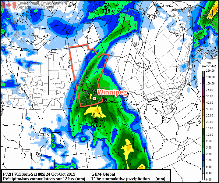
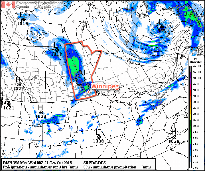
The main weather story today will be the Colorado Low passing to our south. Rain will begin fairly early this morning as it spreads up from the south through the Red River Valley and into the Interlake. The rain will persist through much of the day—although there may be a few lighter periods—and taper off in the evening.

Storm-Total Rainfall Outlook
Storm-total rainfall outlook for October 23, 2015

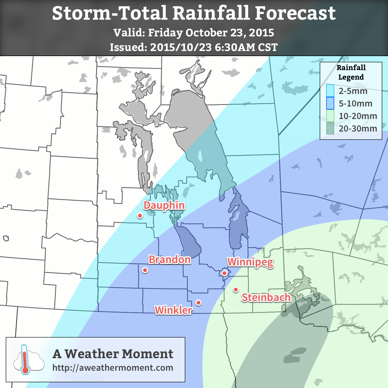
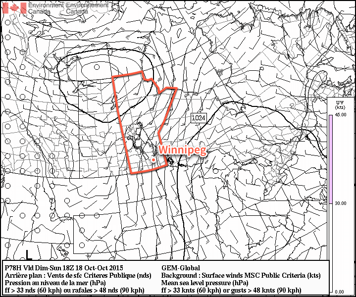
Much of Southern Manitoba will see between 5–15mm of rain, with generally lower accumulations west of the Red River Valley and increasing accumulations heading towards the southeast corner of the province. Here in Winnipeg, we’ll likely see close to 10mm of rain. Aside from the rain, the winds will be fairly light through the Red River Valley with daytime highs climbing to around 9°C. Heading into the evening hours, the wind will likely pick up a bit out of the northwest to 20–30km/h.

As the rain tapers off overnight, we’ll likely see the clouds scatter out and winds diminish. Temperatures will dip down to around 1°C.

Saturday will bring mixed skies and relatively light winds. Much of the day will be dry, but a secondary disturbance pushing in from the northwest will bring a batch of scattered showers through late in the afternoon or early evening and persisting into the overnight period. Temperatures will climb to around 13°C on Saturday and then drop down to around 2°C on Saturday night.

Sunday will be a pleasant day, despite being fairly cloudy. Winds should be relatively light and the daytime highs will be near 7°C. Clouds should clear out overnight, making for a cool low near –2 or –3°C.

Cooler Weather to Start Next Week

Much cooler weather will be in place to start next week with daytime highs likely in the 3–6°C range. Monday looks sunny but perhaps windy in the afternoon ahead of a forecast low pressure system that will bring a chance of rain to southern Manitoba on Tuesday. This system could potentially produce another moderate rainfall event, but it’s too early to really speculate too much. After that, the remainder of the week looks fairly quiet with more seasonal temperatures returning for the second half of the week.

Pleasant Fall Weather Gives Way to End of Week Rain

The weather will be relatively pleasant for late October over the next couple days with above-seasonal daytime highs expected and a fair amount of sunshine. Things will take turn on Friday for the end of the week as a Colorado Low sets its sights on Southern Manitoba and brings a decent shot of rain along with it.

Today will see the cloudy skies that start the day gradually break up and become mixed to partly cloudy. Winds will pick up through the morning and make for a fairly windy afternoon with gusty northwesterlies at 40–50km/h. Today’s daytime high near 12°C will be around 4–5°C above the normal daytime highs for this time of year. Heading into the evening, the winds will taper off and skies will clear as a ridge of high pressure pushes into the province. Expect an overnight low near –2°C.

Thursday will be quite a pleasant day with relatively light winds at 20–30km/h out of the southeast and a high once again near 12–13°C. Clouds will move in overnight as we head to a low near 5–6°C.

Forecast 12hr. precipitation accumulations for Friday from the GDPS
The GDPS is forecasting 10-15mm of rain over Southern Manitoba on Friday.

Friday will see the Colorado Low push into North Dakota and Minnesota, spreading an area of rain northwards into Southern Manitoba. There’s a surprising amount of agreement in the track of the low, but how much rain it will produce seems to be a tough topic. The Canadian Global model, pictured above, shows around 10–15mm through the day on Friday, however I think it’s a bit on the low side. My best forecast at this point is that 10–20mm of rain should be expected through the Red River Valley and southern Interlake on Saturday, however for areas in the RRV south of Winnipeg, particularly closer to the U.S. border, 15–25mm seems like a possibility depending on a number of factors.

Alongside the rain, our daytime high will climb to around 9°C. Winds won’t be too much of an issue and will remain relatively light out of the southeast switching to northwest in the evening. In the evening we’ll see the last of the rain taper off and head to a low near 4°C.

Cooler air looks to push in through the weekend behind the low, so enjoy the milder temperatures today and tomorrow!

Unseasonable Warmth Brings Chance of Rain

Unseasonably warm air will remain in place over Southern Manitoba for another day before a disturbance pushing eastwards across the Prairies brings a chance of rain and more seasonal temperatures for Tuesday. The “cool-down” will be short lived as above-seasonal temperatures are expected to return on Wednesday.

For the 42nd Canadian general election today, weather couldn’t be nicer for late October in Winnipeg. Today will bring plenty of sunshine and light winds with a high near 15°C.1 Temperatures will be cool tonight at around 2°C under increasing cloudiness.

RDPS 3hr. QPF forecast for late Tuesday afternoon.
The RDPS shows precipitation pushing into southern Manitoba late Tuesday afternoon.

Tuesday will be a mainly cloudy day with a cool northeast wind limiting our high to a more seasonal 9°C or so. There will be a chance of some shower activity through the afternoon and overnight period as a trough of low pressure pushes across the region, however amounts from the precipitation are expected to be fairly minimal with just a couple mm likely at most. With cloudy skies overnight, the low temperature will be kept a bit warmer at around 4°C.

Wednesday will see a return of the warmer weather.  Skies will clear through the morning hours letting the sun work a little bit of it’s late-season magic and bring us towards a high near 11°C with relatively light winds.  Expect a low near the freezing mark on Wednesday night under clear skies.

Long-Range Outlook

The second half of the work week looks quite pleasant with mainly sunny skies Wednesday & Thursday and warmer-than-seasonal daytime highs in the low teens.  Many weather models show a large low pressure system ejecting northeastwards out of Wyoming on Thursday night and pushing through Southern Manitoba on Friday, bringing a swath of rain across the region. There’s still quite a bit of uncertainty associated with that system, though, so we’ll keep eyes on it as the week goes on and take a closer look at it in our mid-week forecast!


  1. This is 7°C above the seasonal high temperature of 8°C for this time of year.

A Quick Return to Seasonal Conditions; Windy End of Weekend

Today is off to a cold start after a cold front passed through the Red River Valley yesterday morning, ushering in winds up to 70km/h and some mixed-phased showers as the cooler air mass moved into the region. The cool-down will be short-lived, fortunately, as seasonal to above-seasonal temperatures will return for today & through the weekend.

Today and tomorrow’s dominant weather feature will be a ridge of high pressure that will move through the region over the coming two days. With it in place, daytime highs will be cool at a seasonal or slightly below-seasonal 9–10°C. Winds will be light, and both tonight and tomorrow night will see overnight lows dipping below the freezing mark to around –2°C.

GDPS Surface Wind Forecast for 18Z Sunday October 18, 2015
The GDPS surface wind forecast for midday Sunday shows a core of stronger winds as a result of the outflow from the ridge of high pressure to the east.

Sunday will see a sunny start to the day, but a bit of cloud push in for the evening and overnight hours. The biggest weather issue of the day will be strong southerly winds that develop as surface winds accelerate out of the ridge of high pressure to our east and are aided by the strong temperature gradient as warmer air moves in aloft.[1] As such, winds will increase–likely midday–to around 40–50km/h out of the south with some gustiness on top of it. It won’t be severe-level winds, but it will certainly be a windy fall day. Temperatures will be slightly warmer at around 14°C, kept lower than the air moving in over us would suggest by the cool outflow winds at the surface.

The winds will taper off in the evening and temperatures will head to around 6°C for an overnight low under partly cloudy skies.

The Week Ahead

Next week is looking fairly unremarkable for the most part. There appears to be a slight chance of some rain mid-week, and other than that, it’s nothing but sunny to partly cloudy skies and seasonal to slightly above-seasonal temperatures. Lovely weather for the second half of October.


  1. Additionally, multiple models indicate the likelihood of enhanced anticyclonic curvature to the pressure gradient over the Red River Valley which, if true, will act to enhance the wind speeds.  ↩