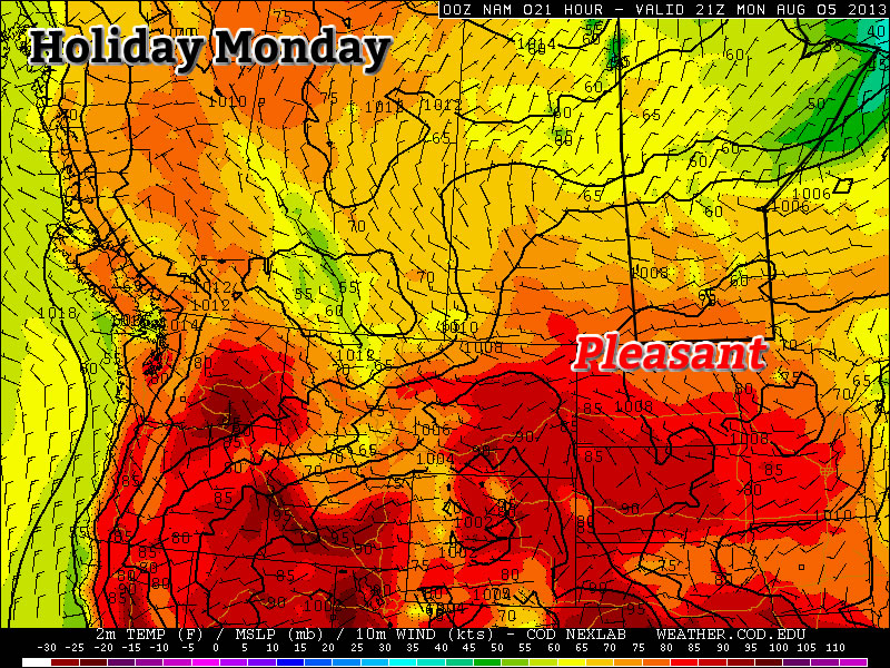
Major Warm-Up To Start April

It look like a major warm-up will usher in the month of April. These warmer conditions come after an abnormally cold March.

image

High pressure will dominate at the surface on Monday (College of Dupage image)

…April fools! No major warm-up is in the cards this week, so read on to see what you can actually expect.

Monday

Monday
image
Mix of sun and cloud. Chance of flurries.
-6°C / -12°C

Monday will be a very similar day to Sunday. The lower atmosphere will once again be quite unstable, so flurries will be possible throughout Southern Manitoba. These flurries will be fairly localized in nature and will not affect everyone. Those areas not under the influence of these flurries will see a mainly sunny day, while other areas will see a combination of clouds and flurries as well as periods of sunnier skies. Generally speaking, high temperatures will be in the mid to upper minus single digits, making it a seasonably cold start to April.

Tuesday and Wednesday

Tuesday
image
Mainly Sunny
-4°C / -8°C
Wednesday
image
Mix of sun and cloud. Chance of flurries.
2°C / -10°C

Tuesday will be slightly warmer than Monday, but not by much. Highs will be in the mid single digits in most areas. The wind will be calm and the sky sunny, so the cities and forested areas will once again be slightly warmer than everyone else.

We will finally warm up to the melting point again on Wednesday, but it won’t be a major warm-up. All of Southern Manitoba should see high temperatures in the low to mid positive single digits.

Long Range

In the longer range models are struggling to resolve the pattern. It appears fairly certain that a cold front will come through on Wednesday night, making Thursday a cooler day once again. However, beyond that things are quite unclear. Some model runs have been showing consistently warmer weather into next weekend, while others have shown cold weather persisting. We’ll just have to wait and see what happens…

Elsewhere in Weather News: March 30th, 2013

Europe Battles Cold

This past month it has not only been Southern Manitoba dealing with pesky cold Arctic air lingering around while the spring thaw should be starting up, most of Europe has also been under significantly below normal temperatures for the month of March. What has been bringing such cold weather can be attributed mostly to the same reason why we’ve been getting such cold; a negative NAO (North Atlantic Oscillation) pattern. This is cause for Scandanavian highs staying put and bringing down some unseasonably cold air from the north-east in Europe’s case.

NAO

Graph of the NAO showing values of below zero for the whole month of March. (Source: NCEP)

Germany has had the worst of the cold in Europe with their average March temperature 4°C below average – the coldest ever since record keeping started in 1883. Other parts of Europe were generally 3°C below average for March. To add to the cold temperatures, Europe has been faced with a few significant snowstorms this month, such as last week’s snowstorm that caused hundreds of flight cancellations and even the closure of Frankfurt’s International Airport. The reason for these significant snow events this late in the season can be attributed to a low pressure system drawing in moist air from the North Mediterranean. This, when combined with the stationary Siberian high feeding cold air into the northern half of the low, makes for ideal snowy conditions.

Low pressure system, Europe

Low pressure system making it’s way across Europe and bringing with it snow. Heavy snow in areas outlined in purple, thanks to cold air being brought down by the Scandanavian high.

The Scandanavian high looks to stay put over the region for just a little less than another week, however, with the NAO trending upwards and with the sun getting stronger every day (we are now at the equivalent of a September sun), this means that warmer temperatures are on the horizon for most of Europe for the second week of April.

A Cooler End to the Weekend

We’ll see two more days of temperatures near or just above 0°C before a cold front sweeps through Southern Manitoba bringing minimal precipitation and cooler weather.

12hr. QPF valid Sunday morning

Precipitation amounts for Saturday night from the NAM forecast model.

Today and Tomorrow

We’ll be off to a cloudy morning with fog patches through the entire Red River Valley; the fog may be quite dense in some areas, so if you’re travelling be prepared to potentially face near-zero visibilities at times. The fog will lift through the morning and by mid-afternoon the sun should be poking out once and a while. We’ll be on our way to a high of around +1°C with light winds. We’ll see increasing cloudiness tonight as the aforementioned system pushes towards Southern Manitoba. The cloud cover will help us keep our overnight low a bit higher than it has been lately with the temperature only expected to dip down to about -5°C. It’s likely that well see the redevelopment of fog patches again tonight.

Friday

Fog patches lifting this morning with gradual clearing.
1°C / -5°C
Saturday

Fog patches lifting then a mix of sun and cloud.
3°C
Saturday Night

A few flurries with the risk of freezing rain.
-12°C

We’ll see temperatures slowly climb back up above 0°C today as the cold front approaches the Red River Valley. Any fog patches that form overnight will lift fairly quickly in the morning as we head into another nice day with a mix of sun and cloud as the temperature climbs to +2 or +3°C.

A cold front will sweep across the Red River Valley tonight, bringing some flurries with it. There’s some uncertainty to the distribution of the snow: the models tend to spread it out, but all simultaneously hint towards a narrow band of heavier precipitation setting up. It’s hard to tell what’s going to happen this early, but suffice to say that there will almost certainly be a few flurries with the potential for local accumulations of 2-4cm somewhere in the RRV. In addition to the snow, there will be the potential for some patchy freezing rain as there will likely be some precipitation before all our warmer air aloft is scoured out by the cold front. Accumulations of freezing rain should not be significant, but may be enough to slick up roadways a little.

Sunday

Saturday

Chance of flurries. Clearing.
-6°C / -15°C

There will be a few lingering flurries about on Sunday morning, but they should clear out by midday and skies will then clear out. Sitting on the back-side of the cold front, our temperature will only climb to around -6°C, although it might be a little colder than that if clouds linger further into the day.

It looks like the cold weather will only stick around for a couple days until temperatures rebound back to the 0°C mark.

Pleasant and Warm

At the risk of sounding like a broken record, more of the same is ahead for the rest of the week with daytime highs near 0°C.

Wednesday

Mainly sunny.
-2°C / -12°C
Thursday

A mix of sun and cloud
0°C / -7°C
Friday

Mainly sunny.
1°C / -5°C

We’ll see temperatures climb a degree or two each day through the rest of the week as the sun continues to slowly chip away at the cooler air over the province. The normal daytime high for this time of year is around 3–4°C, so we’ll still remain a little below normal over the next few days. We’ll see some cloud move in tonight, which should help keep the overnight lows from dropping too much. Skies will clear out on Thursday with sunny skies being dominant through the rest of the week. Overnight lows should actually end up moderating a bit as some warmer air pushes in aloft.

This benign weather pattern looks to continue for at least another 7–10 days with no significant weather systems expected to move through Southern Manitoba. This slowly warming, dry weather is good news in light of the most recent flood forecast which has been upgraded to a risk of moderate to major flooding in the Red River Valley.