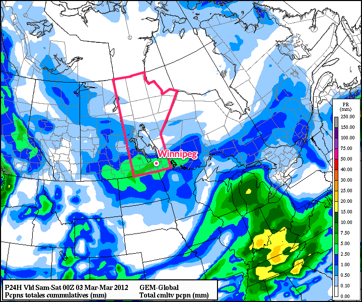
After Manitobans dug out from as much as 21cm of snowfall, it looks like some portions of Southern Manitoba may need to keep the snow shovel ready as another significant weather system tracks across the Northern Plains, bringing significant snowfall to North Dakota. The question is, just how much snow will make it into Southern Manitoba? Read on for our best guess…
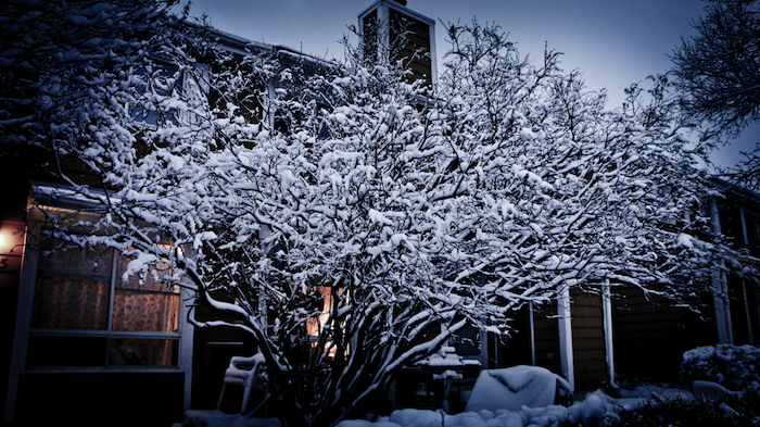
Winters Around – Photo by Jennifer Molnar
First: for today we’ll see a mix of sun and cloud and light flurries through much of the day as the shortwave that brought around 3cm of snow to Winnipeg yesterday slumps southwards into Minnesota. Temperatures will be cooler today than the past few days now that we’re on the back side of the cold front, with daytime highs around -10°C in Winnipeg and the Red River Valley. Overnight, skies will clear and temperatures will drop considerably; in Winnipeg the temperature should get down to around -22°C, while some regions in the Central RRV south of Winnipeg will see temperatures dipping just below -25°C. Saturday will see temperatures rebound back to around -10°C with increasing clouds late in the day.
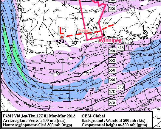
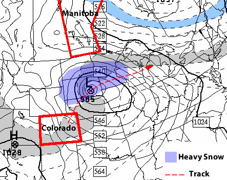
Another system will bear down on Southern Manitoba by the end of the weekend, and this time we’ll be looking at a very strong snowfall gradient from north to south instead of east to west. A powerful low pressure system will make landfall on the British Columbia coast by this evening and then accelerate across the Rockies and slice through the Northern Plains, spreading an intensifying area of snow across North Dakota and Southern Manitoba.
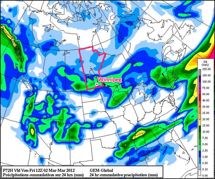
The exact question to be asked is “How much snow?” In this case, that’s not quite so easy a question to answer. In the heart of the heaviest snowfall, this system will pack quite a wallop, dumping up to 20cm (~ 9”) of snow in North Dakota. The situation in Southern Manitoba will be complicated by our old friend, the deformation zone.
While with the last system the deformation zone set up in a north-south orientation, dramatically reducing snowfall amounts across an area as small as Winnipeg, this system’s deformation zone will have a more typical west-east(ish) orientation and will not be quite as strong. This will again produce a relatively sharp drop-off in snowfall amounts from the south side of the deformation zone to the north side. Currently, indications are that it will set up somewhere slightly north of the Trans-Canada highway. This will allow snow to push across Southern Manitoba and give areas along the Trans-Canada highway, such as Brandon and Portage La Prairie, roughly 5cm of snow. Areas north of the Trans-Canada would see a couple cm, but nothing significant. Current indications are that if things pan out as currently forecast, areas south of the Trans-Canada would receive 5-10cm of the white stuff, with the potential for isolated areas of 10-15cm within 50km or so of the International Border.
Any forecast for this system will be extremely sensitive to the track the system takes, which is essentially impossible right now, given the fact the low pressure system is still off the Pacific seaboard. The best way to approach a system like this is through the use of ensemble forecasting.
Ensemble forecasting is a technique where instead of outputting one “answer,” a forecast model produces many “answers,” each a result of slightly altered initial conditions. We then combine all that information to be able to produce probabilities of some weather condition at any given location. This technique produces *probabilistic forecasts compared to the traditional single-“answer” deterministic forecasts.*
We’ll use the NAEFS (North American Ensemble Forecast System) to look at this problem. It consists of output from two models, a Canadian one and an American one, each supplying 21 “answers” to the weather. This will help us find the most likely solution given the conditions we know right now. So, moving forward…
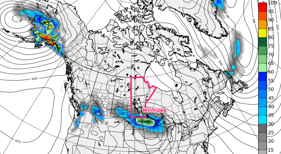
Ensemble probability of greater than 5cm of snowfall accumulation, valid for 06Z to 18Z Monday February 27.
This shows us the probability of any one location getting more than 5cm of snowfall. For various reasons, although it may not seem like it would be, anything above 50% is a pretty good chance of more than 5cm of snow. We can see that Winnipeg sits right on the border of the 30% probability, which means we’ll likely see at least 3 or 4cm for the time period covered by this image.
My best guess for storm-total snowfalls from Sunday through Monday evening, given the current information would be:
- Winnipeg: 7-10cm
- Brandon: 8-12cm
- Portage la Prairie: 8-12cm
- Steinbach: 8-12cm
- Morden/Winkler: 10-13cm
- Emerson: 12-15cm
With the very sharp drop-off visible immediately north of Winnipeg, it becomes quickly apparent how important the track will be for this system. A shift of even 50km could dramatically increase or decrease the amount of snow that ends up on the ground. We’ll have updates in the comments through the weekend as this system develops. I get a feeling that once we can actually see the low and where it’s heading I’ll be updating those numbers above, but hopefully not too much!