More Warm Weather Ahead for Winnipeg

Winnipeg will continue to see mild conditions with daytime highs close to the freezing mark through the weekend.

RDPS 2m Temperature Forecast valid 18Z Saturday February 11, 2023
Mild temperatures will move through southern Manitoba on Saturday with highs climbing above freezing in most areas.

A westerly flow aloft will continue to spread mild Pacific air across the Prairies this weekend. This will keep daytime highs seasonably mild in the Red River Valley and keep the storm track just to the north. As a result, Winnipeg and area will see a very pleasant weekend.

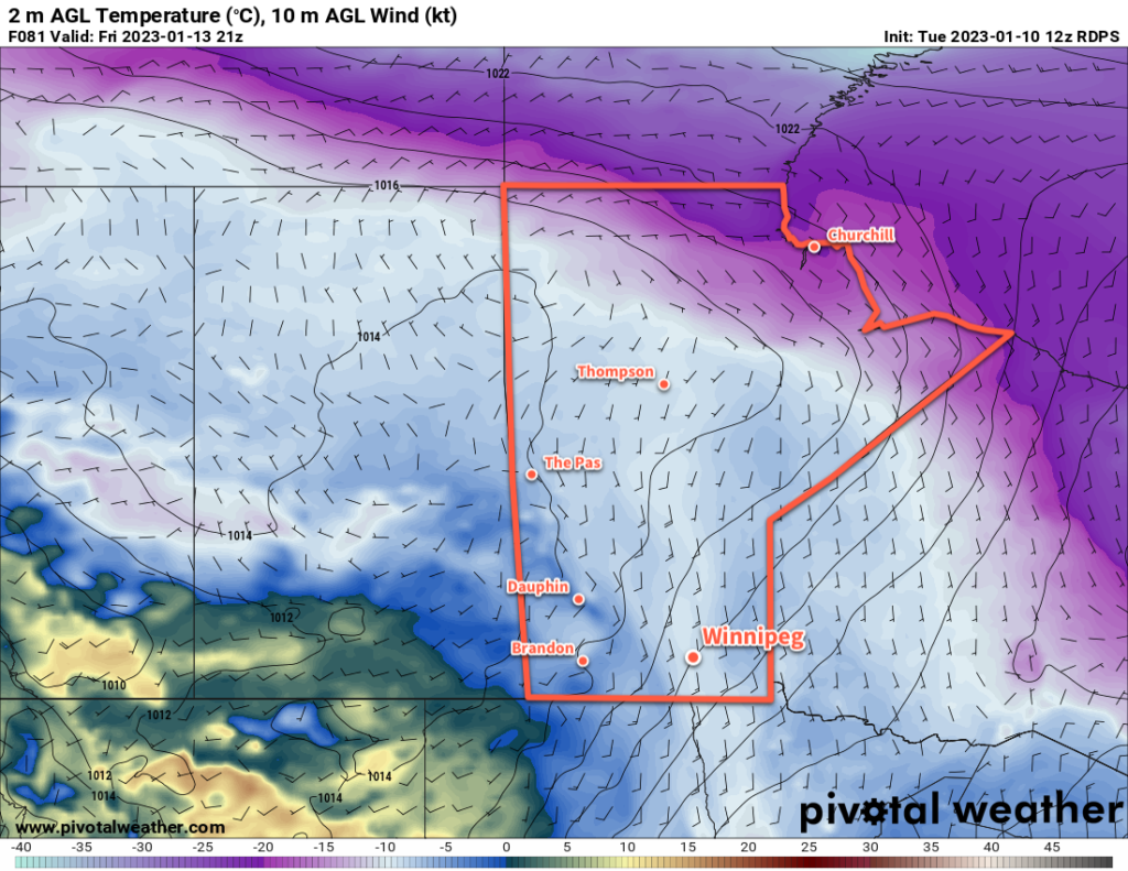
Temperatures will climb to around -2 °C in Winnipeg today with a breezy southerly wind near 30 gusting 50 km/h. Although a low pressure system is moving into Manitoba, skies will stay mainly sunny in Winnipeg as most of its cloud stays north of the RRV.

The area will see clear skies tonight as temperatures continue to rise to around +1 °C. The wind will ease overnight and shift to the west by morning.

For Saturday, the day will start off with sunshine and mild weather as temperatures climb a degree or two more. Some cloud will work into the region later in the day as a cold front slumps southwards into the Interlake. No precipitation will fall in Winnipeg, but some light snow or even a rain shower is possible further north.

Temperatures will dip to a low in the -5 to -10 °C range on Saturday night with clear skies.

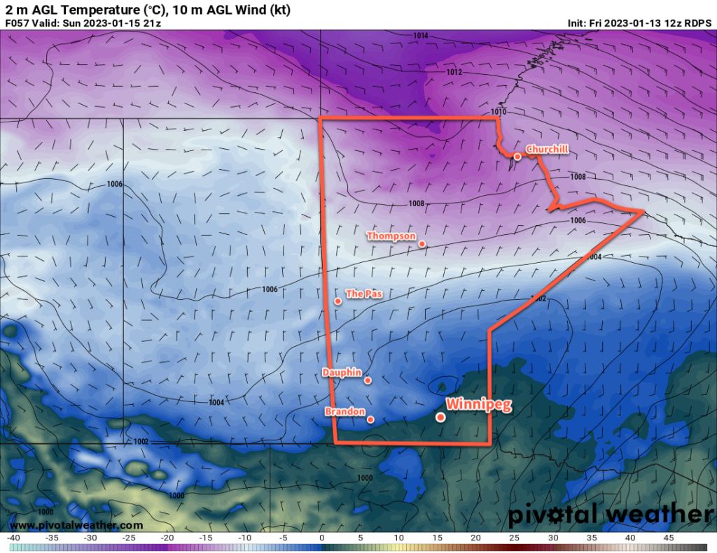
Sunday will bring more warm weather to the region with a high just a bit cooler than Saturday. The region may see some cloud in the afternoon as a weak push of warmer air moves through.

Skies will clear out on Sunday night with a low again dropping into the -5 to -10 °C range.

Long Range Outlook

More warm weather is on the way for Monday with a light south wind and a high near 0 °C. Cloud will move in on Monday night as the next disturbance to affect southern Manitoba moves into the area.

Tuesday will continue to bring mild temperatures, but some flurries are likely later in the day as a cold front sweeps through the region. Some light snow will continue to be possible on Tuesday night as north winds pick up and usher in a much cooler air mass.

The flurries will taper off mid-week with highs dropping back towards seasonal values. Temperatures will likely stay near seasonal values into the weekend.

Today’s seasonal daytime high in Winnipeg is -9 °C while the seasonal overnight low is -19 °C.

Mild Weekend Ahead for Winnipeg

A push of Pacific warmth will bring cloudy and mild conditions to Winnipeg this weekend.

RDPS 2m Temperature Forecast valid 21Z Sunday January 15, 2023
A passing low pressure system will bring very mild temperatures to Winnipeg and the Red River Valley on Sunday.

A slow-moving low pressure system will push warmer air across the Prairies over the next few days. This warmer air will bring with it plenty of cloud cover — it definitely seems like we need to enjoy those fleeting moments of sun while we have them — as daytime highs rise towards the freezing mark.

Some morning sun today will give way to cloudier skies with a high in the -5 to -10 °C range. The cool morning temperatures in the -15 to -20 °C range will result in windy conditions this afternoon as the warmer air pushes in. Southerly winds will increase to around 40 gusting 60 km/h later this morning. Winds will ease later this afternoon, then the city will head to a low near -10 °C under cloudy skies.

Expect mainly cloudy conditions through the weekend with southeasterly winds near 20 km/h on Saturday and lighter on Sunday. Daytime highs will climb into the -5 to 0 °C range for both Saturday and Sunday as a low pressure system pushes into Saskatchewan. Overnight lows will also be quite mild near -5 °C. While the occasional few flakes are possible, any notable snow will stay north and west of Winnipeg.

The most organized area of snow will develop over Saskatchewan on Saturday evening and spread through WestMan and the northern Interlake on Saturday night. A swath of 5 to 10 cm is likely, with localized higher amounts possible as it moves into central Manitoba. The Red River Valley will stay mainly unaffected by this system.

Long Range Outlook

A few flurries will be possible on Monday as a cold front sweeps through the Red River Valley behind the passing low. Temperatures will begin to cool, with near-seasonal values returning for Tuesday. After that, though, milder air will again work its way into the region with daytime highs climbing back towards -5 °C by the end of the week.

For those missing the sun, the week ahead will continue to disappoint. Mainly cloudy conditions will persist through next week, though a few sunny breaks will be more likely on Tuesday.

While everyone’s tastes vary, the cloud cover is generally the trade-off needed for warmth at this time of year. Personally, I’ll take the trade-off of cloud for warmth as it makes getting outside and doing things so much more pleasant. But pretty soon even I’ll be willing to take the trade-off of a few -20 °C days for some blazing sunshine.

Today’s seasonal daytime high in Winnipeg is -13 °C while the seasonal overnight low is -24 °C.

More of the Same Ahead: Cloudy and Mild Weather

Sounding like a broken record, the days ahead shows little change with plenty of cloud and mild conditions.

RDPS 2m Temperature Forecast valid 21Z Friday January 13, 2023
Breezy southerly winds will develop across the Red River Valley on Friday as a push of very mild winter air approaches the region.

An upper ridge will rebound again over western Canada in the coming days, helping keep the colder Arctic air locked up north.

As a result, the region will continue to see seasonably mild weather. Daytime highs will sit in the -5 to -10 °C range through the rest of the work week. A weak disturbance will move through tonight will bring a chance for some light snow to the region, but it won’t leave much more than a dusting of snow across the Red River Valley.

A bit of cooler air will slump in behind this system on Thursday, sending highs towards the lower end of the range mentioned above. On the upside, that might also bring some sunny breaks to Winnipeg as well.

Winds will be a bit of a mixed bag over the coming days. Winnipeg will see southerly winds near 30 km/h today that will ease later this afternoon. They will then shift to northwest winds for Wednesday around 20 km/h and ease on Thursday. Friday could be a bit of breezy day as a more organized push of wamer air works towards the region. Much of the Red River Valley will likely see southerly winds of 40 to 50 km/h develop in the morning. Those winds will last through the day and then ease overnight.

Long Range Outlook

Skies will cloud back over for the weekend as a push of milder air moves into the region. Daytime highs will climb towards 0 °C by Sunday with a chance of some snow.

The snow will likely fall mainly north of Winnipeg from WestMan across the Interlake. There could be close to 10 cm of snow for some places by Sunday evening. We’ll keep an eye on this system as the week progresses. The southern edge of the snow amounts drop-off sharply, and more southerly track could mean poor travel conditions along the Trans-Canada Highway corridor on Sunday.

Until then, though, enjoy the mild conditions! If you’re looking for something to do to get out and take advantage of the winter warmth, The Forks Skating Trail is open on the Assiniboine all the way to the Osborne Bridge and on the Red River to Queen Elizabeth way!

Today’s seasonal daytime high in Winnipeg is -13 °C while the seasonal overnight low is -24 °C.

Mild Weather Continues Into the Weekend

Beautiful late-November weather will continue in Winnipeg for a few more days with daytime highs climbing above freezing.

RDPS 2m Temperature Forecast valid 21Z Friday November 25, 2022
The southern Prairies will see very mild daytime highs on Friday, though existing snow pack could limit some of the warmest temperatures if the winds can’t mix out all of the cool air near the snow-covered surface.

An upper ridge over the Prairies continues to bring seasonably mild temperatures to the region. Across southern Manitoba, daytime highs climbed above freezing yesterday and will stay there for another couple days yet. With Pacific air continuing to wash over the Prairies, daytime highs in Winnipeg will climb above 0 °C into the low single digits both today and tomorrow.

The wind strengthen out of south-southwest today to around 30 km/h and then ease tonight. A weak cold front will go through, bringing some cloud overnight, and then the winds will pick up out of the northwest Saturday into the 20 to 30 km/h range.

The pattern across the Prairies will begin to change on Sunday as the upper ridge collapses and a low pressure system begins to drop southeastwards across the Prairies. As it approaches, the wind will pick back up out of the southeast through the Red River Valley, but the warmer air will have slumped a bit south and more cloud will build into the region. Temperatures climb to a high near freezing, but with cloud building through the day and breezy southeasterlies, it will feel much cooler than the prior days.

As the low pushes into the region on Sunday night, light snow will blossom across the region.

Long Range Outlook

A bit of a complex setup will develop next week as energy collapses southwards from the low over southern Manitoba to a developing Colorado Low. While the Colorado Low will likely impact Ontario, the interaction of these two systems could support some periods of light snow across the region for a couple days.

By the middle of next week, cooler temperatures will begin slumping into the Prairies, sending daytime highs down below -10 °C with overnight lows dipping into the low teens.

Today’s seasonal daytime high in Winnipeg is -5 °C while the seasonal overnight low is -13 °C.