Shot of Cold Air Incoming

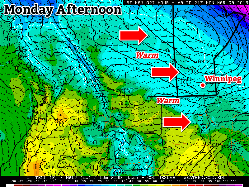
The mild, dry weather we’ve experienced over the past week and a half continues for a couple more days before a powerful cold front sweeps through Southern Manitoba on Thursday night, bringing much colder temperatures to the region. Fortunately, the cool-down is expected to be short-lived with temperatures returning to seasonal values by the end of the weekend.

Wednesday
7°C / -3°C
Mainly sunny

Thursday
8°C / -8°C
Partly cloudy

Friday
-4°C / -15°C
Mainly sunny & breezy

Today will be another beautiful day with a high near 7 or 8°C, light winds and just a bit of cloudiness. Temperatures will drop to around –3°C tonight with light southerlies and mainly clear skies. Tomorrow looks quite nice as well with partly cloudy skies and a high near 8°C. Unfortunately, a big change is swinging through on Thursday night.

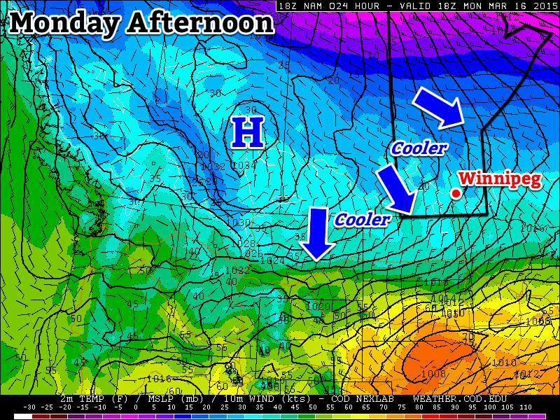
A potent cold front will swing through Winnipeg & the Red River Valley overnight Thursday, bringing with it a chance for some flurries and much cooler air. Winds won’t be too bad through Thursday night, perhaps to around 20km/h or so. Expect a low somewhere in the –8 to –10°C range.

Much cooler weather will persist through Friday and Saturday. Friday will be quite an unpleasant day as northerlies strengthen through the day to around 30–40km/h by late afternoon. The temperature will only climb to around –4°C for a high which will make it the coldest day since March 6th when the mercury topped out at +0.8°C. Temperatures will plummet into the mid-minus teens on Friday night as those strong northerlies really tap into the colder Arctic air plunging southwards.

Cool, Dry Weekend Ahead

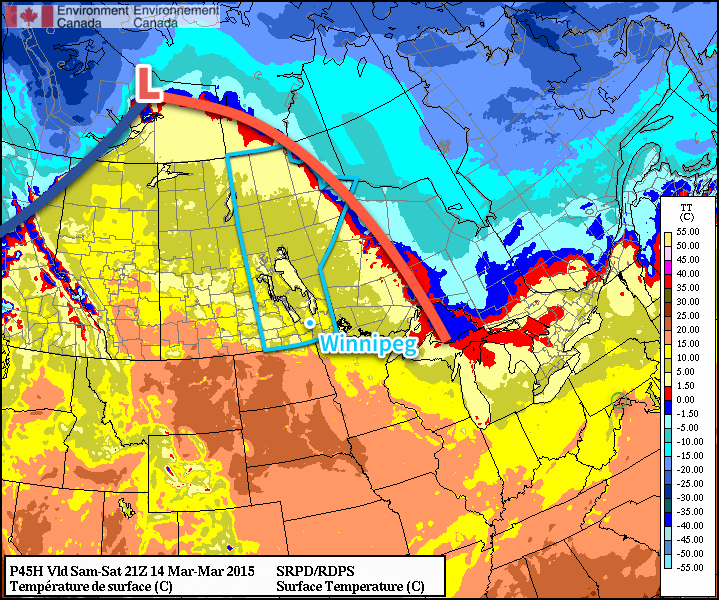
This coming weekend will be dry and generally cool as a ridge of Arctic high pressure dominates the weather over the Red River Valley. Saturday will see highs near –6°C or so while the high on Sunday manages to climb back up towards the 0°C mark.

Record Snow Pack Loss

As of Sunday (March 15th, 2015), Winnipeg’s snow pack officially fell to 0cm. This was thanks to a dramatic melt that took much of Southern Manitoba from snow-covered to bare ground in just a few days thanks to a surge of record-setting warm air.[1]

MODIS imagery revealing significant snow pack melt in Southern Manitoba
MODIS satellite imagery reveals the dramatic melting of the snow pack over much of Southern Manitoba in under a week.

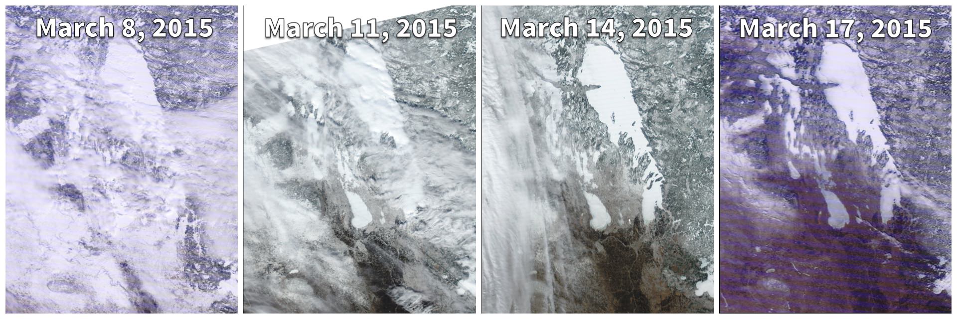
A snow depth of 0cm on March 15th ties for the 3rd earliest snow melt on record since 1955, trailing 2012 by just one day:

Top 11 Earliest Snow Melts (1955 – Present)
Rank Date of 0cm Snow Depth Year(s)
1 February 28 2000
2 March 14 2012
3 March 15 1995, 2015
5 March 17 1981
6 March 18 1973, 2010
8 March 21 1994, 1999
10 March 26 1961, 1984

The early melt was icing on the cake for Winnipeggers wary of a repeat of the never-ending winter of 2013/14. The winter of 2014/15 was effectively 4 months long – from mid-November to mid-March – of which 2 months of it was unseasonably mild. Not bad at all.


  1. On Saturday March 14th, 9 communities in Manitoba set record highs: Winnipeg, Portage la Prairie, Gretna, Dauphin, Brandon, Melita, Pilot Mound, Pinawa, and Sprague.  ↩

Cooling Down a Bit

This week will see somewhat cooler conditions than what we experienced on the weekend, but temperatures will remain above-seasonal nonetheless.

Temperatures will be a bit cooler this week as cooler air floods in from the north

Monday

Monday
3°C / -3°C
Mainly cloudy

Today will be mainly cloudy as extensive upper cloud moves through southern Manitoba. Some precipitation will pass to our south early in the day, potentially giving us a light shower or flurry. Temperatures will certainly be cooler than the record “heat” of Sunday, but with highs in the low single digits, conditions will still be above-seasonal. A chilly north wind will be responsible for ushering in these cooler conditions and also add a slight wind chill factor throughout the day.

Tuesday

Tuesday
2°C / -5°C
Mix of sun and cloud

Tuesday will be similar to Monday temperature-wise, but it should be a sunnier day. Skies will be a mix of sun and cloud with breezy north-west winds. A light shower or flurry will be possible due to some low-level instability developing, but any accumulations will be small.

Wednesday

Wednesday
4°C / -6°C
Mix of sun and cloud

Wednesday will once again see temperatures in the low single digits under a mixture of sun and cloud. There is a slight chance of a shower or flurry again, though the chance will be lower than on Tuesday. Winds will be light and from the south.

Long Range

The long range forecast suggests we should see generally above-seasonal conditions for the rest of the month. Now that our snow cover is gone the ground can effectively absorb solar radiation, converting it to sensible heat. As the ground dries out this process will become even more efficient. Our normal temperatures will gradually increase over the next few weeks, meaning that above-seasonal weather today will become more normal by month’s end. There is no sign of any significant precipitation in the forecast at this time, so flooding should remain minimal in the Red River Valley this spring.

Warm Weekend Ahead for Winnipeg

Winnipeg & the Rest of Southern Manitoba will see a beautiful weekend ahead thanks to a powerful low pressure system set to track through the Arctic, drawing warmer air northwards into the Prairies. The result will be a dry weekend with temperatures soaring well above normal with a fair amount of sunshine to enjoy. The pleasant March weather continues!

RDPS Surface Temperature – 21Z March 15, 2015
The RDPS clearly shows a powerful low pressure system moving north of 60° with a broad frontal system pulling warmer air northwards into the Prairies.

Today will be the coolest day of the next few with a high temperature near 5°C. Skies will start off cloudy but should clear out as the day progresses. Winds will be out of the northwest to 20-30km/h. Expect temperatures down to around -1°C overnight.

Friday
5°C / -1°C
Clearing

Saturday
9°C / 5°C
Mainly cloudy

Sunday
12°C / 0°C
Partly cloudy

Saturday will a transition day as the warm front moves through Southern Manitoba. It will be warmer than Friday, but accompanying those warmer temperatures will be gusty southerly winds to around 40km/h. Skies will be mainly cloudy as temperatures climb to 9°C with no chance for precipitation. With warmer weather moving in, overnight lows will be quite mild near 5°C.

Sunday will be a gorgeous day. Any remnant cloud from Saturday’s warm front will clear out by the end of the morning and we’ll be left with mainly sunny skies with high temperatures climbing into the low teens. Winds will be relatively calm until later in the day when winds will pick up out of the northwest to around 30km/h. Cooler temperatures will move in bringing overnight lows back towards the 0°C mark.

Next week continues to bring mild weather with no signs of any potential precipitation until the end of the week. With much of our snow likely gone by the end of the weekend – and the snowpack pretty much gone in North Dakota – it’s a fairly safe bet to say that spring has arrived in full!

The Melt Begins

The spring snow melt will begin in earnest this week as temperatures soar to above-seasonal values.

Monday will be above-seasonal as a mild westerly flow moves across the Prairies

Monday

Monday
5°C / -2°C
Mix of sun and cloud

Today will be well above-seasonal with high temperatures reaching into the mid single digits. We’ll see skies that are a mixture of sun and cloud as some mid and upper cloud streams through from the north-west. Since there will be a lot of snow melting, some fog patches may develop overnight due to the increase in moisture. It will most certainly be another bad day if you happen to be made of ice!

Tuesday

Tuesday
4°C / 0°C
Mainly sunny

Tuesday will see similar conditions to Monday. Temperatures will once again be in the mid single digits with a westerly wind. Skies should be mainly sunny making for yet another beautiful day.

Wednesday

Wednesday
3°C / 0°C
Mainly cloudy

Some clouds will roll in for Wednesday, but temperatures will remain mild. Highs should be in the low to mid single digits under mainly cloudy conditions. We may even see a light rain or snow shower, but accumulations will be minimal. Wednesday will be a gloomier day, but warm nonetheless.

Long Range

The long range forecast continues to look very good. Models suggest that we will see above-seasonal temperatures stick around until at least mid-March. Given the warm weather expected this week, it’s likely that most of our snow will disappear quite quickly. Once the snow is gone the ground will be less reflective, allowing more sunlight to be absorbed, giving us systematically warmer temperatures. Sounds pretty good, doesn’t it!