Seasonal Weekend Conditions

Winnipeg will see the seasonal conditions over the region continue through the weekend.

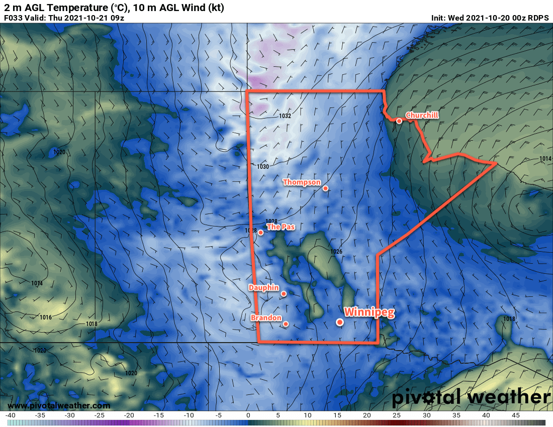
The weather will be slow to change in Winnipeg as a slow-moving ridge combines with another push of cooler air from the north. Daytime highs in the city will hover around the 6 or 7 °C mark for the next few days with lows dipping below freezing each night.

Skies will be variably cloudy over the coming days between a combination of small bands of lake effect stratus and a more organized area of cloud slumping southwards. The forecast has no rain or snow, though, with dry conditions continuing through the weekend.

RDPS 2m Temperature Forecast valid Sunday October 24, 2021
Cool nights will continue through the weekend with morning lows as cool as the mid-minus single digits.

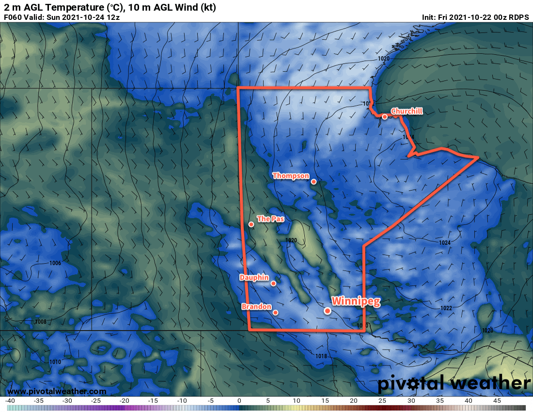
Winds will also stay light out of the north, shifting easterly by Sunday, thanks to the slow-moving area of high pressure over the province. Breezier conditions may develop late Sunday into Monday as an area of low pressure starts pushing towards the province.

Long Range Outlook

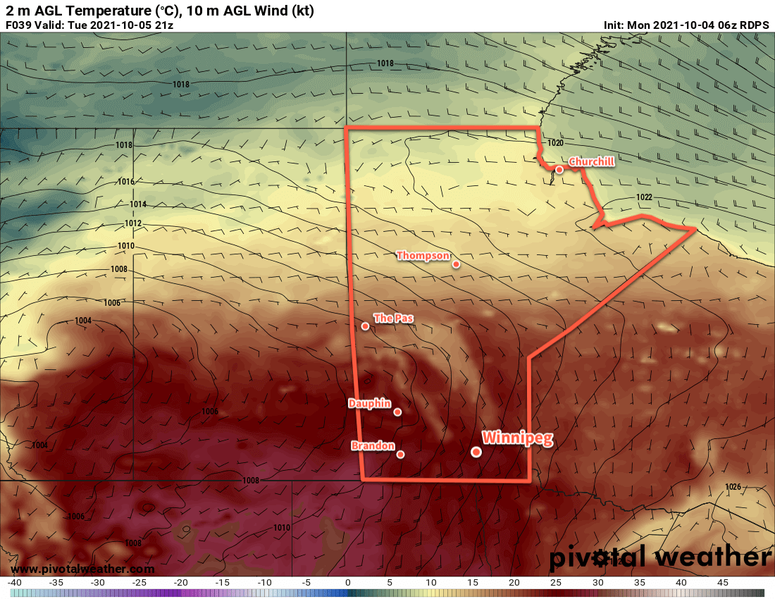
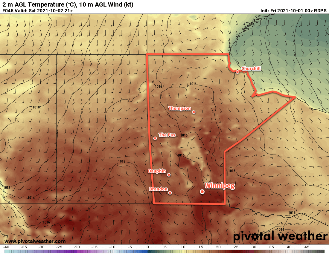
Temperatures will shift into a seasonably mild pattern next week as the high over low block over the central Arctic collapses, allowing milder Pacific air to spill eastwards across the Prairies. Highs will shift back itno the low teens with lows climbing back above freezing. Some rain showers may be possible on Tuesday and Wednesday while the rest of the week looks dry.

Today’s seasonal daytime high in Winnipeg is 8 °C while the seasonal overnight low is -2 °C.

Cooler Weather Ahead

After a blustery Tuesday, notably cooler temperatures are settling over southern Manitoba.

It’s finally time to get the heavier sweaters and jackets out; fall has arrived in Winnipeg. A much cooler air mass has settled into the region and will stick around for the remainder of the week.

The wind seen yesterday will taper off over the coming days as an Arctic high moves into the region; the northerlies will pick up into the 20–30 km/h range today, then ease to light for both Thursday and Friday. Daytime highs will hover close to the 7 °C mark while overnight lows dip below freezing.

RDPS 2m Temperature Forecast valid 09Z Thursday October 21, 2021
Temperatures will fall well below freezing across the eastern Prairies on Wednesday night.

The city will see generally sunny conditions mix with more cloud as the week progresses, with the caveat that there’s some room for the forecast to go a bit wrong if more low cloud spreads off the lakes than expected.

Long Range Outlook

Windier conditions will develop over the weekend as slightly warmer air attempts to move into the region, but more cloud will also spread into the weekend. Some rain showers are possible to start off next week, as temperatures climb into the low to mid-teens. Forecasts show the sun returning mid-week with seasonably warm conditions.

Today’s seasonal daytime high in Winnipeg is 9 °C while the seasonal overnight low is -2 °C.

Sunny & Warm Days Ahead

It’s more late-season warmth ahead for Winnipeg with sunny skies and highs in the mid- to upper-20s.

An upper ridge will build over Manitoba in the coming days, bringing yet more late-season warmth to the region. Temperatures will climb into the mid- to upper-20s over the next few days with plenty of sunshine. Winds will be light today, but moderate southerlies will develop on Tuesday. The wind will pick up to around 40 gusting 60 km/h tomorrow, then ease into the 30–40 km/h range tomorrow night. The wind will stay breezy on Wednesday out of the south at 30 gusting 50 km/h.

RDPS 2m Temperature valid 21Z October 5, 2021
Very warm conditions will spread across the southern Prairies on Tuesday.

Overnight lows will also be seasonably mild, dipping down into the 10–15 °C range over the coming nights.

Long Range Outlook

This pattern will begin to break down later this week as a large upper trough begins to swing into the region from the west. The warm weather will linger to the end of the work week, but with an increased chance of showers beginning on Friday. Temperatures will return to near-seasonal values this weekend with a few more chances of showers.

Today’s seasonal daytime high in Winnipeg is 14 °C while the seasonal overnight low is 2 °C.

October Arrives With More Pleasant Weather

A mild Pacific flow aloft will bring pleasant late-summer weather for the beginning of October in southern Manitoba.

It’s a quiet few days ahead for Winnipeg and area as a benign weather pattern is established. The region will see seasonably mild conditions with highs in the low 20s through the weekend and lows in the mid- to upper single digits. There will be plenty of sunshine and winds will stay fairly light.

RDPS 2m Temperature Forecast valid 21Z Saturday October 2, 2021
October will start off with very pleasant conditions across southern Manitoba.

And…that’s about it. It’s a beautiful few days ahead for the region.

Long Range Outlook

The warm weather will continue into next week as another upper ridge builds into the region. While its too early to say at this point, the high-amplitude upper flow may bring some more smoke into the region such as was seen yesterday. There’s also the potential for flare-ups of regional fires as the warm and dry conditions continue for the coming week.

Today’s seasonal daytime high in Winnipeg is 15 °C while the seasonal overnight low is 3 °C.