Cool Weather And Flurries Easing Friday

Milder spring weather will return to Winnipeg after a couple more cool days.

A brisk northwest wind of 20 to 30 km/h will keep daytime highs nearly 10°C below normal over the next couple days in Winnipeg. The city will see variable cloudiness today and tomorrow – partly cloudy skies today and mixed skies tomorrow – as the spring sunshine continues to produce convective cloud over the region. The low-level instability in the cool air will continue to bring a chance for some light flurries both days.

Overnight lows will dip into the -5 to -10°C range.
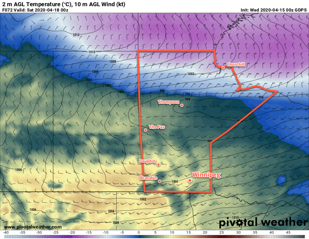
GDPS 2m Temperature Forecast valid 00Z Saturday April 18, 2020
A low pressure system will spread seasonal temperatures eastwards into Manitoba on Friday.

On Friday, a warm front pushing through the province will usher in a milder Pacific air mass. Highs will return towards seasonal values near 10°C with breezy southwest winds of 20 to 30 km/h. Fortunately it’s a fairly dry air mass, so the region should see plenty of sunshine. Near the western escarpement, winds will be a bit stronger with gusts up to 60 km/h.

Long Range Outlook

Winnipeg will see a cloudier weekend with highs in the mid-single digits as a series of disturbances move through. There will be a couple chances for precipitation through the weekend as well. Settled conditions with temperatures rebounding back towards seasonal values will develop early next week.

Today’s seasonal daytime high in Winnipeg is 10°C while the seasonal overnight low is -2°C.
A Short-Lived Snap of Cool Temperatures

Seasonably cool temperatures will start the week in Winnipeg, but the city will see a quick return to milder temperatures.

An Arctic high moving through the region today will bring cooler temperatures to Winnipeg with a high near -10°C. Fortunately, that unpleasant north wind that developed yesterday afternoon will be absent today. Temperatures will dip down to around -16°C tonight as the high exits the area and light winds shift southerly.

On Tuesday, the region will see near-seasonal temperatures as highs climb to around -4°C. Winds will stay light through the day and skies should be mainly sunny. This will be a great day to get outside and enjoy the increasing warmth of the March sun! On Tuesday night, a potent low crossing the northern Prairies will begin to affect the Red River Valley. Winds will pick up out of the south overnight into the 30 to 40 m/h range as skies cloud over. Temperatures will dip to a low near -8°C.

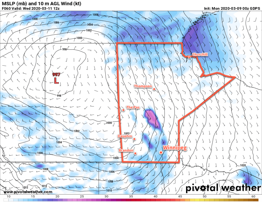
GPDS 10m Wind Forecast valid 12Z Wednesday March 11, 2020"
The Red River Valley will see breezy southerly winds on Wednesday.

Winnipeg will see cloudy skies on Wednesday with those breezy southerly winds easing late in the day. Temperatures will be warm with a high near +2°C as mild Pacific air washes across the southern Prairies. Winds will shift westerly overnight as temperatures dip to a low near -3°C with partly cloudy skies.

Long Range Outlook

Thursday will bring more warm weather, but a cold front moving through on Thursday night will send daytime highs back into the low minus single digits for the end of the week. Seasonably cool temperatures will persist through the weekend with the potential for another round of accumulating snow across southern Manitoba.

Today’s seasonal daytime high in Winnipeg is -3°C while the seasonal overnight low is -13°C.

Plenty of Cloud With Seasonably Cool Conditions

Winnipeg will see plenty of cloud over the coming days as a weak Arctic high slides through the province. Temperatures will return to seasonal values by the end of the week, followed by a return to mild temperatures for the weekend!

Winnipeg should see ample low cloud today trapped under an Arctic ridge moving across the province. The city should see a high near -12°C, which is favourable for the chance of a few non-accumulating flurries. Winds will be light through the day. The region may see some sunny breaks, particularly through the afternoon hours. Temperatures will dip back down to a low near -18°C tonight with mixed to cloudy skies.

On Thursday, winds will be light out of the southeast as the ridge slowly exits the province. Temperatures will be a bit warmer with a high near -9°C as the region sees cloudy skies with periods of light snow. The snow won’t pile up to anything too significant, but 1 to 2 cm by the end of the day may be enough to get the roads nice and slick again. The city will see mixed to cloudy skies on Thursday night with a low near -15°C.

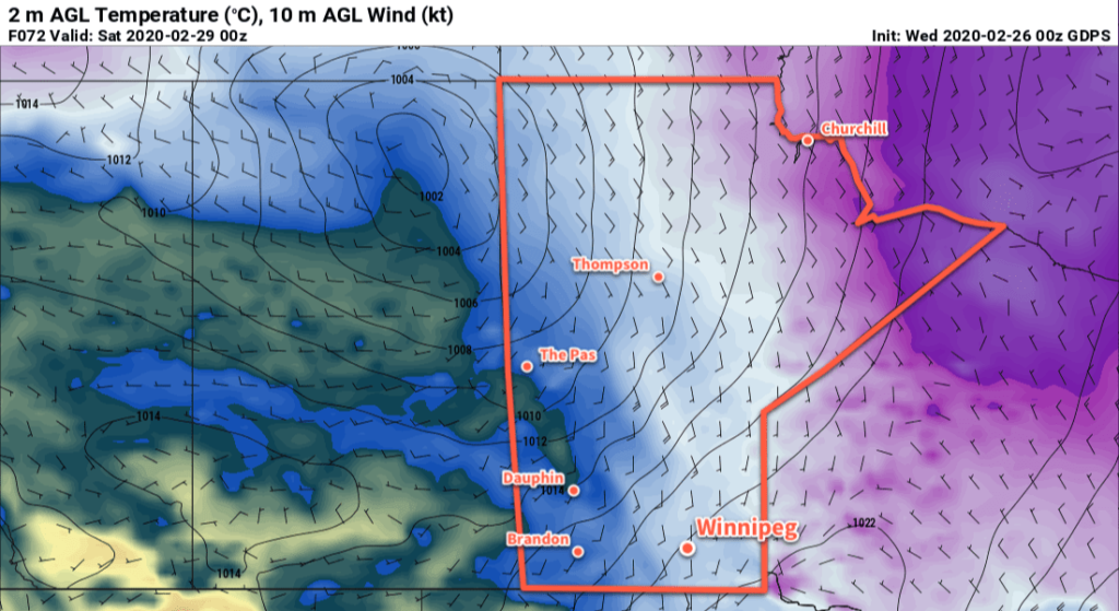
GDPS 2m Temperature Forecast Valid 00Z Saturday February 29, 2020
Warmer temperatures from the west will begin to move into Manitoba on Friday.

Temperatures will climb a tad more on Friday to a high near -8°C in Winnipeg with mostly cloudy skies. Winds will be light through the morning, then pick up into the 20 to 30 km/h range by the end of the afternoon. There’s a chance for some more light snow on Friday evening as a warm front pushes through, but most of the snow should stay north of the city. Winds will shift to the west overnight with mixed skies. Temperatures will rise to around -5°C by Saturday morning.

Long Range Outlook

Warm weather returns to Winnipeg for the weekend with highs near 0°C and variable cloudiness. Breezy conditions will develop on Sunday into Monday with a chance for some light snow later in the day on Sunday through the night as a low crosses the province.

Mild temperatures are forecast to continue through the first half of next week before returning to seasonal values.

Today’s seasonal daytime high in Winnipeg is -6°C while the seasonal overnight low is -16°C.

A Return to More Seasonal Conditions

After a sunny and mild weekend, temperatures in Winnipeg will gradually dip back towards seasonal values.

Cooler temperatures will gradually return to Winnipeg this week as the westerly flow aloft that brought mild Pacific air to the Prairies slowly collapses. As the flow aloft turns northwesterly, a weak ridge of high pressure will build southwards out of the Arctic and through Manitoba.

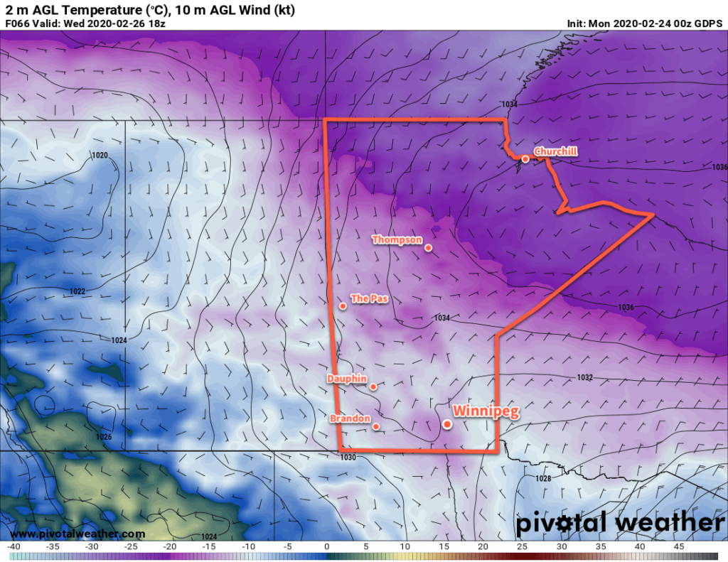
GDPS 2m Temperature Forecast valid 18Z Wednesday February 26, 2020
Cooler temperatures will return to Winnipeg mid-week.

As the high builds in, the region will see variable cloudiness as temperatures head to slightly below-seasonal values. Highs will fall from near -2°C today to -12°C by Wednesday with overnight lows dipping into the -20s midweek. A few flurries will be possible Monday night into Tuesday as the cooler temperatures push into the region.

Winds will be generally light over the coming days. Tuesday will bring comparatively breezy conditions with northwest winds of 20 to 30 km/h. Monday and Wednesday, on the other hand, will see northerly winds up to 15 km/h.

Long Range Outlook

The cooler conditions will be short lived as an upper ridge quickly begins building back into the region. Temperatures will gradually warm through the second half of the week with highs likely reaching back to the 0°C mark by Saturday. The mild weather will persist into next week. No notable snowfall is in the forecast.

Today’s seasonal daytime high in Winnipeg is -6°C while the seasonal overnight low is -17°C.