Hot Summer Weather Continues

A pleasant few summer days lie ahead for Winnipeg with plenty of sunshine and temperatures climbing towards the 30°C mark. A low pressure system passing through on Wednesday will bring breezy winds, muggy conditions, and a chance of showers to the Red River Valley.

Winnipeg will kick off the week with a pristine summer day as a ridge of high pressure moves through the region. Temperatures will climb to a high near 29°C under sunny skies and light winds. The heat will be comfortable thanks to low humidity values. Temperatures will dip to a low near 16°C under mainly clear skies tonight.

Temperatures will climb back towards the 30°C mark in Winnipeg on Tuesday.

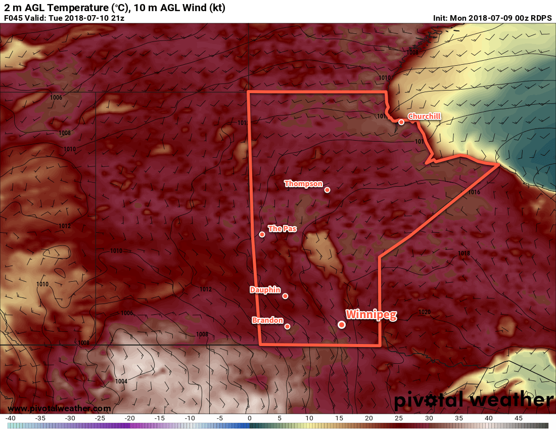
Tuesday will bring partly cloudy skies to the region with a southerly flow redeveloping. There’s a small chance of a shower early in the morning in Winnipeg, but most guidance suggests that the rain will pass to the southwest of the Red River Valley. Otherwise, it will be a warm day with a high near 30°C. Winds will pick up out of the southeast to 20 to 30 km/h.

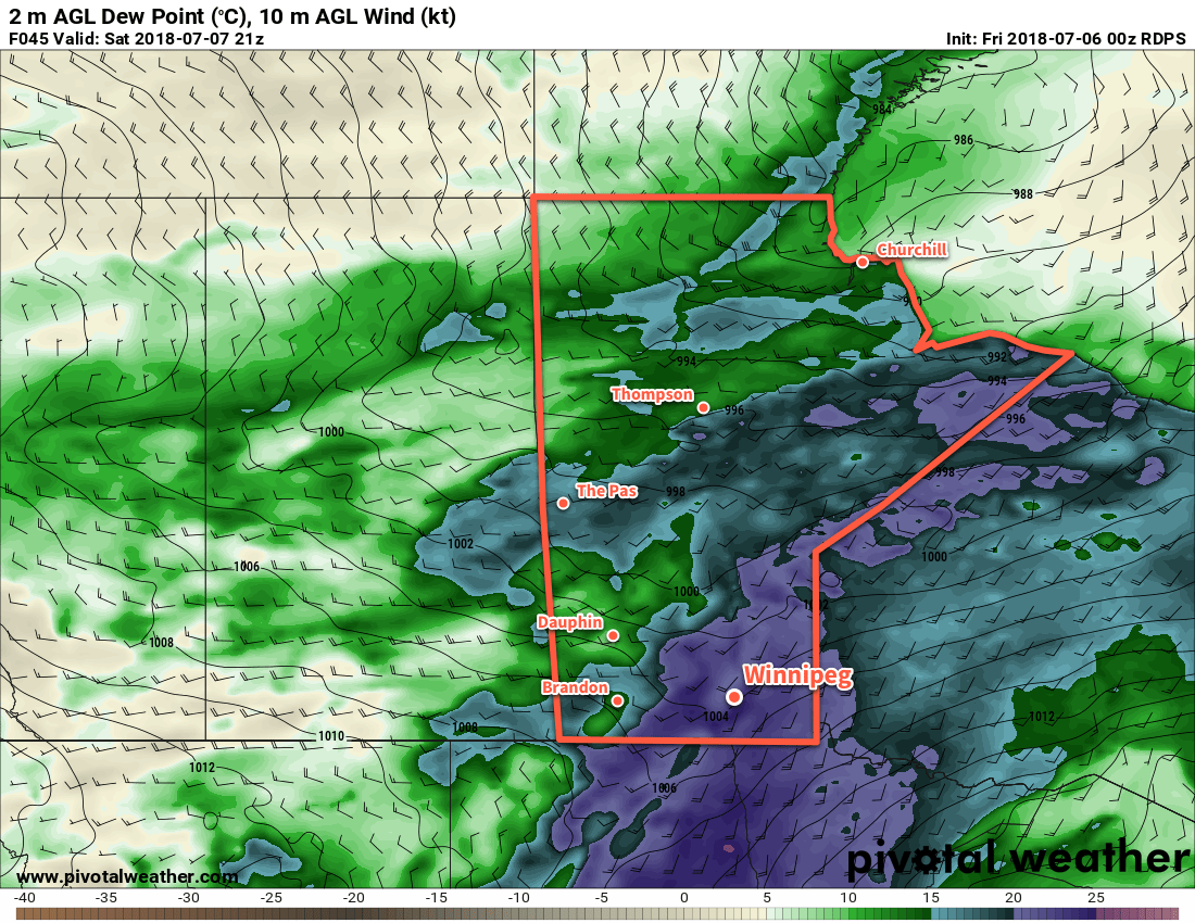
The next low pressure system crossing the Prairies will begin to impact southern Manitoba on Tuesday night. With a chance of showers or thunderstorms, it will spread cloud into southern Manitoba along muggier conditions. Winnipeg will see a mild low near 21°C as winds increase out of the south to 30 to 40 km/h.

Fairly muggy conditions will return to the Red River Valley on Wednesday, however it won’t be as extreme as experienced this past Saturday.

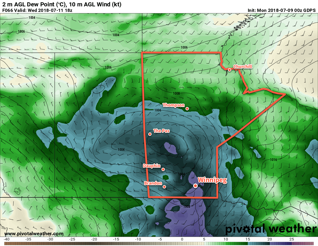
Much of the rain with this low is forecast to spread north of the Red River Valley into the Interlake on Wednesday. That said, Winnipeg and areas south will see a chance of showers on Wednesday morning as a cold front sweeps eastwards through the region. Once it clears midday, the breezy southerly winds will shift to westerly near 30 gusting 50 km/h. Winnipeg will see a high near 30°C again.

Skies should remain clear on Wednesday night with a low near 19°C.

Long Range Outlook

The remainder of the week continues to look warm with highs near 29 or 30°C and comfortable humidity levels. Both Thursday and Friday look to bring mainly sunny skies to Winnipeg.

Unsettled weather is forecast to return Friday night into Saturday as the next low pressure system moves through the region, bringing another chance of thunderstorms to the Red River Valley.

Winnipeg’s seasonal daytime high is currently 26°C while the seasonal overnight low is 13°C.


Sweltering Summer Heat Will Bring Severe Thunderstorm Threat

Winnipeg’s hottest, most humid day of the year is on the way with humidex values forecast to climb over 40 on Saturday. A cold front will push across the province Saturday evening, bringing the risk of severe thunderstorms to the region.

An upper-level ridge building over the Prairies will spread a southerly flow over Manitoba today. Tapping into Gulf of Mexico moisture over the American Plains, this southerly flow will draw very humid conditions northwards into the Red River Valley for Saturday.

Before that happens, though, Winnipeg will see a breezy and warm summer day today. Under sunny skies, temperatures in Winnipeg will climb to a high near 29°C with a southerly wind increasing to around 30 km/h midday then closer to 40 km/h by the evening. Those winds will keep the boundary layer well mixed through the night and keep the overnight low mild; Winnipeg should see a low near 21°C.

An extremely humid air mass will build into southern Manitoba for Saturday.

If you have a sensitivity to heat, then Saturday will be bringing dangerously hot weather into the region. A strong southerly wind near 40 gusting 60 km/h will continue to tap into the humid air mass to the south, pushing dew points into the low 20s across southern Manitoba. The humid weather will combine with daytime highs in the mid-30s – Winnipeg should see a high near 34°C – to produce humidex near or over 40. Humidex values are forecast to be most stressful1 between around 1PM and 8PM.

Skies will remain fairly sunny until a cold front arrives in the afternoon, bringing with it the threat of [severe] thunderstorms. While it’s a bit early to say too much with regard to the overall threat posed to the region, it goes without saying that a cold front pushing through that hot and humid air mass will pose the threat for severe weather. With over 4000 J/kg of MLCAPE forecast alongside 35 to 45 kt of 0-6 km bulk shear, the cold front would favour the development of discrete supercell thunderstorms capable of all modes of severe weather (very large hail, damaging wind gusts, and tornadoes).

The hot and humid weather will create an extremely high energy environment capable of supporting severe thunderstorms.

The biggest unknown at this point is where exactly the thunderstorms will develop. A strong capping inversion should keep things quiet for most of the day, but thunderstorms will likely fire along the cold front early in the evening. Current forecasts place the cold front near or just east of the Red River near 6PM, making the threat conditional for the Red River Valley. Eastwards, towards the Whiteshell and the rest of southeastern Manitoba, the threat will be much greater.

Behind the cold front, westerly winds will begin to ease the humidity as the temperature heads to another mild low near 19°C.

Sunday will bring another sunny day to Winnipeg with northwesterly winds at 20 to 30 km/h and a high near 29°C. The dew point will continue to drop into the low teens, making for a much more comfortable day. Temperatures will drop to a low near 16°C on Sunday night under mainly clear skies.

Long Range Outlook

Next week looks like a prototypical July week: a fair amount of sunshine, plenty of warm days with daytime highs in the upper 20s, mild lows in the upper teens, and a chance for some showers or thunderstorms. The week looks great, but there is a chance that Winnipeg will see thunderstorms late Tuesday through the overnight.

Winnipeg’s seasonal daytime high is currently 26°C while the seasonal overnight low is 13°C.

  1. We identify stressful humidex values as those which exceed the body’s normal temperature of 37°C.


Unsettled Wednesday Gives Way to Sweltering Summer Heat

After an unsettled morning, Winnipeg will see calmer weather and warming temperatures as an upper ridge builds across the Prairies.

Winnipeg will be starting the day with some unsettled weather as a line of thunderstorms moves through the Red River Valley. The stormy weather should clear out a bit later in the morning, leaving behind mostly cloudy skies and humid conditions. Dew points near 20°C will make temperatures in the low 20s feel more like 30 this morning. A cold front will pass through near lunch, bringing westerly winds to around 30 km/h. Along with the wind, markedly drier air will move into the the Red River Valley. Thanks to that, Winnipeg’s high near 25°C should feel comfortable by mid-afternoon. Under clear skies and a light west wind, Winnipeg will head to a low near 15°C tonight.

Conditions will settle quickly in the wake of Wednesday’s cold front. Hot on its heels, an upper-level ridge will begin building into the Prairies and bring sunny skies and increasingly warm weather. Winnipeg will see mainly sunny skies on Thursday with a seasonal high near 25°C. Winds will remain out of the northwest at around 20 km/h.

A ridge of high pressure will move through on Thursday night, bringing light winds, clear skies, and a low near 15°C.

An upper-level ridge will begin building across the Prairies on Friday.

Friday will mark the start of the warm-up as a southerly return flow develops behind the high. Winds will be light out of the south with sunny skies and a high near 27°C with comfortable humidity. Warmer air will continue to build into the region on Friday night, resulting in a mild low near 19°C.

Long Range Outlook

The weekend will be a scorcher as heat and humidity surge northwards into the region. Saturday will see temperatures climb into the low 30’s with dew points climbing into the upper teens. Humidex values on Saturday will climb towards 40. With all the heat and humidity, it does look like there will be a chance for thunderstorms. A “cool” front sweeping across the province on Saturday evening will bring the threat of severe weather back to Winnipeg. Sunday will still be warm with a high of 28 or 29°C, but the humidity will be much lower making for a comfortable summer day.

The warm weather will continue into next week with daytime highs expected to remain in the upper 20s with overnight lows near 18 or 19°C.

Winnipeg’s seasonal daytime high is currently 25°C while the seasonal overnight low is 13°C.


Summer Heat On The Way

Winnipeg will see temperatures in the upper 20’s for much of the week as the season’s first humid spell builds into the region.

Temperatures will be hot in Winnipeg over the next three days. Daytime highs near 29°C will be in place through Wednesday and are about 7-8°C above seasonal. Overnight lows will rise dramatically over the next few days as southerly winds bring humidity northwards into the province.

This increase in humidity will be one of the most significant changes this week. For the past several weeks, dew point temperatures have remained at relatively low values. This week, dew points are forecast to rise into the low teens on Tuesday, then further into the upper-teens on Thursday. This will be the first occurrence of relatively humid conditions this year.

RDPS 2m Temperature Forecast valid 21Z Tuesday May 22, 2018
Temperatures across southern Manitoba will climb towards 30°C on Tuesday afternoon.

Besides warm, the next few days will be pleasant. Winds will be a bit breezy out of the south today at 20 to 30 km/h, then will ease to the 10 to 20 km/h range for Tuesday and Wednesday. Winnipeg will see sunny skies today, but the region will see a bit more cloud with mixed skies on Tuesday. On Wednesday, Winnipeg should see partly cloudy skies. The southern Red River Valley will see more cloud as it spreads out of North Dakota ahead of a low pressure system moving towards the region.

Long Range Outlook

More extensive cloud cover will build into the Red River Valley on Thursday as a low pressure system moves into the region. This disturbance will bring a good chance of showers or thunderstorms Thursday night through Friday. A cold front looks to sweep through late Friday, beginning to clear the cloud and humidity out of the region.

The weekend is looking pretty great with seasonably warm highs in the mid- to upper-20’s and plenty of sunshine.

Winnipeg’s seasonal daytime high is currently 21°C while the seasonal overnight low is 7°C.