Cloudy Skies, Seasonal Temperatures, More Thunderstorms?

Plenty more cloud cover lies ahead for Winnipeg this weekend as another warm front lifts northwards into the province and brings another round of showers and thunderstorms.

Winnipeg will see a bit of sunshine today with some breaks in the clouds expected throughout the day. Daytime highs will climb to a near-seasonal 19°C with light winds courtesy a ridge of high pressure moving through. Winnipeg will see a chance of showers later today as a weak upper-level disturbance rolls through. Temperatures will dip to a low near 8°C tonight with mixed skies continuing through the night.

On Saturday, a low pressure system over North Dakota will slowly lift a warm front north into the province. While Winnipeg may see a bit of sunshine in the morning, skies will cloud over through the day. Winds will be out of the northeast at 10 to 20 km/h. The cooler northeast winds will keep highs near-seasonal despite the advancing warm air.

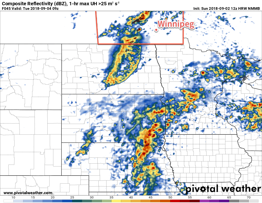
Thunderstorm Threat Returns to Southern Manitoba Saturday Night

On Saturday night, a low pressure system will begin its trek from southwestern North Dakota towards Lake of the Woods. As it lifts northeastwards, elevated convection will once again fire north of the warm front, spreading showers and thunderstorms through a portion of southern Manitoba. This instability will persist into Sunday with the potential for showers and thunderstorms continuing through much of the day.

Given elevated convection 36+ hours out, there’s still a lot of the details that remain unclear. Early indications are that another round of severe thunderstorms will be possible; guidance suggests a fair amount of instability and strong shear to help the elevated convection organize. Right now it looks most likely over the southern Red River Valley into southeastern Manitoba. It’s early, though, and that could easily shift over the coming days. We’ll be keeping an eye on it. Given the extensive cloud cover and proximity of the warm front, Saturday night will remain mild with a low near 14°C in Winnipeg.

Forecast MUCAPE values reveal the substantial instability forecast to develop over southern Mantioba as a warm front lifts north on Saturday night.

The instability continues through Sunday with a chance of showers or thunderstorms for Winnipeg. It won’t be an all-out rainy day and most of the precipitation should end up north of the city. Winds will be out of the northeast at 15-20 km/h for much of the day. As the low passes in the afternoon, winds will shift northerly to 30 gusting 50 km/h. Temperatures should reach a high near 18°C, but much warmer temperatures will be in place just to the southeast on the other side of the warm front where highs near 30°C are possible, so areas closer to the US border, particularly southeast of Winnipeg, will see much warmer highs. Given the large change in temperatures across the front, if its position ends up a bit further north then Winnipeg could see a much warmer high.1

While Winnipeg will see near-seasonal temperatures on Sunday, it may end up being a scorcher over southeastern Manitoba.

The cloud cover will remain as the precipitation moves off to the east on Sunday night. Temperatures will dip to a low near 9°C as cooler air pushes south behind the low.

Long Range Outlook

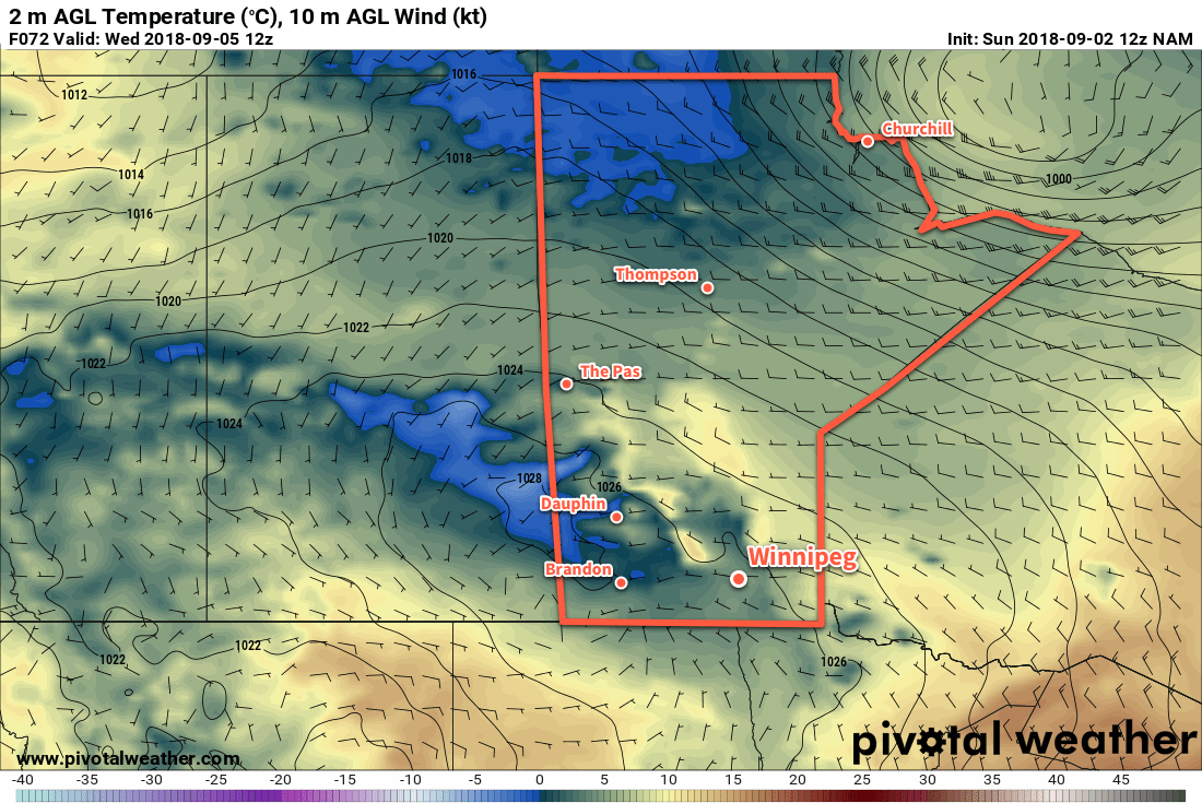
Monday will bring more cloud to Winnipeg with a slight chance of showers as a weak low pressure system moves through the region. Temperatures will be much cooler with a high in the low to mid-teens. The remainder of the week will bring mixed to cloudy skies and seasonal to slightly below-seasonal temperatures. Another batch of rain looks possible in the second half of the week. After a dry first two thirds of the year, it seems like Winnipeg may finally be beginning to catch up on its precipitation deficit!

Winnipeg’s seasonal daytime high is currently 18°C while the seasonal overnight low is 6°C.

  1. That said, it’s not particularly common for warm air to push further north than expected at this time of year.

Humid Conditions Return Tuesday Alongside Unsettled Weather

After a warm and dry Monday, humid and unsettled conditions will redevelop for Tuesday.

The week will start off with pleasant weather as a ridge of high pressure moves through the region. Temperatures will climb to a high near 24°C under sunny skies with westerly winds of 15 to 25 km/h. Winds will diminish to light this evening. Temperatures in Winnipeg will head towards a low near 14°C tonight with increasing cloud cover. Winds will increase out of the south to 20-30 km/h after midnight.

A low pressure system pushing across the province will be the driving force for the weather on Tuesday. A warm front pushing through the region will spread a chance for showers or thunderstorms into the region in the morning. After this initial wave of instability, skies will remain mostly cloudy as temperatures climb to a high near 24°C. Humidity will be noticeable by midday as a southerly wind of 30 gusting 50 km/h spreads Gulf of Mexico moisture back into the region.

The chance for thunderstorms will redevelop in the afternoon as a cold front pushes southeastwards through the Red River Valley. These thunderstorms will be strong to severe with threats of large hail and damaging winds. There’s some uncertainty at this point on the exact positioning of the front, so there is a chance that the thunderstorm activity doesn’t trigger until the front is southeast of Winnipeg. We’ll be keeping an eye on it and post an update if needed on Tuesday.

Humid conditiosn will spread back across the Red River Valley and southastern Manitoba on Tuesday

After the cold front moves through, skies will clear with winds shifting to northwesterly and gradually diminishing. Winnipeg should see a low near 8°C on Tuesday night.

Wednesday will be a much cooler day with northeasterly winds near 20 km/h and a high near 18°C. After a sunny start, Winnipeg will see increasing cloud as it spreads northwards from a disturbance organizing in the Northern Plains of the US. Skies will remain cloudy for Wednesday night with a chance of showers as temperatures head to a low near 14°C.

Long Range Outlook

There seems to be some uncertainty with exactly what will develop south of the border and how it will evolve over time. It seems likely that through the latter half of the week, the Red River Valley will see variable cloudiness with near-seasonal temperatures and light winds. The odd chance for some rain seems likely, although much of the activity could remain east of the Red River Valley.

Winnipeg’s seasonal daytime high is currently 19°C while the seasonal overnight low is 7°C.

Warm, Unsettled Weather on the Way

Winnipeg will see a mild but unsettled weekend as a slow-moving low pressure system works through the region.

Mixed skies will be in place over the Red River Valley today as a warm front approaches from the southwest. Winnipeg will see a seasonal high near 22°C with dry conditions. Areas over the southern RRV, though, may see scattered showers develop later this afternoon into the evening. Winds will increase from 10 to 20 km/h in Winnipeg to closer to 30 km/h near the US border. Temperatures will remain seasonably mild tonight with a low in Winnipeg near 14°C. An approaching warm front will sustain southeasterly winds at 20 to 30 km/h as well as bring increasing cloud cover. By early Saturday morning, showers and/or thundershowers will be in place across much of the Red River Valley.

The showers will stick around through the first half of Saturday morning, then push off to the east. In their wake, Winnipeg will continue to see mixed to mainly cloudy skies with moderate southerly winds increasing to 40 gusting 60 km/h. Despite the cloud, temperatures should climb to a high near 25°C in Winnipeg. Heading into Saturday night, the remainder of the warm front will push through, bringing more cloud and another chance of [thunder]showers to the Red River Valley. Temperatures will dip to a low near 16°C with breezy winds persisting right into early Sunday morning.

A band of [thunder]showers will spread eastwards acoss southern Manitoba on Friday night into Saturday morning.
After those showers clear out early Sunday morning, Winnipeg will see a relatively pleasant day. Mixed skies will continue, but winds will ease into the 20 to 30 km/h range as temperatures climb to a high near 27°C. A cold front will push through on Sunday evening, bringing with it a good chance of showers or thunderstorms. There may even be a low chance of scattered strong to severe thunderstorms along the front as it moves through. The region will finally see some marked clearing on Sunday night as winds ease and temperatures head to a low near 13°C.

Long Range Outlook

Winnipeg will see a return to seasonal temperatures and settled conditions on Monday. It will be short-lived though; most long-range forecasts show the return of unsettled conditions by Wednesday. Winnipeg looks to see several chances for rain through the second half of next week. While a stretch of cloudy weather won’t be what most people would like, numerous chances for some rain sounds quite nice to my increasingly parched lawn!

Winnipeg’s seasonal daytime high is currently 20°C while the seasonal overnight low is 8°C.

Warm Weather Brings Chance of Thunderstorms

Temperatures will climb well above-seasonal in Winnipeg today, but a cold front moving through tonight will bring a chance of thunderstorms to the region.

An approaching low pressure system will bring seasonably warm temperatures and breezy conditions to Winnipeg today. Under mainly sunny skies, temperatures will climb to a high near 27°C as winds pick up out of the south to 30-40 km/h. Those breezy winds will persist into the evening as the low continues to advance into the province. In the latter half of the night, the chance for showers or thunderstorms will increase as a cold front pushes into the Red River Valley. With the cold front not arriving until early Tuesday morning and the southerly winds continuing for much of the night, temperatures will remain mild in the Red River Valley. Winnipeg will see a low near 17°C.

The best chance for showers or thunderstorms will occur early Tuesday morning as the cold front pushes through the Red River Valley. There’s a chance that some of these thunderstorms will be strong, although severe looks unlikely at this point. This system will bring the potential for severe thunderstorms, but the most likely areas will be southwestern Manitoba earlier in the night, then shifting southwards into North Dakota.

A cold front pushing through the Red River Valley early Tuesday morning may bring strong thunderstorms to the region

After the cold front passes mid-morning, northwesterly winds near 30 gusting 50 km/h will move into the Red River Valley. These winds will usher in a much cooler air mass; Winnipeg will see a near-seasonal high near 21°C. On the bright side, though, the cloud cover will clear out of the region, leaving Winnipeg with mainly sunny skies for much of the day.

A ridge of high pressure will push into the province on Tuesday night, easing the winds but bringing very cool overnight lows. Winnipeg will likely see a low near 4°C, but southwestern Manitoba will likely see a widespread area of lows in the -1 to +2°C range. The chance for patchy frost can’t be dismissed for the Red River Valley, particularly in the southeastern portions.

NAM Forecast 2m Temperature valid 12Z Wednesday September 5, 2018
Portions of southern Manitoba will see very cool low temperatures on Wednesday morning with frost likely over portions of western Manitoba into central Saskatchewan.

Wednesday will bring near-seasonal conditions with a high near 20°C in Winnipeg. Winds will remain light and the region will see plenty of sunshine. The coldest air will shift off to the east through the day which will allow overnight lows to remain a bit higher on Wednesday night. Winnipeg should see a low near 5 or 6°C.

Long Range Outlook

The remainder of the week looks quite pleasant with daytime highs returning to the low to mid-twenties and overnight lows climbing back into the low teens. Winnipeg will see a fair amount of sunshine right through to the weekend with dry conditions continuing.

Winnipeg’s seasonal daytime high is currently 21°C while the seasonal overnight low is 8°C.