Cloudier Conditions Follow A Sunny & Warm Monday

Winnipeg has seen an abundance of sunshine lately, but it comes to an end on Tuesday as extensive cloud cover moves into the region ahead of a low pressure system that will bring unsettled weather to the region.

Before the cloud moves into the region, Winnipeg will get another beautiful day today with plenty of sunshine and highs approaching the 30°C mark. Winds will remain light through the day and the humidity will still be quite comfortable. All in all a great summer day.

RDPS 2m Temperature forecast valid 21Z Monday August 14, 2017
Highs across much of Manitoba will climb into the upper 20’s or low 30’s on Monday.

Clouds will move in on Monday night as temperatures dip to a low near 15°C and the winds become light out of the south.

Tuesday will bring mostly cloudy skies to Winnipeg with winds picking up out of the south to 20-30 km/h. Scattered showers or thunderstorms are likely over the southwest corner of the province, but things should stay dry in the Red River Valley. Expect cloudy skies on Tuesday night with a low near 17°C and a slight chance of showers.

RDPS 12hr. Precipitation Totals valid 00Z Wednesday August 16, 2017
An area of showers and/or thunderstorms will move into southwestern Manitoba on Tuesday evening.

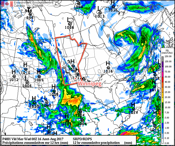
Wednesday will bring slightly cooler temperatures to Winnipeg as highs reach just around 23°C under cloudy skies. There will be a good chance of showers, particularly through the morning hours. Winds will be out of the east at around 15-25 km/h. Conditions will slowly settle through the afternoon and there may even be a few sunny breaks. Expect the clouds to clear out on Wednesday night as temperatures dip to a low near 15°C.

Long Range

Once this system moves out, it looks like another long stretch of warm and dry conditions. Thursday through next Tuesday looks warm with highs around the 27 or 28°C mark with plenty of sunshine. A couple disturbances will move through over those days and bring a low chance for some thunderstorms, but at this point models disagree significantly on their placement and how much, if anything, they’ll be able to produce. We’ll be keeping an eye on it and have more details in Wednesday’s forecast post.

Winnipeg’s seasonal daytime high is currently 25°C while the seasonal overnight low is 12°C.

Showers And Thunderstorms Today, Then Beautiful Weather Ahead

A disturbance moving through Southern Manitoba today is bringing showers and thunderstorms across many areas this morning, and will be the focus for the redevelopment of more significant thunderstorm activity this afternoon. Once the disturbance leaves the region tonight, it’s nothing but beautiful weather ahead for Winnipeg & the Red River Valley.

A frontal wave collapsing southwards through the region is bringing scattered showers and thunderstorms to the region this morning, and will continue to for much of the day. The focus for most of the thunderstorm activity will be a shortwave spinning up along the international border. This feature will support an area of slow-moving thunderstorms this afternoon; these storms will potentially be capable of producing significant rainfall totals due to their slow speed.1 Where exactly these thunderstorms develop will depend exactly on the track o the shortwave; at this point though it looks like the most likely area is south of the Trans-Canada Highway between Pilot Mound and Emerson.

PASPC Day 1 Thunderstorm Outlook valid 1PM CDT August 9, 2017 to 7AM CDT August 10, 2017

Other than the rain, today will see temperatures climbing to a below-seasonal high near 20°C with winds out of the northeast at 20 gusting to 40 km/h.

The showers and thunderstorms will head out of the province to the southeast later this afternoon into the evening. Skies will clear as temperatures head to a low near 10°C with light winds.

Thursday and Friday will bring pleasant weather back to the region with plenty of sunshine, highs near 25 or 26°C, and lighter winds. Expect a low near 11°C on Thursday night and near 14°C on Friday night.

Long Range

Looking further ahead, the general trend will be for the upper-ridge over B.C. to gradually work its way eastwards, bringing mild and dry weather to the region. Expect to see seasonal to above-seasonal temperature build in through the weekend with the potential for more humid weather to arrive next week. It also looks fairly dry precipitation-wise with little chance of rain until the latter half of next week.

So make it through today and there’s plenty more sunshine and summer warmth to enjoy ahead!

Winnipeg’s seasonal daytime high is currently 26°C while the seasonal overnight low is 12°C.

  1. Anywhere from 25 – 75 mm seems possible with today’s thunderstorms.

Mild Monday Followed by A Cold Front & Chance of Showers

Mild weather returns to Winnipeg and the Red River Valley today thanks to a warm front that moved through the region overnight. It will be short-lived, however, as a cold front sweeps through on Monday night, bringing with it a chance of showers and a return to below-seasonal temperatures.

Today will be a very pleasant day across the Red River Valley as a sunny start to the day sends temperatures climbing towards a high near 27°C. A cold front slowly pushing southwards will start spreading cloud into the region from the north for mixed skies this afternoon and then clouding over this evening. Winds will pick up out of the west around 20 km/h.

Tonight will bring a chance of showers with the risk of isolated thunderstorms to Winnipeg & area as temperatures dip to a low near 14 or 15°C.

A cold front will be slumping southwards across the Prairies this afternoon.

Tuesday will bring mixed to cloudy skies to the region as the cold front swings through, with a continued low chance of showers. Temperatures will be much cooler with a high of just near 22°C as winds shift to northerly at 10-20 km/h. Temperatures will then drop towards a low near 12°C under cloudy skies on Tuesday night with a continued low chance of showers.

Things will finally clear out on Wednesday as the front pushes off to the southeast. Expect temperatures to reach a high near 24°C with a low near 12°C on Wednesday night.

Long Range

It appears that things will settle down again with near-seasonal temperatures for the remainder of the week into the weekend as a very broad area of high pressure moves through the Prairies.

Winnipeg’s seasonal daytime high is currently 26°C while the seasonal overnight low is 13°C.

Cooler Weather Arrives

A big change is on the way for Winnipeg and the Red River Valley; after a stretch of hot and humid weather, the jet stream is plunging southwards and will spread significantly cooler conditions across the southern Prairies.

Today’s weather will be dominated by an upper-level low tracking into North Dakota, shunting the jet stream further south and bringing cooler air into the region. Here in Winnipeg, temperatures will climb to around 21°C this afternoon — some 5°C below normal — with northerly winds at around 15-20 km/h. We may see a few showers in the morning, but most of the day should be cloudy with no rain. Skies will clear out late tonight into the early morning hours of Thursday as temperatures dip to a low near 11°C.

This height anomaly map of the upper atmosphere shows how the jet stream will dive southwards, bringing cooler temperatures to southern Manitoba.

Thursday will bring clearing skies as a broad ridge of high pressure builds into the region. Winds will remain light, and with a bit of sunshine highs should be a little higher than Wednesday at around 24°C. There will be a very slight chance of an isolated shower developing along lake-breeze boundaries in the Interlake and drifting south towards Winnipeg in the late-afternoon, but that the chance is low. Skies will be clear Thursday night with a low near 11 or 12°C once again.

Friday will be more of the same; light northwesterly winds under partly cloudy skies with a high near 24°C. Temperatures will dip down to a low near 13°C on Friday night.

Long Range

Saturday will continue the cooler conditions with a high in the low 20’s, but a passing disturbance will bring a slight chance of some scattered showers or thunderstorms. The remainder of the weekend into next week will bring seasonal to slightly below-seasonal temperatures with mixed skies and occasional chances for showers.

Winnipeg’s seasonal daytime high is currently 26°C while the seasonal overnight low is 13°C.