This week will start out on a cooler and more unsettled note, but then conditions will begin to change. Hot weather looks set to return before the weekend.
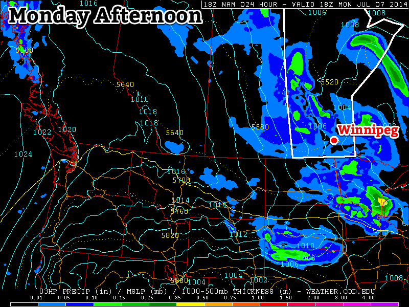
Monday
Today will be quite unsettled, with a good chance of showers and thundershowers. Skies will start out mainly sunny in the morning, but daytime heating will quickly cause the atmosphere to become unstable, allowing widespread convective precipitation to develop. For the most part the precipitation will be in the form of showers, but there will likely be some thunder in lightning in some of the cells as well. Some small hail could even occur in some of the stronger cells. This activity will die off in the evening, with little rain expected overnight. High temperatures today will be in the low to mid twenties with a breezy north-west wind.
Tuesday
We may see some more shower activity on Tuesday, but it will be less widespread than Monday. Most areas will see a mix of sun and cloud through the day, with temperatures in the low, or maybe mid, twenties. The wind will once again be breezy and from the north-west.
Wednesday
Wednesday looks like quite a nice day in southern Manitoba. The heat will begin to return, with high temperature climbing up into the mid and upper twenties. Skies should remain mostly sunny, though the odd pop-up shower can’t be ruled out. The wind should be fairly light, with the direction being somewhat variable as we’ll be under the eastern edge of a high pressure ridge.
Long Range
The current long-range forecast looks good for those that like the heat! Models suggest that hot weather will continue from late this week into next weekend. We’ll likely see humidity gradually build late in the week as well. We may even see another risk of strong storms at some point once that humidity starts to return, but it’s too early to say if and when that might occur.