Mild spring temperatures will stick around for the weekend in Winnipeg, but unsettled conditions will bring a couple chances for [thunder]showers.
A low pressure system over northern Manitoba will bring moderate westerly winds to the Winnipeg area today. Winds will strengthen up to 40 gusting 60 km/h today as temperatures climb to a high in the low 20s. An upper trough will swing into the region from the west later in the day and support an area of [thunder]showers.
With weak instability, severe weather is unlikely. Scattered showers with risk of a thundershower will likely develop late this afternoon over the southwest corner of the province and move across the Red River Valley this evening. Much of the activity will taper off on Saturday night, but a chance of showers will persist to Saturday morning. Temperatures will dip down to a low near 10 °C overnight with diminishing winds.
Skies will clear on Saturday as a ridge of high pressure moves into the region. With lighter winds, temperature swill climb back to a high in the low to mid-20s. The quiet, calm weather will be short-lived as another disturbance moves towards the region on Saturday night. A low pressure system tracking along the international border will begin to spread cloud into southern Manitoba later in the night. Otherwise, it should be an uneventful night with a low once again near 10 °C.
As the low tracks across the region on Sunday, it will spread showers and thunderstorms with it. Much of southern Manitoba will see cloudier conditions on Sunday with a good chance of rain. Temperatures will be mild, though, with highs steady in the low to mid-20s. Many areas could receive another 5 to 15 mm of rain through the day.
The showers taper off on Sunday night as the low tracks into Ontario. Light northerly winds will develop behind this system with temperatures dipping to a low in the low teens.
Long Range Outlook
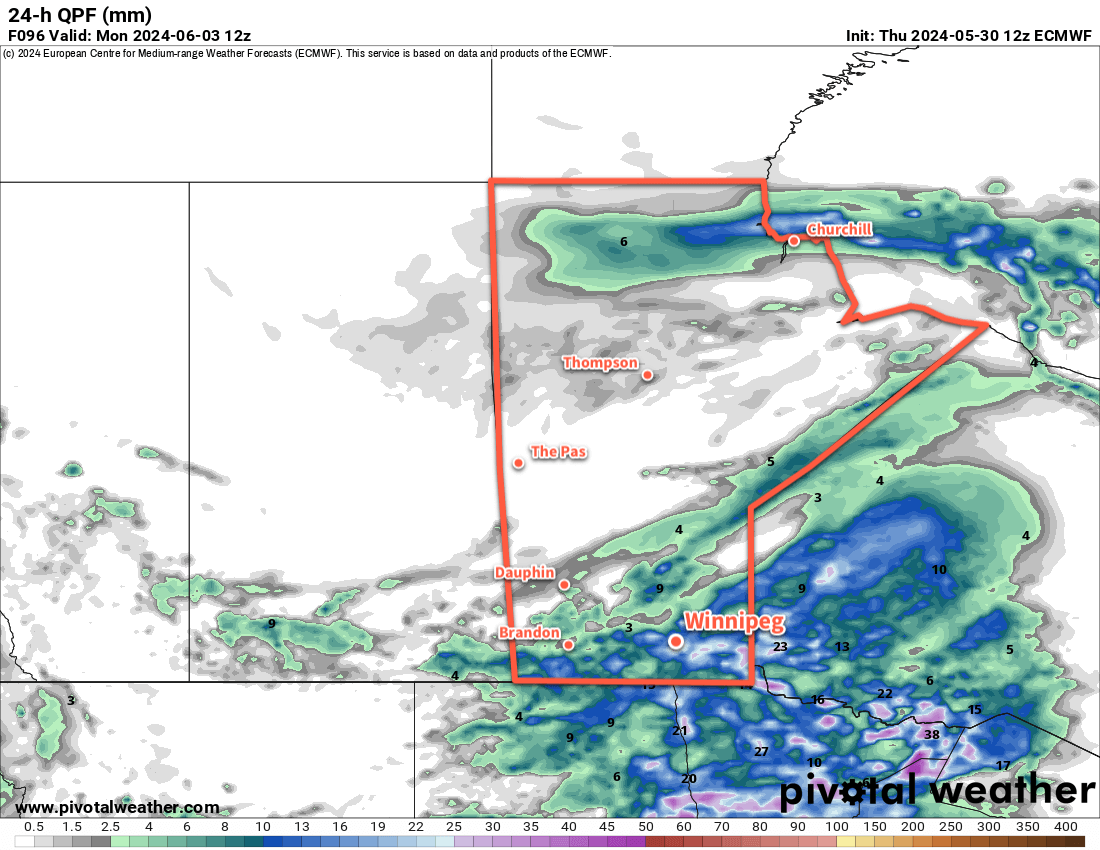
Next week will start with a flip back to sunnier skies, but another notable low is forecast to move into the region for Tuesday. This system could bring waves of rain to the region through Wednesday with a risk of thunderstorms. Rainfall totals will have significant variability with this system, but early indications are that localized accumulations as high as 30 to 60 mm of rain may be possible across southern Manitoba.
The wet weather will come to an end for Thursday as a high builds into the region and brings sunnier conditions into next weekend.
Today’s seasonal daytime high in Winnipeg is 22 °C while the seasonal overnight low is 8 °C.