Unsettled Tuesday Brings A Break From The Heat

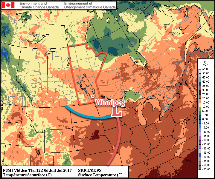
Today will be another warm day in Winnipeg, but unsettled weather is on the way for Tuesday as showers and thunderstorms roll through the region, ushering in cooler weather for mid-week. It’s a short break, though, as temperatures will climb back into the upper 20’s and low 30’s for the end of the week into the weekend.

Another great summer day is on tap for Winnipeg today as some mixed skies in the morning gives way to a bit more sunshine for the afternoon. Temperatures will be warm with highs up around 29°C, but a light northwest wind to around 20-25 km/h will help out with that a little bit. Heading into the evening, things begin to get interesting.

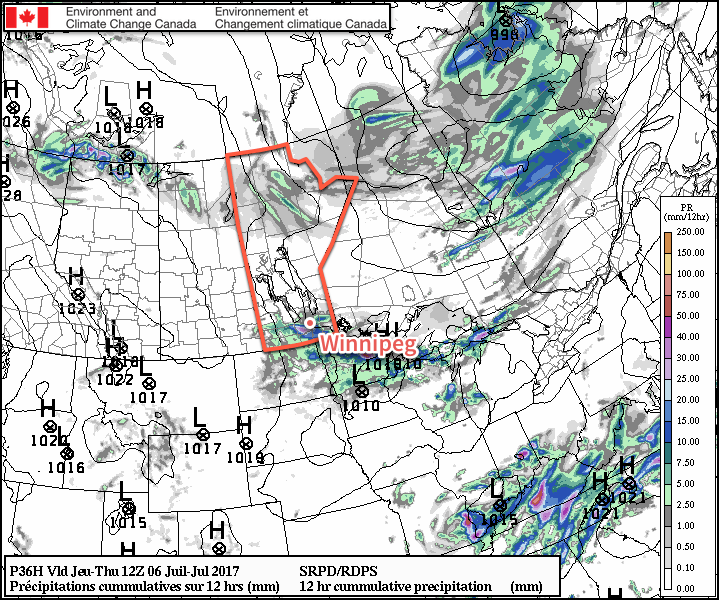
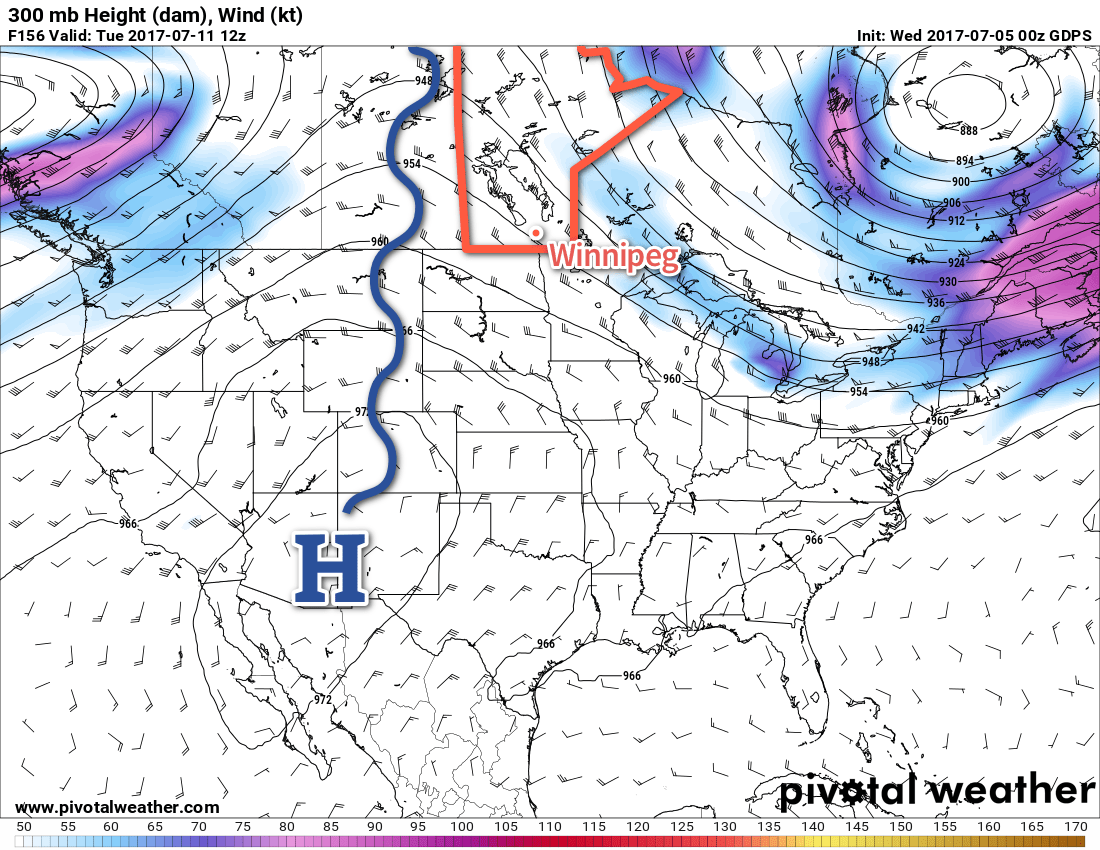
Showers and thunderstorms will spread into western Manitoba this evening, triggered by a low pressure system moving across Saskatchewan. For portions of Parkland and Southwestern Manitoba, some of these storms may still be severe as they cross the border posing threats of large hail and strong winds. While tornadoes are possible on the Saskatchewan side of the border, it’s unlikely that they’ll be a significant threat by the time the thunderstorms move into Manitoba.

PASPC Thunderstorm Outlook valid 12PM Monday July 7 to 6AM Tuesday July 11, 2107

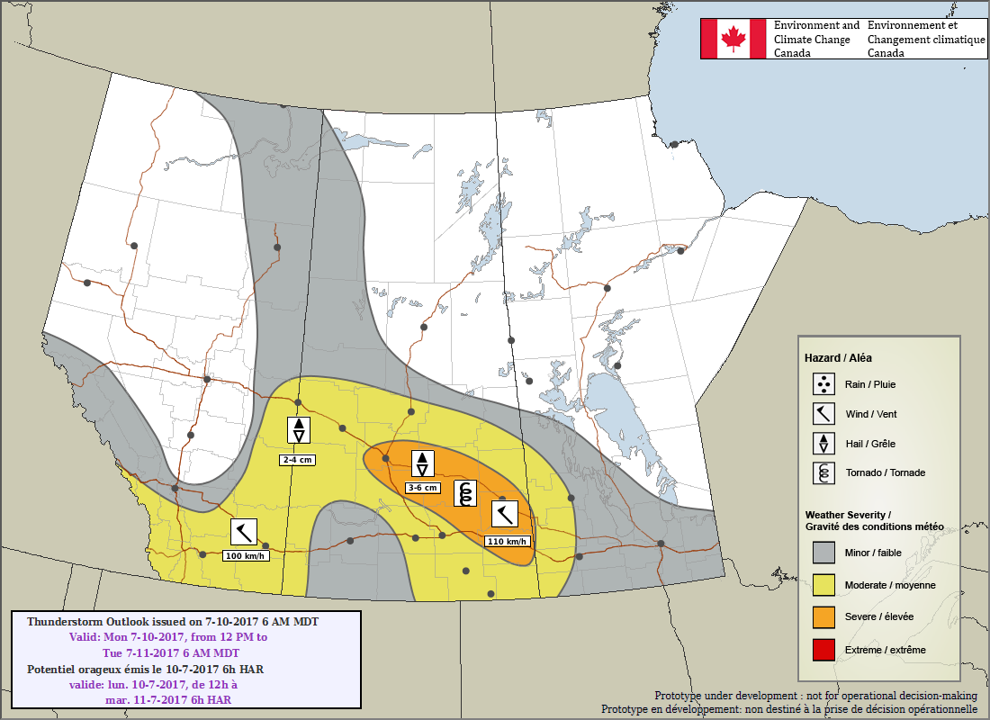
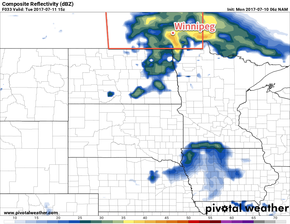
These storms will continue east-southeastwards all night, gradually weakening as they do so. They activity should reach the Red River Valley sometime between 3-6AM and while an impressive light show is likely, no severe weather is expected here.

Tuesday will continue unsettled, however there’s uncertainty as to the extent. The setup for showers or thunderstorms will be good; a low pressure system tracking east-southeast will have a warm front laid out west-to-east across the southern portion of the province, likely being a focus for further surface-based thunderstorm development (which would likely be south of Winnipeg), or elevated thunderstorm development (which would likely impact the city). It seems likely that there will be showers and/or thunderstorms throughout the region on Tuesday, but it’s just too early to say where exactly they’ll set up. Otherwise, expect mostly cloudy skies and a high near 21°C. Skies will continue cloudy on Tuesday night as temperatures drop to a low near 14°C with a continued chance of showers.

NAM forecast of simulated reflectivity valid  mid-morning on Tuesday July 11, 2017
NAM forecast of simulated reflectivity valid mid-morning on Tuesday July 11, 2017

Wednesday will be cloudy and cooler, but more settled as a trough of low pressure remains in place over the region. Temperatures will reach a high near 21°C with some sunny breaks in the late afternoon or evening before dropping to a low near 15°C on Wednesday night. Some additional showers or thunderstorms may materialize as an upper-level disturbance moves through the region overnight.

Long Range

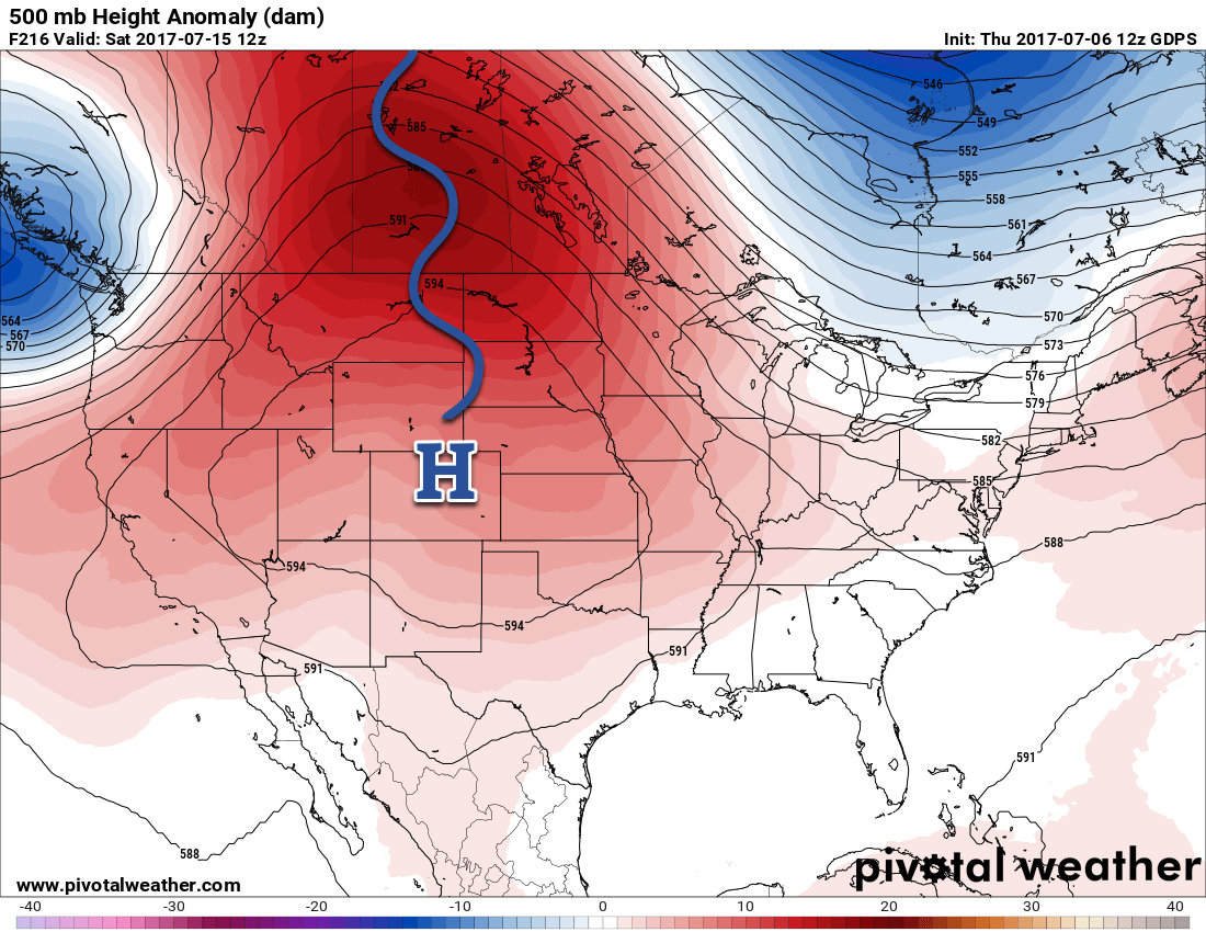
The cool weather won’t last long; the heat begins to return on Thursday with seasonal temperatures building back into the region. A low passing to our northeast on Friday will bring warmer temperatures back into the region that will persist through next week. The weekend looks dry, but next week may bring a couple chances for thunderstorms amid the heat.

Winnipeg’s seasonal daytime high is currently 26°C while the seasonal overnight low is 13°C.

The Average of the Extremes Made June A Near-Seasonal Month

June 2017 started off with exceptional warmth as daily mean temperatures1 climbed 5-10°C above normal, a sharp break from a cool end to the month of May. Temperatures peaked on June 2nd when two new records were set in Winnipeg:

  • Record daily maximum of 34.5°C, breaking the old record of 32.2°C set on June 2, 1948.
  • Record warm daily minimum of 17.6°C, breaking the old record of 17.5°C set in June 2, 1988.

The warmth continued with above-seasonal temperatures gradually trending towards seasonal values by mid-June.

A significant pattern shift occurred on June 15th, shifting Winnipeg into a prolonged period of below-normal temperatures that would end up lasting the remainder of the month. Temperatures bottomed out on June 24th when Winnipeg set a new record:

  • Record cold daily maximum temperature of 12.6°C, breaking the old record of 13.9°C set in 2004.

Temperatures then moderated to near-normal for the last few days of the month.

From record-setting warmth at the beginning of the month to record-setting cold at the end of the month, June 2017 averaged out to near-normal with a monthly mean temperature of 16.7°C, which was just -0.3°C below the normal monthly mean of 17.0°C. Perhaps a notable example of how the mean can be misleading.

In other temperature statistics:

  • June 2017’s average high temperature was 23.1°C, just -0.2°C below the 30-year average of 19.2°C.
  • June 2017’s average low was 10.2°C, -0.4°C below the 30-year average of 10.7°C.

Perhaps Not As Wet As You Think

Many people think of rain when they think of June, and it certainly had its fair share of precipitation with accumulating rainfall measured on 14 of 30 days, largely clustered between June 9th and 25th where there was measurable rainfall on 12 of 17 days.

While it rained frequently, total rainfall was actually below normal. The Winnipeg airport measured a total of 51.5 mm of rain through June 2017, well below the normal of 90.0 mm. So despite seeing many damp days, Winnipeg ended up with only 57% of the normal rainfall for the month.


So in the end, June 2017 was not quite what it seemed. Despite a mean monthly temperature near-normal, it was actually a month that progressed from record warmth in the first half to record cold in the second half. Despite raining almost half the days of the month, it ended up with just over half of the normal rain accumulation.

June 2017 Temperature Summary – Winnipeg, MB

July is off to a much more consistent start with seasonal to slightly above seasonal temperatures and dry conditions. We’ll be keeping track of how the rest of the month progresses!

With regard to climatological normals in this post, we are using the 1981-2010 Climatological Normals for the Winnipeg International Airport.


  1. The daily mean temperature is the average of the daily maximum temperature and daily minimum temperature. 

Beautiful Summer Weekend Ahead

Get the sunscreen & shorts out, there’s a beautiful summer weekend ahead for Winnipeg & the Red River Valley.

Today will be a beautiful mostly sunny day…after a weak disturbance tracking through the region overnight clears out early this morning, likely bringing some showers or thundershowers through the city with it. In its wake, skies will clear as temperatures head to a high near 25°C with light winds out of the northwest. Not much to say about today; it’s going to be a nice one!

Tonight will bring clear skies to the region with a low near 15°C and light winds the shift to southerly through the early evening as a weak warm front moves through.

If there was little to say about today, Saturday has even less. Temperatures will climb to a high near 28°C under clear skies. Winds will back to the northwest midday and increase to 15-25 km/h for the afternoon as a weak trough swings through the Red River Valley. Expect a low near 14°C on Saturday night with light winds and partly cloudy skies.

Sunday will bring a few more clouds to the region as a disturbance moves through North Dakota, but it appears conditions will be dry for Winnipeg & much of the Valley. A few showers or thunderstorms will be likely Saturday night into Sunday morning over the southwestern corner of the province and some of this activity could creep into the southwestern Red River Valley early Sunday, but it seems unlikely at this point. Temperatures will remain warm with highs once again near 28°C with light winds.

Skies will clear for Sunday night with temperatures heading to a low near 15°C.

Long Range

As we’ve been advertising all week, it continues to look like next week will be a warm one. A warm and sunny start to the week will then see a disturbance moves through the Prairies on Tuesday and Wednesday. Behind that system, the upper-level ridge responsible for the warm, dry weather will rebound and strengthen as it shifts eastwards from the western Prairies.

A potent upper-level ridge is forecast to develop over the Prairies in the latter half of next week.
As the upper ridge shifts eastwards, it will spread even more intense warmth into southern Manitoba. Current indications show the latter half of the week seeing daytime highs in the low 30’s and overnight lows near 20°C.

Winnipeg’s seasonal daytime high is currently 26°C while the seasonal overnight low is 13°C.

Cover photo by Flash Bros

Beautiful Summer Weather Continues

There will be plenty of sunshine over the next few days as near-seasonal warmth remains in place over southern Manitoba. After a risk of thunderstorms this evening, conditions will settle and Winnipeg will round out the work week under plenty of sunshine.

Today will be a beautiful day in Winnipeg; this morning will start off still a bit muggy as some remnant humidity from yesterday remains trapped near the surface, but things should dry out quite quickly as the temperature rises through the morning. With a more comfortable humidity level, Winnipeg’s high of 29°C under mainly sunny skies will make for a great summer day.

The Red River Valley will see some increasing cloud cover late in the day as a disturbance slides along the international border and drags a cold front southwards. This will likely trigger thunderstorms, however the extent is still uncertain. The chances are best close to the U.S. border, and then diminish heading northwards. North of the Trans-Canada Highway, it appears there will be just a very small chance of seeing anything. Temperatures will then drop to a low near 17°C with any remaining cloud clearing out overnight.

The RDPS is forecasting thunderstorms to roll across southern Manitoba on Wednesday night.

Temperatures will drop back closer to seasonal on Thursday as slightly cooler air moves into the region behind a cold front that will pass through early in the day. Winds will pick up out of the northwest to around 30 gusting 50 km/h as temperatures climb to high of 25°C under sunny skies with just a few afternoon clouds.

The wind will taper off in the evening as temperatures dip down to a low near 12°C with just a few clouds lingering through the night.

A cold front will move through Southern Manitoba on Wednesday night, slumping south of the border by Thursday morning.

Friday will be another beautiful day with temperatures once again climbing to a seasonal 25 or 26°C. Winds will be much lighter than Thursday, and skies will be partly cloudy to mixed for much of the day. All in all still a very pleasant summer day. Expect lows to dip down into the mid-teens on Friday night.

Heat Builds in Through Weekend

Warmer weather will build back into the region this weekend with temperatures climbing back into the upper 20’s or perhaps even the low 30’s.

An upper-level ridge (blue squiggle) will build into the Prairies early next week.

This warm weather will be the result of an upper-level ridge building into the Prairies. This feature will remain established over the Prairies for much of next week, giving Winnipeg and the Red River Valley above normal temperatures through much of next week. Conditions look generally dry, but we may see one or two chances of thunderstorms through the week. Summer has arrived!

Winnipeg’s seasonal daytime high is currently 26°C while the seasonal overnight low is 13°C.