The first significant heat wave of the year starts today for Southern Manitoba as temperatures soar to the low 30’s and the humidity really starts to build into the region.
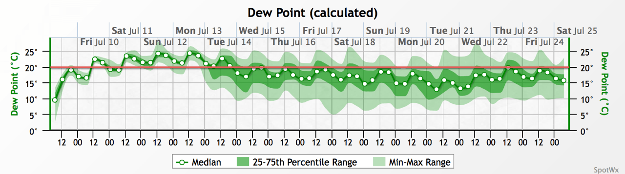
As mentioned above, today marks the start of a significant heat wave for Southern Manitoba that will see temperatures in the upper 20’s to lower 30’s alongside very humid conditions with dew point values climbing into the low 20’s. The humid conditions will result in humidex values[1] climbing into the upper 30’s or low 40’s:
| Day | Max Temp | Humidex |
|---|---|---|
| Friday | 31°C | 39 |
| Saturday | 31°C | 39 |
| Sunday | 30°C | 40 |
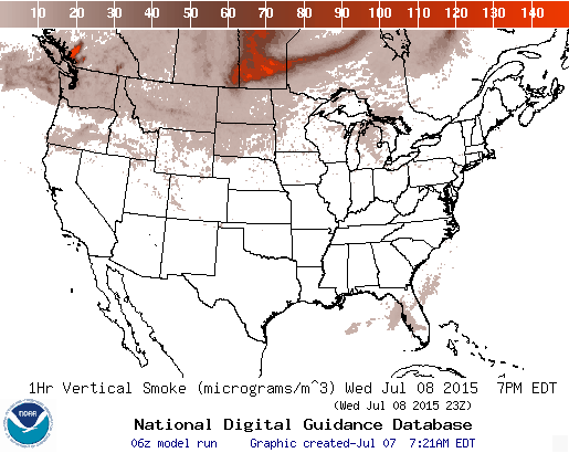
These hot and humid conditions are the result of a significant upper-level ridge building into the Prairies will bring a prolonged south to southeasterly flow over Southern Manitoba as it spreads hot weather into the region. Significant humidity will build into the region as the southerly winds tap into Gulf of Mexico moisture, combining with local evapotranspiration to produce deep moisture with dew points near 20°C.
The big story here will be the duration the hot and humid weather is here to stay. The broad pattern will remain unchanged at least through the weekend. While the ECMWF & GDPS models have more progressive solutions that would result in the humidity being flushed out early next week, the NAM & GFS – which are generally slightly better at dealing with nocturnal convection – produce a blocked pattern that would keep the moisture in place at least until the middle of next week. Some of this uncertainty is reflected in the GEPS graph above with greater uncertainty (spread) showing up after Sunday. For the next few days, though, the heat will be on.
Severe Weather Potential
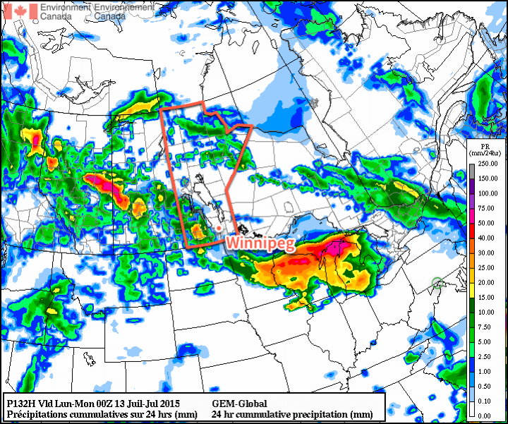
Alongside the heat and humidity, a severe weather threat will develop over the Red River Valley for both Saturday and Sunday. Unfortunately, it’s still too early to produce any sort of concrete outlook. As the main upper low pushes into Saskatchewan this weekend, multiple shortwaves will track over Southern Manitoba, providing instability for thunderstorm development. There are numerous question marks in place regarding the thunderstorm potential:
- It’s still too early to try to pin down where exactly the shortwaves may track; southwestern Manitoba will likely see the greatest potential for thunderstorms, but that threat could easily shift eastwards into the Red River Valley or even southeastern Saskatchewan.
- Instability will be quite high, primarily driven by the high dew point values. SBCAPE values will easily exceed 3,000 J/kg – which is very high – but the actual thermodynamics are marginal; 700mb temperatures are forecast to be near 9 or 10°C, which is quite warm in the mid-levels and makes it more challenging for thunderstorms to get going. If mixed-layer dew points are used instead of just surface-based dew points, the CAPE values drop fairly dramatically.
- With a large portion of the instability provided through the excessive latent heat potential thanks to the high dew points while environmental lapse rates remain somewhat marginal, a trigger will be very important. At this point, any sorts of triggers remain fairly fuzzy. There are numerous small features that could produce thunderstorms, the big question of whether or not they’ll be strong enough to break the cap and get things going is crucial. At this point, the answer is very unclear.
- If thunderstorms do develop this weekend, they’ll be struggling against very weak bulk shear values of only around 15–20kt. This would likely result in slow-moving thunderstorms whose main threat would be large hail and very heavy rain.[2]
At this point, it’s best to say that thunderstorms are possible throughout the weekend, and to keep track of updated forecasts. We’ll be keeping an eye on things and likely produce a convective outlook Friday evening for Saturday.
Update: Slight Risk of Severe Thunderstorms Saturday
There will be a slight risk of severe thunderstorms across southwestern Manitoba this afternoon, spreading eastwards this evening and through the overnight period into the Red River Valley.

A very hot and humid air mass in place over the region will bring the threat of severe thunderstorms today. Scattered thunderstorms will develop through western portions of the slight risk area today and will have the potential to become severe due to the copious amounts of energy available to them. Their overall strength will be limited by relatively weak wind shear, however these thunderstorms may still become quite potent with the capability of producing large hail, torrential downpours and very strong wind gusts.
The hail threat is quite significant today; with MLCAPE values expected to be in the 2000-2500 J/kg range, there will be more than enough energy available to support strong updrafts capable of large hail. The growth may be limited by the lower shear values, but significant hail is definitely possible today.
Heavy rain will be one of the greatest threats today thanks to the humid air in place; PWAT values have climbed to around 35-40mm which, when combined with expected storm speeds of only around 10-25km/h, will result in rainfall accumulation potentials of upwards of 75-100mm.
Wind is the final significant threat today and comes from two possible places. The first is during storm collapse; the low shear values may make it difficult for storms to persist for a long time and we may see some storms cut off their own energy source and collapse; if this were to happen, strong winds would be possible as outflows from those storms. The other possibility comes from the significant energy available to the storms; if a north-south line of storms manages to develop, there’s a chance that they may develop bowing segments or into a bow echo; if that were the case then we would see a wider swath of significant winds. The former possibility is more likely during afternoon and early evening while the latter case would be more likely as we head later into the evening.
The threat for severe thunderstorms across Southwestern Manitoba is already underway; it will gradually spread eastwards through the day and into the Red River Valley through the evening.
A slight risk of severe thunderstorms will likely exist across Southern Manitoba tomorrow as well, but shifted further east. We’ll have an outlook for tomorrow available later tonight.
Update: Hot & Humid Sunday Brings Severe Thunderstorm Risk
A heat warning is in place for a Sunday that will see the heat and humidity cranked up over the Red River Valley bringing humidex values in the low 40’s. All that heat and humidity will bring a slight risk for severe thunderstorms in the Red River Valley alongside portions of Saskatchewan and much of Southern Manitoba.

In Manitoba, huge CAPE values are expected to develop today with SBCAPE values exceeding 4500 J/kg and MLCAPE values exceeding 3500 J/kg. Bulk shear will be on the lower side at around 20kt and is likely the major limiting factor in today’s storm potential. After a bit of elevated convection clears out this morning, a capping inversion of around 25-50 J/kg should hold storms back until later in the afternoon. With weak shear, the tornado threat should be minimal today, although if any storm realizing 3000+ J/kg of CAPE manages to get organized, I’d go with “all bets are off.” Storm development has the chance to be truly explosive today, so be sure to stay alert for any watches and warnings issued by Environment Canada as the day progresses.
The main threats will be large hail and torrential downpours. Storms will likely be moving faster than they did on Saturday, but will likely also be more intense. Strong winds will be a threat with any sufficiently organized thunderstorm.
The thunderstorm threat will persist into the evening and overnight, spreading eastwards into SE Manitoba & Lake of the Woods.
- The Humidex is a calculated value that attempts to create a “feels like” temperature that takes into account the reduced evaporation occurring on the skin surface that results in a diminished ability for the body to shed heat. ↩
- With dew point values near 20°C or even creeping above that value, perceptible water values are expected to climb towards 45mm, it’s not impossible that a slow-moving storm would be able to produce 3–4” of rainfall (roughly 75–100mm) in a relatively short time. ↩