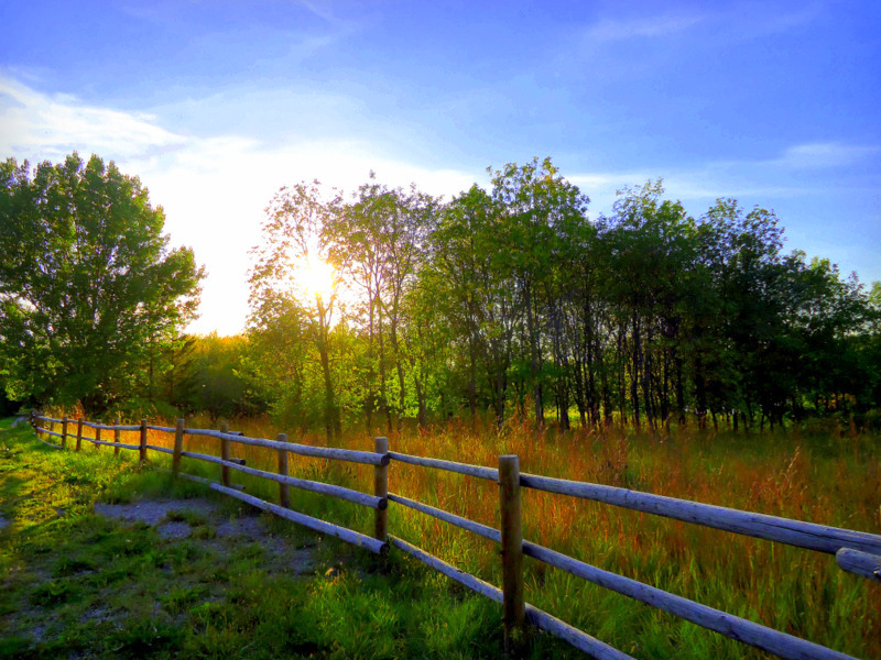
Seasonal weather will be in place over the Red River Valley this weekend with dry conditions and comparatively mild temperatures.
Today will be the least pleasant day of the weekend with temperatures climbing to around -9°C with somewhat gusty northwesterly winds – around 30km/h with gusts closer to the 40-50km/h mark – ushering cooler air than we had yesterday. While we’ll see a fair amount of cloud today clearing out in the afternoon, no snow is expected. Temperatures will dip to the mid-minus teens tonight as winds taper off.
Saturday looks like a fairly pleasant day. A ridge of high pressure over the region will bring mainly sunny skies and a high near -6°C. Winds will begin picking up out of the south a little later in the day, making it feel a bit colder but limiting our overnight low to just around -8°C or so. Some light snow is possible late Saturday afternoon into the evening hours ahead of a warm front gradually lifting northwards through the night.
Sunday will be a very mild day that starts off with somewhat unpleasant southeasterly winds. By late morning or early afternoon it looks like the winds will die off and the temperature will climb to a very balmy high of around -2 or -3°C. Some snow is possible in the afternoon, but it looks like the bulk of the precipitation will remain to the north and east of the Red River Valley, with just a light dusting of snow possible. Temperatures on Sunday night continue mild with lows near -9°C.
Pattern Change Next Week Brings More Mild Weather
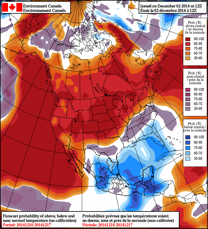
As we mentioned earlier this week, a major pattern shift covering much of North America will occur through the early half of next week that will move most of the continent into an above-average temperature regime for an extended duration.
The general gist of the pattern evolution is this: over the next few days, a very strong frontal zone over the northern Pacific will shift eastwards alongside a train of upper-level disturbances reflected at the surface by a very intense low pressure system – bottoming out today at 950mb or so. This intense low will become stacked east of the Aleutians and absorb several weaker, more disorganized disturbances, becoming a very impressive, large storm over the northeastern Pacific. This intense system will build an upper-level ridge over western North America, beginning the push of warm air. The second key ingredient is the evolution of the polar vortex that has been anchored over Hudson Bay for the last few weeks.
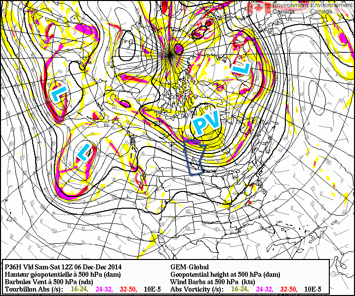
Fortunately, a powerful low pressure system heading up the east coast with teleconnections to the polar vortex will help “push” the vortex from its resting place and rapidly shunt it eastwards over Greenland. This is the second key ingredient because the polar vortex over Hudson Bay[1] is what anchors the eastern Prairies into a northwesterly to northerly flow for such long periods of time, reinforcing colder air and shunting warmer air to our south. With the vortex skipping town, the arctic jet stream will retreat northwards and the warm air spreading northeastwards with the upper ridge will be able to spread eastwards across the Prairies unhindered.
It’s a very interesting situation that highlights how stable the ridge-trough pattern that is so common is; in order for us to be kicked out of this pattern that has brought us a very cold November, we need very potent, significant storms on both coasts at the same time disrupting the upper-level pattern enough to get things moving again.
Within the warming pattern, we’ll see relatively warm and cool spells as disturbances ripple across the Prairies , but overall it looks quite dry in the Red River Valley as daytime highs climb into the -5 to 0°C through the second half of next week with the possibility of above-zero temperatures late into the week through the weekend. different from
- Its worth noting given how much press the term “polar vortex” gets lately that this is a completely normal feature that is dominant over Hudson Bay for huge swaths of winter every single year. ↩