2016 Kicks Off With Mild Weather

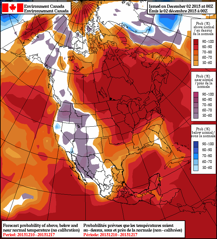
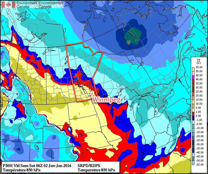
Winnipeg will be ringing in 2016 with temperatures 5-10°C above normal as a surge of mild Pacific air sweeps across the Prairies.

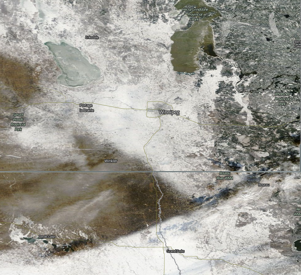
A gorgeous holiday Friday and weekend is on tap for Winnipeg thanks to a surge of warmer air that swept into the province overnight. Today will bring mainly sunny skies and breezy westerlies at 20-30 km/h. Temperatures will climb to around -4°C for the afternoon with a chance of some cloudiness as a bank of stratus cloud passes mainly to the east of the Red River Valley. Winds will persist out of the west-northwest at about 20 km/h as temperatures dip to to around -10°C.

Tomorrow will bring some afternoon cloud as a weak cool front approaches, but not before temperatures climb to the -3 or -2°C mark! At this point, it doesn’t look like there will be too much cloud on Saturday afternoon as once again, the main area of cloud is forecast to pass east of the Red River Valley. Temperatures will dip to around -12°C on Saturday night before moderating slightly as cloud cover begins building into the Red River Valley.

RDPS Forecast 850mb Temperatures valid 06Z Saturdy Morning
A significant push of warm air sets up over the Red River Valley for Saturday, shown here via the forecast 850mb temperatures.

Sunday looks like the weather takes a bit of a turn for the worse, but the mild weather persists. The cloud that will be tied up to our east over the next couple of days is forecast to finally spill westward and push into the Red River Valley. With that happening, it looks like Sunday will be mainly cloudy, but still mild for early January, with a high near -7°C. The cloud will keep things warm on Sunday night with a low near -10°C.

Long Range

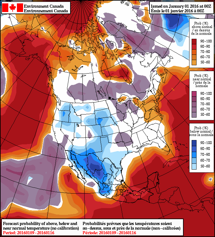
Conditions will remain mild through the week with daytime highs in the -5 to -10°C range. No significant precipitation is expected until possibly the end of the week, so all in all it’s looking great!

NAEFS 8-14 Day Temperature Anomaly Outlook
NAEFS 8-14 Day Temperature Anomaly Outlook valid January 9-16, 2015

In the longer range, models are converging on seasonal temperatures for the region. This would mean occasional snow and highs in the -10 to -15°C range and lows between -20 to -25°C.

Exceptional December Warmth Continues

The warm weather bathing over southern Manitoba shows no end in sight as daytime highs above freezing will remain in place for the next week, absolutely rocketing past the seasonal high temperatures near -8°C.

The coming days will be dominated by a broad zonal flow over the southern Prairies that will maintain the unseasonal warmth over the region and continue to keep the Arctic air bottled up north. Mainly sunny skies over the coming days will help produce daytime highs near 3 or 4°C, some 10°C above normal for this time of year.  While we likely won’t be hitting record high temperatures—which range from +5-12°C for the coming days—this period of warmth is nonetheless remarkable for early December.

For the coming days, temperatures will remain at least 8°C above normal for this time of year.  The prolonged period of warmth will result in a gradual erosion of the snowpack over the majority of the Red River Valley.

MODIS (Aqua) True Colour Satellite for December 3, 2015

With little-to-no snow in the forecast, there’s a decent chance that by the start of next week, there’s a lot more bare ground showing around the Winnipeg area.

Other than the warm temperatures, there’s little to talk about in the forecast.  Today will be a fairly windy day with southerlies increasing through the day to around 40-50 km/h this afternoon. Winds will subside tonight and remain relatively light through the weekend. Overnight lows will sit in the -2 to -4°C range.

Long-Range Outlook

Nothing but warmth.

Both the NAEFS and the CPC show very high probabilities of above-normal temperatures continuing through the coming week or two. Little-to-no precipitation is expected.

Enjoy the beautiful weather!

Beautiful Start to December Continues

Beautiful Start to December Continues

A foggy start today will be the minor blip in what looks to be a beautiful second half of the week, and start to meteorological winter, as the mild weather shows no end in sight.

The forecast for the remainder of the work week is pretty straightforward: beautiful with warm and sunny weather.

This morning will be the one blip over the next few days as fog over the region gradually burns off. After that, we’ll see mainly sunny conditions over the coming days with temperatures slowly warming as a train of low pressure systems tracking across the Northern Prairies drag warmer air eastwards across the Prairies.

Winds will be calm today, however pick up through the remainder of the week. Thursday will see westerly winds around 20–30 km/h while Friday will see gusty southerlies at 30–40 km/h.

By Friday, daytime highs will be 10°C or more above seasonal values with the potential for substantial snow-melt through much of the Red River Valley.

Weekend Outlook & Beyond

The mild weather will continue into the weekend with daytime highs slightly above 0°C expected throughout much of the Red River Valley. Saturday will likely be the nicest day of the week with daytime highs of 2–4°C and some breezy westerlies. Sunday will be a bit cooler with lighter winds.

NAEFS 8-14 Day Temperature Anomaly Forecast valid December 10 to 17th, 2015

Looking further ahead, the NAEFS continues to remain very confident in above normal temperatures for the region. With no indication that the Polar Jet has any plans to shift further south, out of the Northern Prairies, it seems fairly safe to go with the NAEFS forecast. Early indications are that we can expect daytime highs next week in the range of –2°C to +2°C or so with little in the way of precipitation.

Near-Record Heat for Thanksgiving Weekend

The heat is on for Thanksgiving weekend in Southern Manitoba as a low pressure system tracking across the northern Prairies and draws unseasonably warm air eastwards into the province. Temperatures will soar into the 20’s on the weekend—some 10–15°C above normal for this time of year—with possible record-breaking heat in place for Sunday.

Today will be a fairly cloudy day despite our sunny start, thanks to a large area of cloud spreading eastwards along the leading edge of the warm air. As the cloud moves in, winds will increase out of the south-southeast to 30–40km/h with a bit of gustiness on top. Today’s daytime high will be near 15°C throughout much of the Red River Valley. The cloud cover will thin this evening into the overnight as temperatures dips to the high single digits.

GDPS 850mb Temperature Forecast valid Sunday October 11, 2015 at 18Z.
Shown by this forecast of 850mb temperatures, a large area of warm air will be in place over southern Manitoba on Sunday.

Saturday will be a gorgeous day with partly cloudy skies, southwest winds at 20–30km/h and a high temperature around 23°C in the Red River Valley.[1] Temperatures will dip to around the 10°C mark on Saturday night with clear skies.

Sunday will bring mixed skies as a cold front approaches from the northwest. Temperatures will soar into the mid–20’s, giving a run at the record high of 26.1°C set in 1942. It looks like Winnipeg’s temperature will likely end up just short of the record, but it’s something to keep an eye on!

Record Temperatures for Thanksgiving Weekend 2015 in Winnipeg, MB
Date Record Temperature Record Year
October 9 27.8°C 1938
October 10 27.8°C 1934
October 11 26.1°C 1942

A cold front will slump through the Red River Valley on Sunday evening, ushering in breezy northwesterly winds up to 40–50km/h and a cooler airmass. The low temperature will settle around 10°C on Sunday night. There will be a chance for some rain on Sunday night into Monday depending on exactly where the wrap-around precipitation of the low passing to our north ends up, but at this point there’s too much uncertainty to make any confident forecast at this point.

Thanksgiving Monday & Beyond

Thanksgiving Monday looks less pleasant than the weekend; there will be plenty of cloud around alongside a chance for rain as a strong low pressure system moves into northern Ontario. Winds will be fairly strong, likely around 40km/h or so. The daytime high will only be in the 10–15°C range, so it will certainly feel significantly cooler than the weekend.

After Monday, things look fairly seasonal with temperatures potentially slightly above normal. No particularly big weather systems appear to be on the horizon, although a slight northwest flow is forecast to develop mid-week, which could increase our chances of some shower activity. All in all, though, a fairly quiet week expected.

Happy Thanksgiving! Enjoy your weekend!


  1. Daytime highs might climb a degree or two higher near the western escarpment of the Red River Valley where southwesterly downslope winds may add a bit of warmth.  ↩