Grey Skies Return on Monday

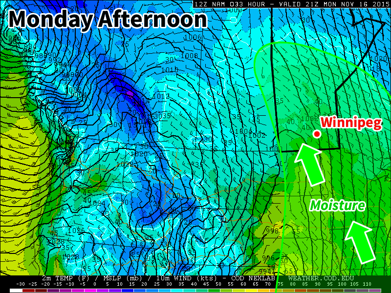
Grey and drizzly weather return today as a surge of moisture from the south generates an area of low cloud over southern Manitoba. It looks like we may see the sun again by midweek.

Monday will be overcast with periods of drizzle as a surge of moisture generates low cloud over southern Manitoba

Monday

Today will be a grey, dreary day in southern Manitoba. A strong push of low-level moisture from the south will generate a broad area of low-cloud, bringing periods of drizzle to southern Manitoba throughout the day. Temperatures will remain relatively mild, in the mid single digits, but with the drizzle and wind it won’t feel particularly comfortable. Wind speeds will be gusty, at 30km/h gusting to 50km/h, out of the south-east.

Tuesday

Tuesday will see generally cloudy skies stick around in southern Manitoba, but we may see some clearing by late in the day. The flow will shift to westerly on Tuesday, allowing a drier airmass to move into the region. However, it doesn’t look like this drier air mass will arrive in time for us to see clear skies before sunset. Winds will be westerly at 20km/h with temperatures in the mid single digits.

Wednesday

We should finally see sunnier conditions on Wednesday as we sit between two approaching low pressure systems. Current forecast models suggest we’ll remain in a dry airmass for most of Wednesday, before the risk of precipitation increases again on Wednesday night. Winds should generally be light, with temperatures in the mid single digits.

Long Range

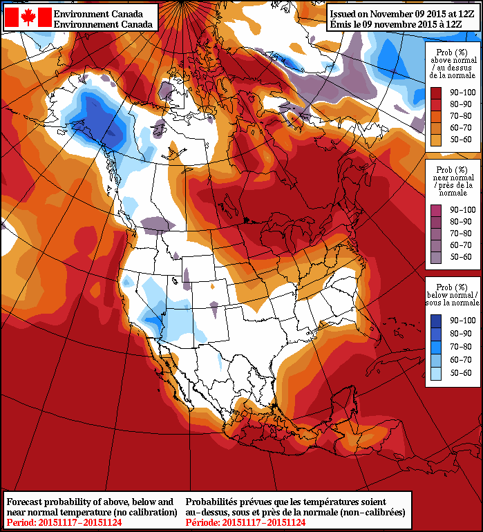
It looks like we’ll see a fairly stark change in the weather on Thursday as a powerful cold front ushers in a more arctic-like airmass. Very strong winds are expected on Thursday in the wake of this front along with decreasing temperatures. Unfortunately, we may see some accumulating snow with this system, though it’s too early to say how much can be expected. It still appears that the overall pattern will remain above normal for the foreseeable future, but as we move further into the winter season snow and cold are inevitable.

Seasonal Temperatures & Dreary Weather Rounds Out The Week

The remainder of the work week will bring fairly seasonal temperatures to Winnipeg as the weather slowly improves. For the weekend, however, another blast of well above-seasonal temperatures is on the way!

Today will see a continuation of yesterday’s fog and drizzle patches through the morning hours, but it should dissipate with conditions improving by late morning as a weak cold front passes through the region. Behind that, we’ll be left with mainly cloudy conditions and light winds as the temperature climbs to around 3°C. The cloud cover will stick around overnight as we head to a low near –1°C.

Thursday will see a chance of flurries in Winnipeg & the Red River Valley as a weak shortwave drifts over the region in the northwest flow aloft. Northwesterly winds to around 20km/h will accompany a very close to seasonal high of 1°C. If we do see snow, it won’t accumulate to much, if anything at all.

12hr. Cumulative QPF valid 00Z Friday November 13, 2015
Flurries are possible through the day on Thursday while a much larger system passes through Ontario. Accumulations are expected to be light.

After the shortwave passes through on Thursday, skies will begin to clear, although with so much low-level moisture in the region, exact timing will be tricky. Skies will likely clear out at some point Thursday evening/overnight, however the cloud might persist into Friday morning before clearing. This timing will affect our overnight low forecast; if things clear out earlier, then we should see a low near –5°C or so, while if the cloud sticks around through the night, the low will be closer to –1 or –2° C.

Regardless of how Friday starts, we’ll be heading towards a mainly sunny high of 3 or 4 °C. Friday’s overnight low will sit near 0 to +1°C as much warmer air begins building in for the weekend.

More Warm Weather This Weekend And Beyond

Heading into the weekend, temperatures will soar again as the large-scale northwesterly flow that was in place shifts to be a more zonal, westerly flow, replacing cooler air with more mild, Pacific-sourced weather.

NAEFS 8-14 Day Temperature Anomaly Outlook valid November 17 to November 24, issued 12Z November 9, 2015
The NAEFS continues to forecast above-normal temperatures for Manitoba in the 8-14 day time range.

Generally speaking, daytime highs should climb into the upper single digits for both Saturday and Sunday which, while not sounding particularly warm, will be anywhere from 7–10°C above normal for this time of year.

Another low pressure system will work its way into southern Manitoba early next week, and while most of the precipitation looks like it will remain well north of the Red River Valley, the pattern does look like we may once again see the return of low cloud, drizzle and fog. It’s too early to tell, but just in case, you’d better get out there and enjoy the sun this weekend before it gets covered up again!

Unsettled Weather Continues; Snow Evades Red River Valley

Unsettled Weather Continues; Snow Elusive in Red River Valley

The unsettled pattern that’s been a mainstay of weather chatter since the beginning of the weekend will continue to bring more dreary and wet weather to Winnipeg through the remainder of this week. The upside? Temperatures will continue to remain unseasonably warm for the foreseeable future; not a bad trade if you can handle the absence of sunshine!

Today will see Winnipeg and the Red River Valley under the influence of a low pressure system moving through the Lake of the Woods region and off into northwestern Ontario. While this system is expected to spread 5–10cm of snow across the Parkland region of western Manitoba, here in the Red River Valley generally light shower or drizzle activity is expected with total rainfall amounts under a couple mm or so. Daytime highs will climb to around the 7°C mark with relatively light winds eventually shifting out of the northwest to 20–30km/h in the afternoon.

RDPS 24hr. Total Precipitation valid at 12Z 05 November, 2015
This total precipitation forecast from the RDPS shows how much precipitation is expected from Wednesday morning through the overnight period.

As we head into the evening, the chance for showers or drizzle will continue well into the evening and overnight period. Total amounts, once again, look quite low. The drizzle and/or shower activity will likely taper off late overnight or early Thursday morning. Expect a low near 3°C.

Thursday will be a bit of an unpleasant day as a cooler temperature steady near 4°C combines with brisk northwesterly winds at 30–40km/h as another low pressure system passes by southeast of the Red River Valley. While conditions will be dry through the morning hours, Winnipeg will quite likely see more shower activity push in from the south for the afternoon hours, clipped by the northwestern flank of the area of rain and snow produced by the low moving through.

RDPS 12hr. Total Precipitation valid at 00Z 06 November, 2015
The RDPS, among many other models, is forecasting Winnipeg to be clipped by the northwestern flank of an area of precipitation that will spread across SE Manitoba through the day.

The showers will taper off late in the afternoon and the Red River Valley will head towards an overnight low near –1°C under mainly cloudy skies with diminishing winds.

Friday continues the above-normal daytime highs, and the dreary weather, as mainly cloudy conditions give way to a few scattered showers in the afternoon with northwest winds of 20–30km/h. Daytime highs will sit near 4°C. Friday night will be quite cool with a low near –3°C and, finally, clouds beginning to scatter out.

Mild Weekend Ahead; Sunshine Possible Too!

This weekend looks to continue the above-seasonal temperatures with daytime highs in the mid-single digits and mixed to mainly sunny skies. Saturday might see somewhat windy conditions, however things look quite pleasant on Sunday with little by way of wind, sunshine and a high near 5°C or so. Granted, at this time of year, sunny forecasts can quickly become stratus-filled broken promises, so we’ll be keeping an eye on things as we head towards the weekend.

Cool Start with a Quick Recovery

After a stretch of summer weather last week that saw daytime highs climbing into the mid-to-upper 20’s, cooler weather has moved into Southern Manitoba behind the weekend’s cold fronts that will start the week off with cooler weather. Temperatures will rebound quickly through what will be a dry & quiet start to the week before things turn more unsettled through the week’s second half.

Today will be the coolest day of the next few with temperatures climbing to just 17 or 18°C as the main axis of cold air behind the weekend’s cold fronts moves across Southern Manitoba. There will be a bit of morning drizzle, but then things should scatter out nicely and Winnipeg will be left with partly cloudy skies through much of the remainder of the day. Winds will be out of the north at around 20 km/h. The clouds will clear out tonight and much of the Red River Valley will see a low near 9°C with light winds.

Tomorrow will bring warmer air to the region; daytime highs will be around 5°C warmer than today at the 22–23°C mark. Winds will be light. The day will start sunny, but by the afternoon cloud associated with a weather system moving through North Dakota will spill across the Red River Valley bringing variable cloudiness; in the southern valley it will be overcast through much of the afternoon while further north in Winnipeg it will be a little more variable and a bit later in arriving. Skies will clear overnight as the temperature drops to around 12°C.

Forecast 850mb Temperatures for Wednesday Morning
A warm front moving through on Wednesday morning will bring warmer weather back to Winnipeg.

Wednesday will see warm weather return with daytime highs climbing back to the mid–20’s with just a few clouds. Winds will continue to be fairly light, making for a very pleasant day. We’ll see some cloudiness on Wednesday night with a chance of showers. The temperature will drop just below 10°C or so.

Unsettled Second Half of the Week

Cooler, more unsettled weather will move into the Red River Valley for the second half of the week. Temperatures will drop back into the high teens or low 20’s with an increasing chance of shower activity towards the end of the week. There’s still a fair amount of uncertainty in location, but in general it looks like Thursday will see the shower activity west of the Red River Valley and see it push eastwards for Friday into the weekend. Like this past weekend, it likely won’t be a rainy weekend, but rather one with some chances for periods of wet weather.