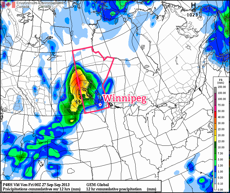
Our beautiful start to fall – a start that has seen two days in a row a full 9–10°C above normal – will continue with well above-normal temperatures continuing through the week. A powerful storm system moving into Saskatchewan will lead to more unsettled weather as we move towards the end of the week, but rain is far from guaranteed here in Winnipeg.
Wednesday
25°C / 16°C
A mix of sun and cloud; windy out of the south.
We’ll see another pleasant but breezy day today under a mix of sun and cloud as some patchy cloud cover moves eastwards from a powerful storm system taking shape over central Saskatchewan. Temperatures should climb to around 25°C this afternoon as gusty winds pick up to 30–40km/h out of the south. The winds will let up a little bit overnight but will still be noticeable which, when combined with increasing cloudiness, will conspire to keep our overnight low around a balmy 16°C – which is coincidentally the average daytime high for this time of year.
Thursday

24°C / 12°C
Cloudy with gradual clearing. Chance of showers midday through the afternoon.
Thursday will bring mostly cloudy skies as the Saskatchewan storm edges eastwards slowly. While showers will push in over Western Manitoba, here in Winnipeg we’ll see just a slight chance of seeing some shower activity. The chance will start midday and last through much of the afternoon, but if we do get any rain it shouldn’t accumulate to anything significant.
The day will start mainly cloudy, but we should see mainly sunny skies by the evening as everything lifts off to the north. Our temperature will climb to around 24°C with winds around 30km/h diminishing through the afternoon. Thursday night will start with mainly clear skies but we’ll see increasing cloudiness by Friday morning as cloud streams in from the southwest ahead of yet another disturbance.
Friday
18°C / 7°C
Cloudy periods. Very slight risk of a morning shower.
We’ll see some cloudy periods on Friday as another disturbance spreads cloud ahead into Southern Manitoba. Our temperature will be a bit cooler; the daytime high is expected to hit around 18°C as a cold front pushes across the Red River Valley.
Friday night holds some promise of seeing some precipitation, which is rapidly becoming needed in Winnipeg. Only 4mm of rain has fallen in Winnipeg so far this September, not even 10% of the average of 45.5mm that falls in this month. The last significant rainfall in Winnipeg was the heavy thunderstorms that occurred through the morning of Sunday, August 18th which brought 15–30mm to the city. Since then, only 6mm of rain has fallen.
The GDPS is currently the only system that’s bringing rain into Winnipeg on Friday night, however there are some indications that other models could begin to fall in line with that thinking as well. Unfortunately, it’s going to be yet another system that has a very sharp cutoff on it’s edges. This system will be very sensitive to track, so we’ll be sure to keep an eye on things as they develop. Be sure to check back in the comments below for updates closer to the weekend.
