Unseasonably cool temperatures will be seen across all of Manitoba through the duration of the Easter long weekend thanks to an Arctic air mass that was ushered into the region behind a potent cold front that brought intense snow showers and strong winds yesterday. In addition to the cooler temperatures, the s-word will likely be seen in many regions along and south of the Trans-Canada corridor over the next couple days.
A clear and cold start to the day in Winnipeg will see more cloud move into the area through the morning as a weak disturbance slides through the region. Flurries will move into the Red River Valley midday and linger into the evening. Winds will be light and daytime highs will climb to around -1°C. A chance for flurries will persist overnight as another weak disturbance begins approaching from Saskatchewan. Temperatures will dip to around -9°C tonight.
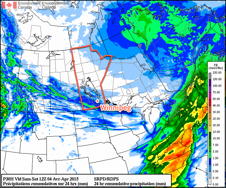
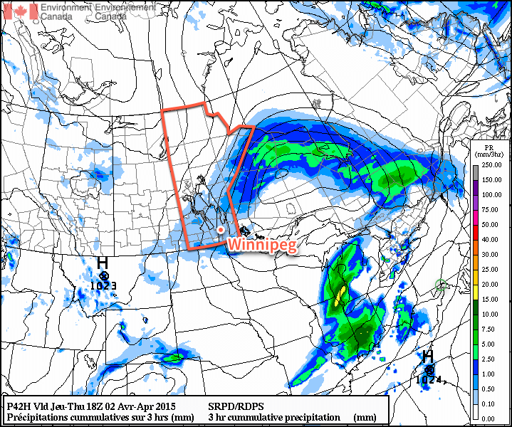
As the next disturbance ripples through tomorrow morning, it will push an area of snow through the province. Amounts from this band will be around 1cm and will be centered from the Parkland region southeastwards into the southwestern Red River Valley. Winnipeg will be on the northern edge of the system and will likely see some snow through the morning hours. Once the disturbance moves past, clearing will begin pushing into the Red River Valley. Daytime highs will be a bit cooler than today at around -3°C or so with winds out of the north at 20km/h. Saturday night will bring mainly clear skies and a low near -12°C.
Sunday will be another cool, but mainly sunny, day. For areas near the U.S. border, the story will be different as a low pressure system moving through the States pushes a band of flurries through the region Saturday night into Sunday morning. Highs will be around -2°C on Sunday with lows down to -10°C on Sunday night.
Long Range
Next week is looking like a return to form; daytime highs are expected to rebound to a seasonal 6°C by mid-week at the latest when a chance for showers returns as another low pressure system moves through Manitoba. Before then, we’ll see plenty of sunshine making for fairly pleasant days despite the slightly cooler-than-normal temperatures.