Coldest Weather of the Winter On The Way

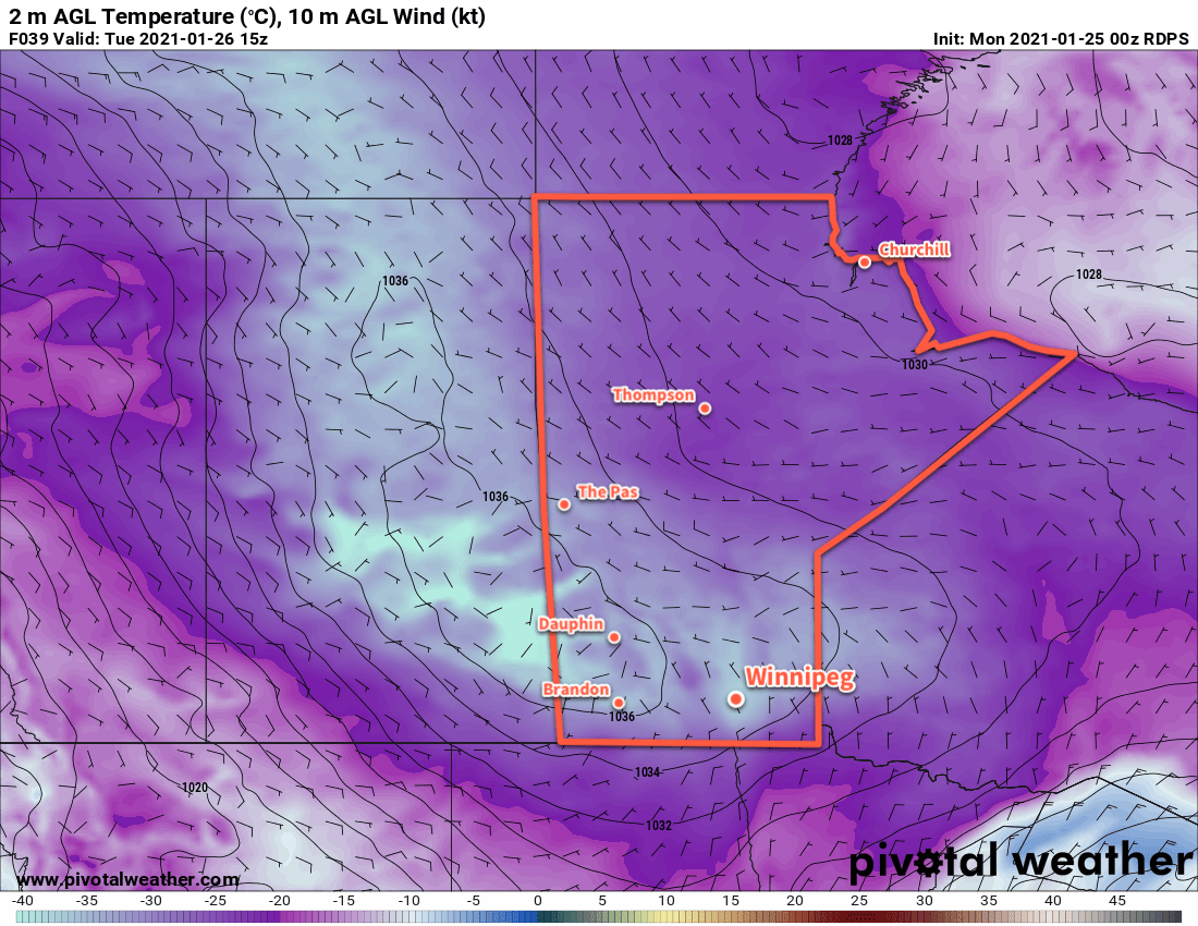
After one more mild day, a cold front moving through Wednesday night will usher in a prolonged outbreak of bitterly cold air. Winnipeg will likely see the coldest temperatures of the season over the coming week.

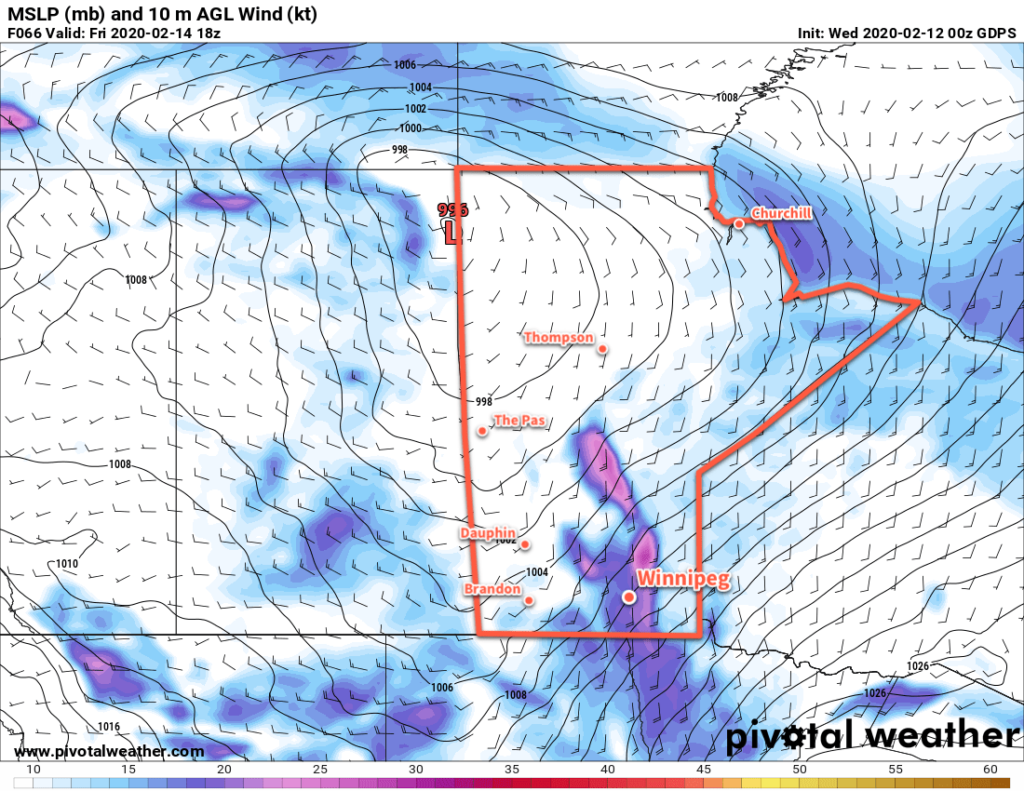
Temperatures will climb back towards the freezing point today as a brisk southerly wind pushes mild air into the region. Skies should stay mostly cloudy as temperatures climb to a high near -2 °C. Southerly winds near 30 gusting 50 km/h this morning will ease to light this afternoon as a low pressure centre moves across southern Manitoba.

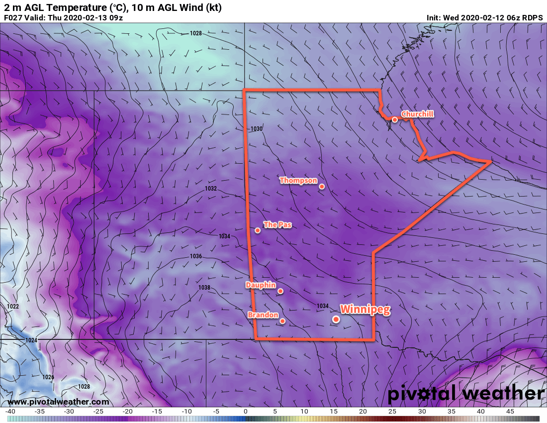
As the low passes, colder air will begin to move into the region. Snow will come with it, beginning in Winnipeg sometime early this evening. Shortly after the snow, moderate northwest winds of 30–40 km/h will push into the region. Snow and local blowing snow will persist through the night as temperatures drop to a low near -14 °C. Winnipeg and the Red River Valley will likely see 5–10 cm of snow with higher amounts of 10–15 cm across the Interlake.

NAM 24hr. Accumulated Snowfall Forecast (at 10:1 SLR) valid 18Z Thursday February 4, 2021
Much of southern Manitoba will see accumulating snow on Wednesday night.

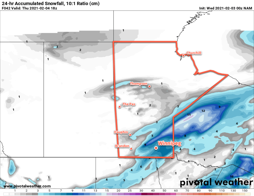
Moderate northwest winds near 40 gusting 60 km/h will mark Thursday along with mostly cloudy skies. Flurries may linger through the morning before tapering off in the afternoon. Temperatures will be near-seasonal with a high around -13 °C. The winds will ease into the 20–30 km/h range on Thursday night with a low near -21 °C. Skies will stay mostly cloudy on Thursday night.

RDPS 2m Temperature Forecast valid 12Z Saturday February 6, 2021
A bitterly cold Arctic air mass will spread into the Prairies late this week and through the weekend.

The winds will pick back up into the 30–40 km/h range on Friday with highs near -17 °C. The cloud cover should finally start breaking up and give mixed skies to the region. Winnipeg will see partly cloudy skies on Friday night with a low near -29 °C and northwest winds near 20 km/h.

Long Range Outlook

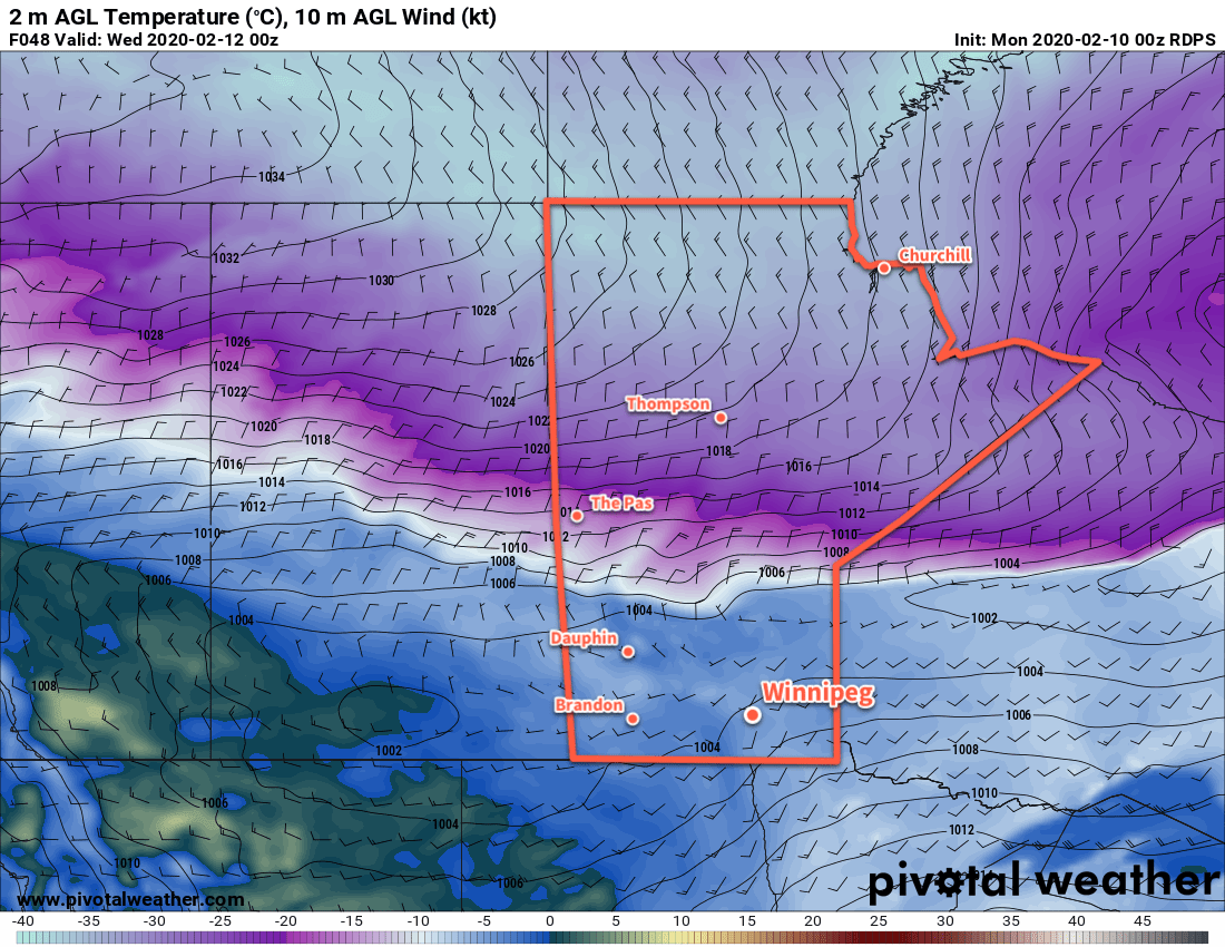
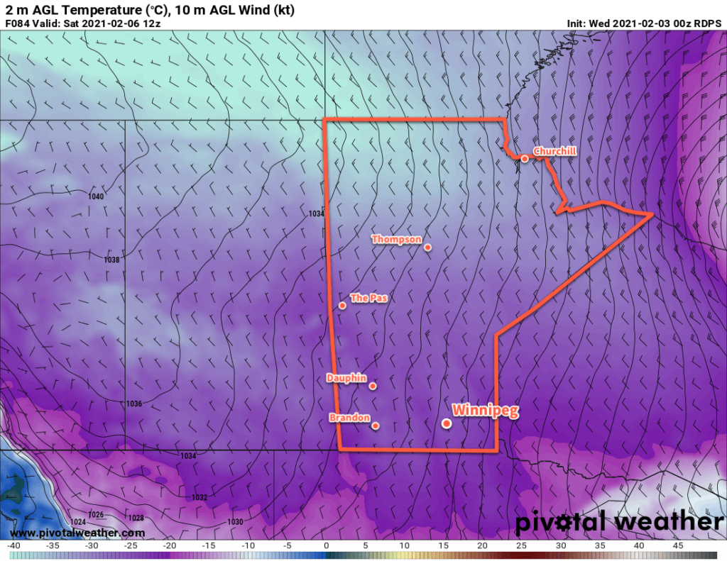
A potent Arctic high will build into the Prairies this weekend and stall out over the region next week. This will bring a period of brutally cold temperatures with daytime highs in the mid-minus twenties and overnight lows into the mid-minus thirties. Wind chill values into the mid-minus 40s are likely. The coldest weather looks to be Saturday through Monday, but temperatures will continue to be below seasonal through the rest of the week.

Today’s seasonal daytime high in Winnipeg is -10 °C while the seasonal overnight low is -21 °C.

Bitter Cold Arrives

Extremely cold temperatures will stay entrenched over southern Manitoba through the first half of the week.

Winnipeg will see mainly cloudy skies today, supported by a weak inverted trough collapsing southwards into the United States. This cloud cover will bring a few flurries to the region, but most of it will stay south of Winnipeg. In the city, there will a chance for a bit of light snow, but mainly in the morning hours.

The cloud cover won’t help temperatures much. The main story over the coming days will be the bitter cold over the region. Temperatures won’t climb above -20 °C over the next two days, and only nudge above the mark on Wednesday. Overnight lows will be bitterly cold and dip below -30 °C both tonight and Tuesday night. Note that these overnight lows are difficult to forecast; there is a chance that temperatures could dip even colder than this, or stay a bit warmer. The difference in outcomes is subtle, but its worth noting that temperatures of -35 to -40 °C have occurred over western Manitoba into central and northern Saskatchewan. This is the air mass that will move into the Red River Valley today.

RDPS 2m Temperature Forecast valid 15Z Tuesday January 26, 2021
Bitterly cold temperatures will spread into southern Manitoba over the coming days.

Extreme cold warnings will be likely as it does not take much wind to drive wind chills below -40 with these bitterly cold overnight lows.

Skies will clear out Monday night and stay mainly sunny right through Wednesday. Some cloud will begin working into the region late Wednesday as warmer air starts to move towards the province.

Long Range Outlook

The upper flow supporting the bitterly cold temperatures will collapse in the second half of the week. This will allow milder air to surge back across the Prairies and send temperatures back to seasonal or seasonably mild for the latter half of the week. Comparatively pleasant winter weather will persist through the weekend with a chance for a few centimetres of snow on Saturday.

Today’s seasonal daytime high in Winnipeg is -12 °C while the seasonal overnight low is -23 °C.

Arctic Outbreak Grips The Prairies, Improvement By Weekend

Temperatures have plummeted in Winnipeg with the arrival of an outbreak of Arctic air. Fortunately, the cold snap will be short-lived with a return to seasonal temperatures by the weekend.

A sprawling Arctic high will move through the Prairies today and tomorrow, keeping temperatures well below seasonal values. North winds of 30 gusting 50 km/h will combine with temperatures in the low minus twenties this morning to produce extreme wind chill values of -40 to -45. ECCC has an extreme cold warning in effect for dangerous wind chills that are in place across most of the province this morning.

Wind chills will moderate through the day as the high approaches and winds ease. Temperatures won’t recover much, though, with a high of only -24°C expected in Winnipeg. On the bright side, the city will see plenty of sunshine today.

Temperatures will dip to a low near -30°C tonight with westerly winds up to 15 km/h. Wind chill values will likely drop back below -40 overnight.

RDPS 2m Temperature Forecast valid 09Z Thursday February 13, 2020
Temperatures will fall below -30°C tonight across parts of the southern Prairies.

More sunshine is on the way for the city tomorrow with a high near -20°C. Winds will be light through the day, shifting from westerly to southerly as the high works its way across the province. Temperatures will fall to a low near -24°C on Thursday night with winds increasing to 30 km/h through the night.

Milder temperatures will gradually work into the region on Friday, but as is common with these transition days, it will be windy. The Red River Valley will see southerly winds of 40 to 50 km/h through most of the day with mostly cloudy skies.

GDPS 10m AGL Wind Forecast valid 18Z Friday February 14, 2020
Moderate southerly winds will develop over the Red River Valley on Friday morning.

By the time the sun goes down, temperatures should reach around -10°C, then increase further to around -8°C for the night as winds shift to the west.

Long Range Outlook

Winnipeg will see seasonal conditions on Saturday, then another cool snap will move into the region for Sunday and Monday. It won’t be nearly as bad as today’s Arctic outbreak, though; highs are forecast to be around -15°C. Through the rest of next week, most models agree in a general trend towards another spell of mild temperatures for the second half of the week.

Today’s seasonal daytime high in Winnipeg is -9°C while the seasonal overnight low is -19°C.

Arctic High Barreling Towards Southern Manitoba

A series of low pressure systems will bring mild temperatures and light snow to southern Manitoba over the next couple days. Then bundle up, because bitter cold will crash through the Prairies into southern Manitoba.

A low pressure system passing through the region will bring cloudy skies with light snow to Winnipeg today. The city will see about 2 cm of snow before it tapers off later this afternoon. Temperatures will be seasonably mild with a high near -6°C. Winds will be breezy this afternoon, picking up to northwest to 30 gusting 50 km/h behind a weak cold front. Skies will clear out this evening with temperatures dipping to a low near -13°C. Winds will ease and shift westerly, but some breezy conditions will continue to be possible along the escarpment of the western Red River Valley.

On Tuesday, more cloud will build into the region as the next low rapidly approaches. The city will see mixed skies becoming cloudy later in the day. Winds will pick up to 30 gusting 50 km/h out of the southwest, sending temperatures to a high near -3°C. The low will pass through in the evening, bringing snow into the region and ushering in a powerful cold front.

After a few hours of light winds late in the day, northerlies will strengthen to 40 gusting 60 km/h overnight. Light snow will move into the region in the evening and persist through much of the night. Although only around 2 cm of snow will fall, the strong winds may still produce some areas of reduced visibility in blowing snow. Temperatures will plummet through the night, reaching a low near -26°C on Wednesday morning. Dangerous wind chills of -40 or colder are possible overnight into Wednesday morning.

RDPS 2m Temperature Forecast valid 00Z Wednesday February 12, 2020
A powerful cold front will surge southwards through the province on Tuesday night, ushering in a bitterly cold Arctic air mass.

Skies will clear on Wednesday as the Arctic high moves into the region. Temperatures will barely recover with highs of just -24°C expected. Northwesterly winds of 30 to 40 km/h will continue for much of the day, not easing until the latter parts of the afternoon into the evening. Temperatures will head to a low near -31°C on Wednesday night with dangerous wind chills of -40 or lower possible again.

Long Range Outlook

The cold weather will stick around for Thursday, then seasonal temperatures are forecast to return after a windy Friday. The weekend will bring near-normal temperatures and variable cloudiness with no significant snowfall expected.

Today’s seasonal daytime high in Winnipeg is -9°C while the seasonal overnight low is -20°C.