Nice Start to the Week, Then Some Rain

This week will start out very nice, with temperatures in the twenties. However, a strong low pressure system will move in toward the middle of the week, bringing more unsettled conditions.

Monday

Today will be a great day in southern Manitoba. Temperatures will be near the 20C mark with sunny skies and light winds. There isn’t much else to say, enjoy the weather!

Tuesday

Tuesday will be another very nice day as temperatures climb into the low twenties, once again under mainly sunny skies. Winds will be from the south-east at about 20 km/h.

Wednesday

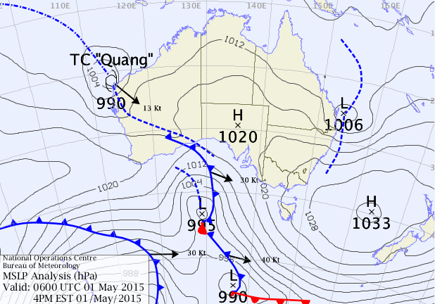
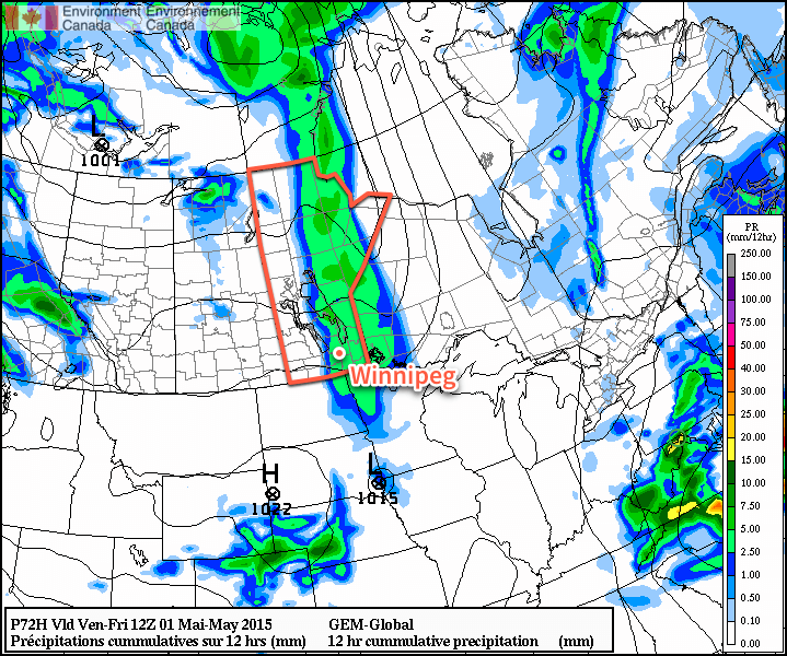
Wednesday will remain warm, but more unsettled conditions will begin to take hold in southern Manitoba. An approaching low pressure system is expected to bring rain showers to southern Manitoba late in the day and into Wednesday night. This system may bring us more significant precipitation on Thursday, but it is too early to speculate on potential rainfall amounts.

Long Range

It looks like we’ll see cooler weather late this week into the weekend as a much cooler air mass gets pulled down from the north. This push of cool air will result from the departure of this week’s low pressure system. Long range models suggest we’ll return to above-seasonal conditions at some point next week.

Eastern Australia Sees another Coastal Low

Elsewhere in Weather News posts are beginning to sound like a broken record with all the recent flooding stories coming out of Australia. This past week there were yet again significant flash flooding problems across regions of Australia.

[map zoom=”11″ type=”hybrid” autofit=”1″ disable_scrollwheel=”1″] [pin tooltip=”Last week’s flooding”]Maitland, AU[/pin] [pin tooltip=”This week’s flooding”]Lismore river[/pin] [/map]

Northern New South Wales and southern Queensland were hardest hit this time as a low pressure quickly wrapped up just off the Eastern Coast of Australia – very similar to the setup that occurred last week. Observation sites indicate that there was a large swath of 150-200mm that fell across Northern NSW along the coast in just over 24 hours. With already saturated soils from the past week’s storm that dumped around 50mm in the same area, conditions were primed for flash flooding once the heavier rain bands arrived. Similar to last week’s low featured in EIWN, strong wind gusts of up to 100km/h were also observed.

Surface Map analysis from overnight Thursday shows the east coast low just off Australia's eastern shores and the tropical storm Quang about to make landfall on Western Australia territory. (Source: BoM)
Surface Map analysis from overnight Thursday shows the east coast low just off Australia’s eastern shores and the tropical storm Quang about to make landfall on Western Australia territory. (Source: BoM)

Flash flooding was the main cause of the damage in the region once again, as roads washed out and numerous homes were inundated. The Wilson and Lismore rivers were expected to peak later today at a moderate flood stage, meaning that properties along the banks of the rivers are at risk. In total, six people died from the most recent flood events, five of the six as they attempted to drive through flood waters that covered roads. This brings a harsh reminder to residents that when roads get flooded out it’s best to turn around and not drive through.

The east coast low wasn’t the only form of severe weather to affect Australia this past week – a cyclone also formed in the Eastern Indian Ocean and strengthened in to a category four over open waters. After substantially weakening due to cooler waters near Australia’s coast the system made landfall on Northwestern Australia’s shores as a tropical storm, prompting officials to issue rainfall warnings in the region. Damage from the storm appears to have been minimal, other than some minor flooding.

Hot Weather Continues

The summer-like temperatures seen in Winnipeg over the past couple days will continue into the weekend with daytime highs 10°C above normal. A cold front will finally push through on Saturday evening, bringing an end to the exceptional warmth and ushering in a return to seasonal temperatures.

Today will be a gorgeous day in the Red River Valley with light winds and daytime highs near 25°C with a bit of a southwesterly wind. Expect a few clouds tonight with a low near 10°C.

Tomorrow will be a more interesting day as a more organized southerly flow develops over the Red River Valley ahead of an approaching low pressure system. Temperatures will climb to around 27°C while a meager amount of moisture pools through the Red River Valley ahead of an approaching trough. As the trough moves into the Red River Valley, it’s looking quite possible that we may see a few thunderstorms develop, however the chance is largely conditional.

Winnipeg Forecast Sounding for the afternoon of Saturday May 2, 2015
This forecast sounding valid Saturday afternoon for Winnipeg from the NAM model shows a deep layer of instability, adequate moisture and favorable shear for thunderstorm development.

Given the fairly low amount of moisture available, cloud bases would likely be very high; the forecast sounding indicates cloud bases near 10,000ft which would mean the biggest threat from the storms would be strong wind gusts. Some hail might be a threat further south in North Dakota, perhaps sneaking onto extreme southeastern Manitoba, but overall it looks more like we’ll see a few weak thunderstorms develop capable of producing some fairly gusty winds. The overall environment, save for the lack of moisture, looks quite favorable for the development of the storms, though. Winds will generally be out of the south to southwest at around 30 gusting 50km/h with a slight chance for some 50 gusting 70km/h winds in the afternoon.

Some cloud will linger overnight as temperatures dip to around 9°C with winds relatively light out of the west to northwest.

Sunday will bring a bit of cloudiness and slightly cooler temperatures with a daytime high of “only” 19°C. Winds could be gusty out of the northwest for a few hours beginning in the morning before settling down to 30 gusting 50km/h for the afternoon. Sunday night looks mainly clear with a low near 5°C.

Summer Warmth Arrives

Summer-like warmth has arrived for Winnipeg and the Red River Valley thanks to an upper-level ridge moving into the region that will spread warm air over Manitoba for the coming days. Some rain looks likely on Thursday evening as a “cool” front passes, but the other days through the second half of the week look beautiful with plenty of sun to go along with the warmer weather.

Today will be a mainly sunny day with a high near 21°C. Winds will remain fairly light through the day as well. With an overnight low near 8°C or so, the warmth should hang on into the evening making for a pleasant evening to be outside.

Thursday will bring a fair amount of cloud, however the sun will still poke out a few times through the day. Winds will be breezy out of the south, picking up to around 30–40km/h with gusts to 50–60km/h or so. Heading into the second half of the afternoon should really bring in the thicker cloud ahead of the approaching “cool” front. A band of showers will move in sometime between 6–9PM and last for a few hours as they move through.

RDSP 12hr. Precipitation Accumulation
The RDPS shows around 2mm of rain through much of southern Manitoba associated with the passage of a “cool” front on Thursday evening. Image above is total accumulations from Thursday evening at 7PM to Friday morning at 7AM.

Precipitation is expected to be fairly light, however, with total accumulations around 2mm, although if the odd convective cell gets going, some places may see closer to the 5mm mark. Winds will taper off with the passage of the front and temperatures will drop to around the 7°C mark with clearing skies overnight.

Friday will be another pleasant day with light winds, mainly sunny skies and a high near 21°C. Expect a low near 8°C on Friday night.